Cahokia Heights in St. Clair County, Illinois — The American Midwest (Great Lakes)
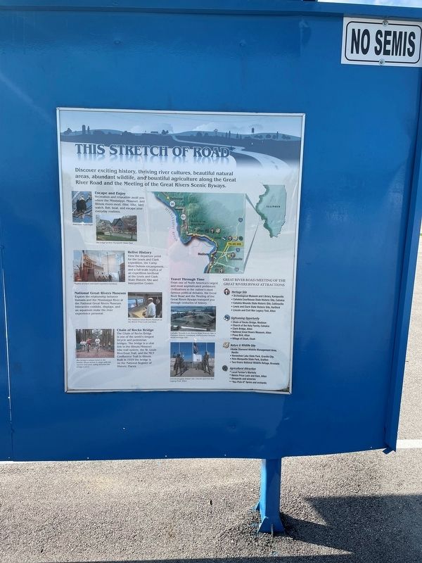
This Stretch of Road
Discover exciting history, thriving river cultures, beautiful natural areas, abundant wildlife, and bountiful agriculture along the Great River Road and the Meeting of the Great Rivers Scenic Byways.
Escape and Enjoy
Recreation and relaxation awaits you where the Mississippi, Missouri and Illinois rivers meet. Hike, bike, bird watch, fish, boat, and escape your every day routine.
National Great Rivers Museum
Explore the relationship between humans and the Mississippi River at the National Great Rivers Museum. Interactive exhibits, displays, and an aquarium make the river experience personal.
Chain of Rocks Bridge
The Chain of Rocks Bridge is one of the world's longest bicycle and pedestrian bridges. The bridge is a vital link in the Illinois/Missouri bike trail system, the St. Louis River front Trail, and the MCT Confluence Trail in Illinois. Built in 1929 the bridge is on the National Register of Historic Places.
Travel Through Time
From one of North America 's largest and most sophisticated prehistoric civilization to the nation's most famous debates, the Great River Road and the Meeting of the Great Rivers Byway transport you through centuries of history.
Topics. This historical marker is listed in these topic lists: Animals • Bridges & Viaducts • Waterways & Vessels. A significant historical year for this entry is 1929.
Location. 38° 34.205′ N, 90° 11.247′ W. Marker is in Cahokia Heights, Illinois, in St. Clair County. Marker is at the intersection of East 1st Street and Falling Springs Road, on the right when traveling east on East 1st Street. Touch for map. Marker is at or near this postal address: 124 E 1st St, East Saint Louis IL 62206, United States of America. Touch for directions.
Other nearby markers. At least 8 other markers are within walking distance of this marker. Jarrot Mansion (within shouting distance of this marker); a different marker also named Jarrot Mansion (within shouting distance of this marker); Church of the Holy Family (within shouting distance of this marker); French-Colonial Home Site Of Jean Baptiste Hamelin (within shouting distance of this marker); Fort Bowman (about 300 feet away, measured in a direct line); Great River Road (about 300 feet away); Cahokia - The Birthplace of the Midwest (about 300 feet away); The Grand Plan (about 400 feet away). Touch for a list and map of all markers in Cahokia Heights.
Credits. This page was last revised on August 2, 2023. It was originally submitted on September 19, 2022, by Thomas Smith of Waterloo, Ill. This page has been viewed 69 times since then and 6 times this year. Photo 1. submitted on September 19, 2022, by Thomas Smith of Waterloo, Ill. • Devry Becker Jones was the editor who published this page.
Editor’s want-list for this marker. A wide shot of the marker in context. • Can you help?
