Frankfort in Franklin County, Kentucky — The American South (East South Central)
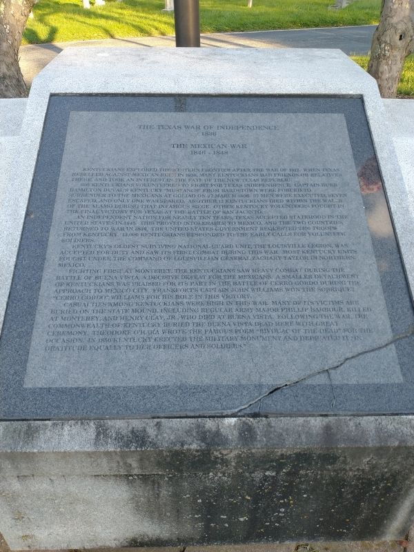
The Texas War of Independence 1836
The Mexican War 1846 - 1844
Photographed by Craig Doda, August 30, 2022
1. The Texas War of Independence 1836 Marker
Kentuckians explored the western frontier after the War of 1812. When Texas rebelled against Mexican rule in 1836, many Kentuckians had friends or relatives there and took an interest in the fate of the new Texas Republic.
500 Kentuckians volunteered to fight for Texas Independence, Captain Burr Hamilton Duval's Kentucky "Mustangs" from Hardstown were forced to surrender to the Mexicans at Goliad on 27 March 1886. 37 men were executed, seven escaped, and only one was spared, another 12 Kentuckians died within the walls of the Alamo during that infamous siege. Other Kentucky volunteers fought in the final victory for Texas at the Battle of San Jacinto.
An independent nation for nearly 10 years, Texas accepted statehood in the United States in 2845. This proved intolerable to Mexico, and the two countries returned to war in 1845. The United States government requested 2400 troops from Kentucky. 13,000 Kentuckians responded to the early calls for volunteer soldiers.
Kentucky's oldest National Guard Unit, the Louisville Legion, was accepted for duty and saw its first combat during the war. Most Kentucky Units fought
this page online
Fighting first at Monterey, the Kentuckians saw heavy combat during the Battle of Buena Vista, a decisive defeat for the Mexicans. A smaller detachment of Kentuckians was praised for its part in the Battle of Cerro Gordo during the Approach to Mexico City. Frankfort's Captain John Williamson the Sobriquet "Cherro Gordo" Williams for his roll in the victory.
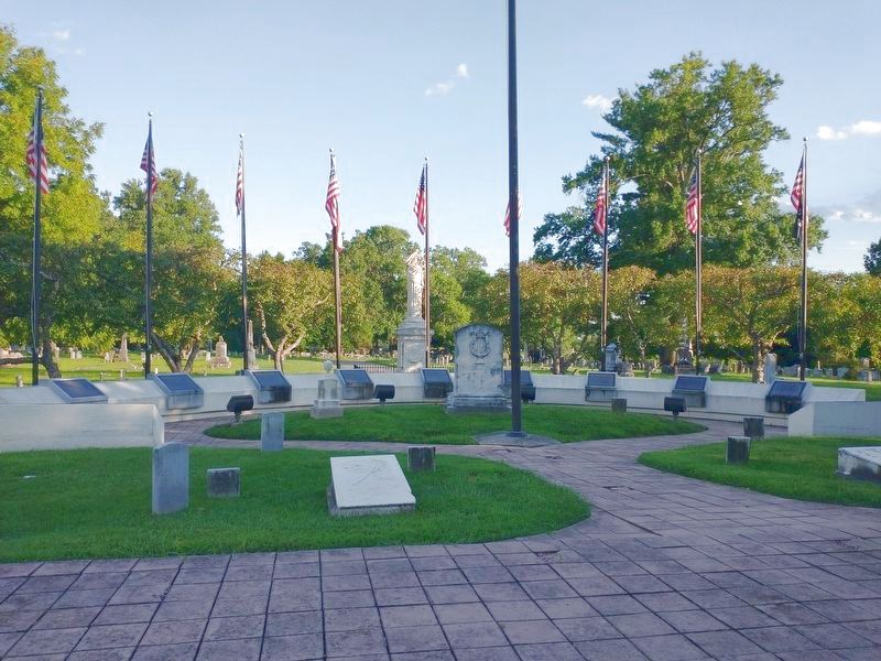
Casualties among Kentuckians were high in this war. Many of victims are buried on the State Mound, including Regular Army Mjor Phillip Barbour, killed at Monterey, and Henry Clay, Jr., who died at Buena Vista. Following the war, the Commonwealth of Kentucky buried the Buena Vista dead here with great ceremony. Theodore O'Hara wrote the famous poem "Bivouac of the Dead" for the occasion. In 1856 Kentucky erected the military monumentand dedicated it in gratitude equally to her officers and soldiers.
Topics. This historical marker is listed in these topic lists: War, Mexican-American • War, Texas Independence. A significant historical date for this entry is March 27, 1886.
Location. 38° 11.612′ N, 84° 51.881′ W.
Photographed by Craig Doda, August 30, 2022
2. The Texas War of Independence 1836 Marker

Regionally, this marker is in the Bluegrass Region. It is also in the American South and specifically in the Upper South. Globally, it is in North America, the Western Hemisphere, the Western World, and the Anglosphere. Historically, it finds itself in what was once the territory of the Mississippian Culture and also the Antebellum South.
Other nearby markers. At least 8 other markers are within walking distance of this marker: Spanish-American War (here, next to this marker); War of 1812 (here, next to this marker); Civil War (here, next to this marker); World War I (here, next to this marker); War Of Independence (a few steps from this marker); Korean Conflict (a few steps from this marker); The Persian Gulf War (a few steps from this marker); Vietnam Conflict (a few steps from this marker). Touch for a list and map of all markers in Frankfort.
Credits. This page was last revised on August 23, 2024. It was originally submitted on September 20, 2022, by Craig Doda of Napoleon, Ohio. This page has been viewed 1,235 times since then and 102 times this year. Photos: 1, 2. submitted on September 20, 2022, by Craig Doda of Napoleon, Ohio. • Mark Hilton was the editor who published this page.
