Near Homer in Dakota County, Nebraska — The American Midwest (Upper Plains)
Tonwantonga
Photographed by Cosmos Mariner, August 24, 2022
1. Tonwantonga Marker
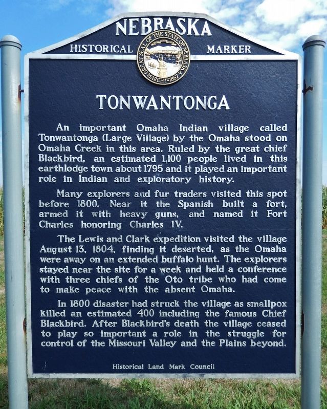
An important Omaha Indian village called Tonwantonga (Large Village) by the Omaha stood on Omaha Creek in this area. Ruled by the great chief Blackbird, an estimated 1,100 people lived in this earthlodge town about 1795 and it played an important role in Indian and exploratory history.
Many explorers and fur traders visited this spot before 1800. Near it the Spanish built a fort, armed it with heavy guns, and named it Fort Charles honoring Charles IV.
The Lewis and Clark expedition visited the village August 13, 1804, finding it deserted, as the Omaha were away on an extended buffalo hunt. The explorers stayed near the site for a week and held a conference with three chiefs of the Oto tribe who had come to make peace with the absent Omaha.
In 1800 disaster had struck the village as smallpox killed an estimated 400 including the famous Chief Blackbird. After Blackbird’s death the village ceased to play so important a role in the struggle for control of the Missouri Valley and the Plains beyond.
Erected by Historical Land Mark Council. (Marker Number 013.)
Topics and series. This historical marker is listed in
this page online
Location. 42° 21.254′ N, 96° 27.792′ W. Marker is near Homer, Nebraska, in Dakota County. It can be reached from U.S. 77 0.9 miles north of 225th Street, on the right when traveling north. Marker is located in a wayside on the east side of the highway. Touch for map. Marker is in this post office area: Homer NE 68030, United States of America. Touch for directions.

Regionally, this marker is in Eastern Nebraska. It is also in the American Midwest, in the Lewis & Clark Corridor, in the Corn Belt, and on the prairies. Globally, it is in North America, the Western Hemisphere, the Western World, and the Anglosphere. Historically, it finds itself in what was once the Louisiana Purchase.
Other nearby markers. At least 8 other markers are within 6 miles of this marker, measured as the crow flies: Combs School (approx. 4.3 miles away); Territorial Church (approx. 4.7 miles
Photographed by Cosmos Mariner, August 24, 2022
2. Tonwantonga Marker
Also see . . .
1. Mackay, the Otos & Omaha.
In November of 1795, Mackay laid out Fort Charles on a tiny rise of ground in the Missouri floodplain a mile from the Omaha Indian village near present-day Homer, Nebraska. Fort Charles was an impressive stockade with corner bastions, a storehouse, living quarters, and a trade room for the Omaha. The Spanish presence on the upper Missouri River would, in the course of time, become only an extended footnote in history. One of the principal results would be their legacy of maps that Lewis and Clark would find so faithful in their first year of travel.(Submitted on September 30, 2022, by Cosmos Mariner of Cape Canaveral, Florida.)
2. Lewis and Clark Expedition, August 13, 1804: The Omaha's Big Village.
The expedition passes old Fort Charles, a starting point for a previous exploration of the upper Missouri. They camp on a sandbar east of present-day Homer, Nebraska naming the camp Fish Camp. Men are sent to invite the Omahas to council.(Submitted on September 30, 2022, by Cosmos Mariner of Cape Canaveral, Florida.)"We came to where their had been a village of about 300 Cabbins. It was burned about 4 years ago immediately after near half the Nation died with the Small pox, which was as I was informed about 400, we found none of the natives about the place they were out hunting the Buffelow."
—John Ordway
Additional commentary.
1. Changed text marker placed.
A marker with different text, and a change in type style for the marker title has been installed in place of this marker. It is entitled "𝐓𝐨ⁿ𝐠𝐰𝐨ⁿ𝐠𝐭𝐡𝐨ⁿ 𝐓𝐨𝐧𝐠𝐚" (see https://mynehistory.com/items/show/602).
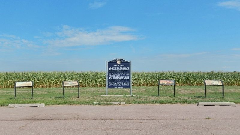
Additionally there are 4 interpetive markers next to this marker.
— Submitted November 18, 2025, by Mark Hilton of Montgomery, Alabama.
Credits. This page was last revised on November 18, 2025. It was originally submitted on September 30, 2022, by Cosmos Mariner of Cape Canaveral, Florida. This page has been viewed 1,851 times since then and 156 times this year. Photos: 1, 2. submitted on September 30, 2022, by Cosmos Mariner of Cape Canaveral, Florida.
Editor’s want-list for this marker. Photo of replaced marker added as a new marker page along with adding 4 new marker webpages for the nearby interpretive markers. • Can you help?
