Latexo in Houston County, Texas — The American South (West South Central)
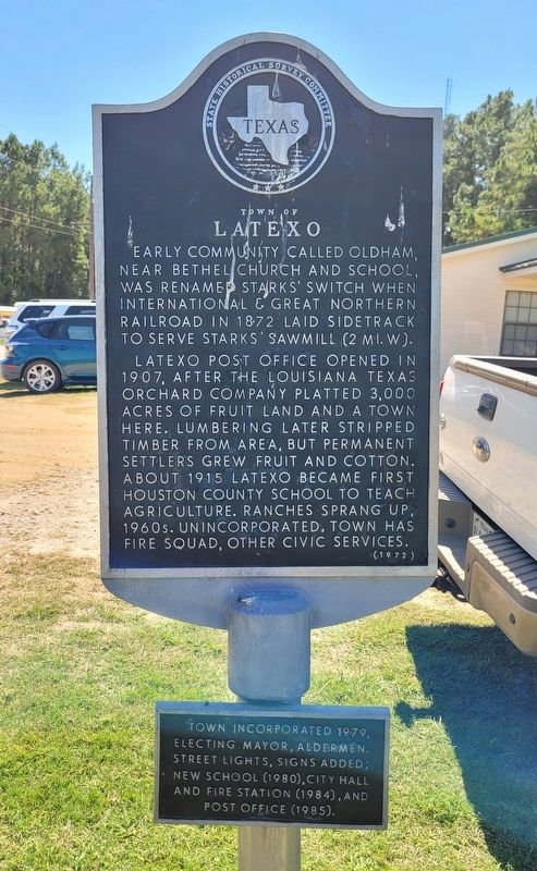
Town of Latexo
Latexo post office opened in 1907, after the Louisiana Texas Orchard Company platted 3,000 acres of fruit land and a town here. Lumbering later stripped timber from area, but permanent settlers grew fruit and cotton. About 1915 Latexo became first Houston County school to teach agriculture. Ranches sprang up, 1960s. Unincorporated, town has fire squad, other civic services.
2nd Plaque
Town incorporated 1979, electing mayor, aldermen. Street lights, signs added; new school (1980), city hall and fire station (1984), and post office (1985).
Erected 1972 by State Historical Survey Committee. (Marker Number 7028.)
Topics. This historical marker is listed in these topic lists: Agriculture • Education • Horticulture & Forestry • Industry & Commerce. A significant historical year for this entry is 1872.
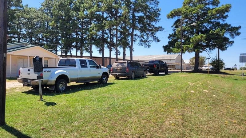
Location. 31° 23.72′ N, 95° 28.294′ W. Marker is in Latexo, Texas, in Houston County. Marker is on Farm to Market Road 2663, ¼ mile east of U.S. 287, on the right when traveling east. The marker is located in front of the Latexo Fire Station. Touch for map. Marker is at or near this postal address: 388 FM 2663, Latexo TX 75849, United States of America. Touch for directions.
Other nearby markers. At least 8 other markers are within 5 miles of this marker, measured as the crow flies. Latexo Baptist Church (approx. ¼ mile away); John Wortham (approx. 2½ miles away); Houston County (approx. 4.6 miles away); Site of Mary Allen Seminary (approx. 4.7 miles away); The Beazley House (approx. 5 miles away); Kings Highway Camino Real — Old San Antonio Road (approx. 5 miles away); Stage Coach Inn (approx. 5.1 miles away); Original Site of the Joseph R. Rice Log Cabin (approx. 5.1 miles away).
Also see . . . Stark's Switch. Texas Almanac
Latexo, previously known as Stark's Switch, is an incorporated rural community five miles north of Crockett on U.S. Highway 287 and State Highway 19 in north central Houston County. It was established in 1872, when the International and Great Northern Railroad was constructed through the area. The railroad built a small siding to serve nearby Stark's Sawmill, and a community, known as Stark's Switch, developed. Just after 1900 the Louisiana Texas Orchard Company purchased 3,000 acres surrounding the settlement and platted a town named Latexo, an acronym of the company's name.(Submitted on October 2, 2022, by James Hulse of Medina, Texas.)
Credits. This page was last revised on October 2, 2022. It was originally submitted on October 1, 2022, by James Hulse of Medina, Texas. This page has been viewed 161 times since then and 31 times this year. Photos: 1, 2. submitted on October 2, 2022, by James Hulse of Medina, Texas.

