Near Ewing in Lee County, Virginia — The American South (Mid-Atlantic)
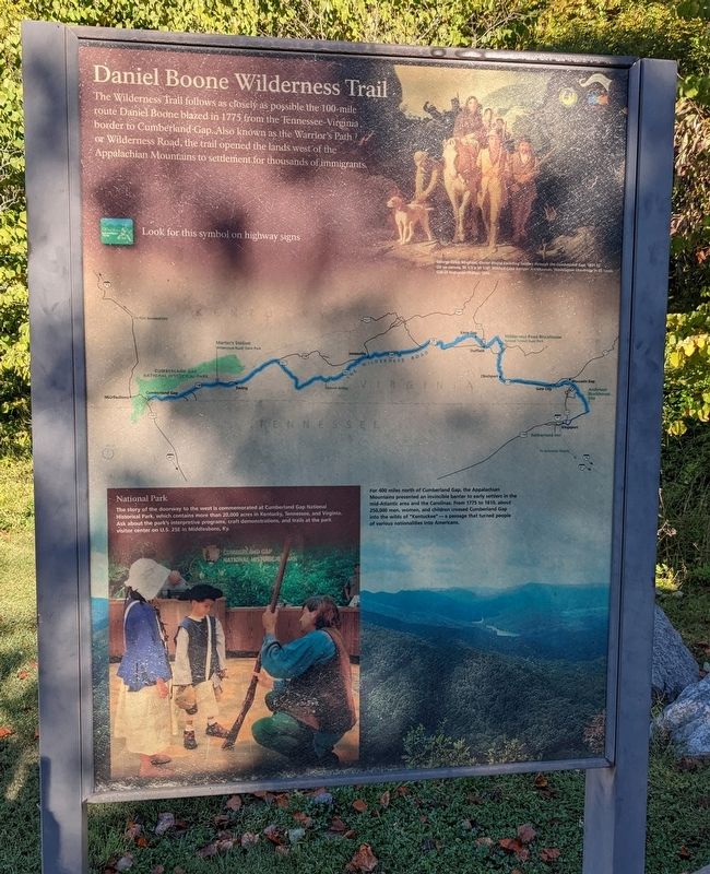
Daniel Boone Wilderness Trail
The Wilderness Trail follows as closely as possible the 100-mile route Daniel Boone blazed in 1775 from the Tennessee-Virginia border to Cumberland Gap. Also known as the Warrior's Path or Wilderness Road, the trail opened the lands west of the Appalachian Mountains to settlement for thousands of immigrants.
(Painting caption) George Caleb Bingham, Daniel Boone Escorting Settlers through the Cumberland Gap, 1851-52. Oil on canvas, 36 1/2 x 50 1/4". Mildred Lane Kemper Art Museum, Washington University in St. Louis. Gift of Nathanael Phillips, 1890.
(Inset caption) National Park The story of the doorway to the west is commemorated at Cumberland Gap National Historical Park, which contains more than 20,000 acres in Kentucky, Tennessee, and Virginia. Ask about the park's interpretive programs, craft demonstrations, and trails at the park visitor center on U.S. 25E in Middlesboro, Ky.
(Background caption) For 400 miles north of Cumberland Gap, the Appalachian Mountains presented an invincible barrier to early settlers in the mid-Atlantic area and the Carolinas. From 1775 to 1810, about 250,000 men, women, and children crossed the Cumberland Gap into the wilds of "Kentuckee" — a passage that turned people of various nationalities into Americans.
Erected by Cumberland Gap National Historical Park, National Park Service, U.S. Department of the Interior.
Topics. This historical marker is listed in these topic lists: Exploration • Immigration • Settlements & Settlers. A significant historical year for this entry is 1775.
Location. 36° 36.11′ N, 83° 39.614′ W. Marker is near Ewing, Virginia, in Lee County. Marker can be reached from North Cumberland Road north of Wilderness Road (U.S. 8), on the right when traveling north. Marker is an upright wayside outside the Daniel Boone Visitor Information Center. Touch for map. Marker is in this post office area: Ewing VA 24248, United States of America. Touch for directions.
Other nearby markers. At least 8 other markers are within walking distance of this marker. Abundance of Wild Beasts (within shouting distance of this marker); Warriors and Traders (within shouting distance of this marker); In Search of Food (within shouting distance of this marker); Fulfilling the Dream (about 700 feet away, measured in a direct line); Lee County / Tennessee (approx. ¼ mile away); Harrow School (approx. ¼ mile away in Tennessee); Boone Trail Highway Marker (approx. 0.3 miles away in Tennessee); Cumberland Gap Veterans Memorial (approx. 0.3 miles away in Tennessee). Touch for a list and map of all markers in Ewing.
Also see . . . Daniel Boone Wilderness Trail Association. Association website homepage (Submitted on February 25, 2024, by Larry Gertner of New York, New York.)
Credits. This page was last revised on February 25, 2024. It was originally submitted on October 3, 2022. This page has been viewed 198 times since then and 70 times this year. Last updated on October 12, 2022. Photos: 1. submitted on October 3, 2022. • Bernard Fisher was the editor who published this page.
