Gordonville in Lowndes County, Alabama — The American South (East South Central)
The Crosby Water System "The Well"
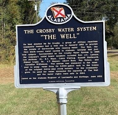
Photographed by Jon Pridgen
1. The Crosby Water System "The Well" Marker
Erected 2015 by Alabama Historical Association.
Topics and series. This historical marker is listed in these topic lists: African Americans • Settlements & Settlers. In addition, it is included in the Alabama Historical Association series list. A significant historical month for this entry is January 1955.
Location. 32° 9.114′ N, 86° 41.98′ W. Marker is in Gordonville, Alabama,
this page online

Regionally, this marker is in Alabama’s Tri-Counties River Region. It is also in the American South, specifically in the Deep South, and in the Black Belt. Globally, it is in North America, a Gulf of Mexico state, the Western Hemisphere, the Western World, and the Anglosphere. Historically, it finds itself in what was once the territory of the Mississippian Culture, one of the Confederate States of America, and the Antebellum South.
Other nearby markers. At least 8 other markers are within 9 miles of this marker, measured as the crow flies: Enslavement & Racial Terror / Lynching Targeting Black Sharecroppers (approx. 5.6 miles away); First Missionary Baptist Church, Hayneville (approx. 6.9 miles away); Varner's Cash Store (approx. 7.3 miles away); In Memory of Jonathan Myrick Daniels (approx. 7.3 miles away); Lynching in America / The Courthouse Lynching of Theo Calloway (approx.
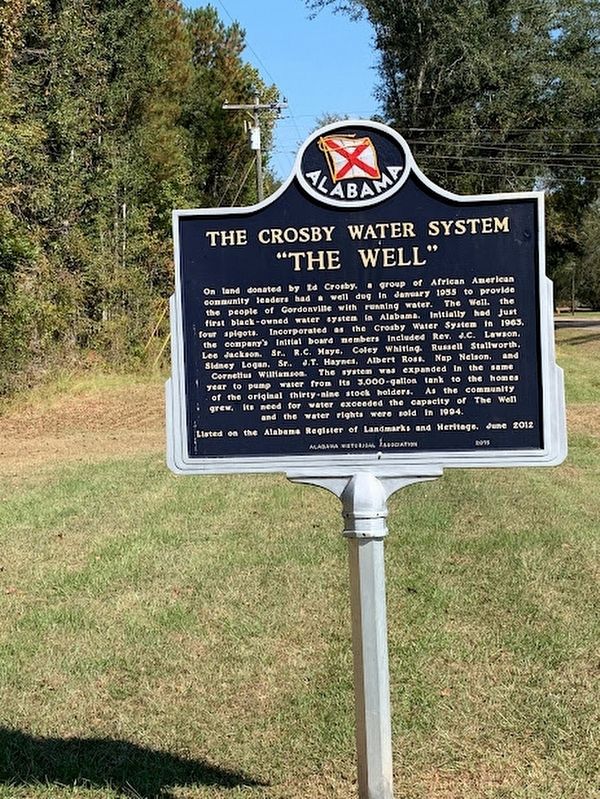
Photographed by Jon Pridgen
2. The Crosby Water System "The Well" Marker
Other markers no longer nearby. The Soldier Dead of Lowndes (was approx. 7.3 miles away but has been permanently removed); Hayneville (was approx. 7.3 miles away but has been confirmed missing); Town of Hayneville (was approx. 7.3 miles away but has been permanently removed).
Regarding The Crosby Water System "The Well". The site was listed on the Alabama Register of Landmarks and Heritage in June of 2012.
Credits. This page was last revised on October 8, 2022. It was originally submitted on October 7, 2022, by Jon Pridgen of Prattville, Alabama. This page has been viewed 564 times since then and 46 times this year. Photos: 1, 2. submitted on October 7, 2022, by Jon Pridgen of Prattville, Alabama. • Mark Hilton was the editor who published this page.
