Bloomfield in Stoddard County, Missouri — The American Midwest (Upper Plains)
The Civil War in Bloomfield
A State Divided:
— The Civil War in Missouri —
Photographed By Craig Swain, September 28, 2022
1. The Civil War in Bloomfield Marker
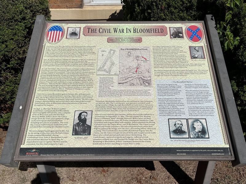
The marker features portraits of Gen. John McNeil (upper left); Gen. M. Jeff Thompson and Gen. John Marmaduke (upper right); Col. William L. Jeffers (lower left); and Maj. Samuel Montgomery and Martha Walker Montgomery (lower right).
Gen. M. Jeff Thompson's "Swamp Fox Brigade" of the pro-Confederate Missouri State Guard seized the town first, in late July 1861. Thompson set up his headquarters at Bloomfield and made the town a military center with gunsmith shops, hospitals, and enough supplies to accommodate some 3,000 southeast Missourians in his command.
In early November 1861, Union troops converged on Bloomfield from Pilot Knob and Cape Girardeau, Missouri and Cairo, Illinois to destroy Thompson's command. Two of the Federal columns marched into Bloomfield on November 8, only to find that Thompson and the Swamp Brigade had gone. Unable to contend with these forces, Thompson had retreated to New Madrid. The occupying Union soldiers ransacked some stores before making camp. That evening Federals commandeered the press of the Bloomfield Herald. With it, printers from the ranks published a camp newspaper titled the Stars and Stripes. This was the first edition of this famous military newspaper. The next morning brought word of Grant's defeat at Belmont, Missouri, and orders from Grant for the Union columns to return to their bases at Cape Girardeau and Cairo, Illinois. Elements of Thompson's cavalry reoccupied the town the following day.
Union forces raided Bloomfield again in January 1862, and captured a number of discharged Guardsmen enjoying a dance at the courthouse. In May, the 1st Wisconsin Cavalry rode into town once more and surprised Col. William G. Phelan's recruitment camp south of town. The Wisconsin troopers captured Phelan and several others and scattered the recruits. Detachments of the 1st Wisconsin retained possession of the town throughout the summer.
On Sept. 11, 1862 Capt. William L. Jeffers' Confederate command attacked Bloomfield, which was lightly defended by only a company of the 1st Wisconsin and a few Enrolled Missouri Militia. Jeffers drove the Union troops from the town and captured a large cache of weapons and ammunition including two pieces of artillery. The next day, Union reinforcements shelled the town and sent Jeffers retreating into Dunklin County.
The town changed hands again later in 1862, but, by spring of 1863, Gen. John McNeil's Union troops occupied Bloomfield.
During Confederate Gen. John S. Marmaduke's raid into southeast Missouri in April 1863,he dispatched troops to capture McNeil and his command, but they had escaped to Cape Girardeau. Marmaduke followed but was repulsed at Cape Girardeau on April 26, 1863. The Confederates, now pursued, retreated south along Crowley's Ridge through Bloomfield en route back to Arkansas. Marmaduke initially intended to make a stand on the northeast part of town near the Henry Miller home, but reconsidered and continued his withdrawal rather than face a superior Federal force.
After several relatively quiet months, Jeffers attacked Bloomfield for a second time on September 22, 1864. This was during Gen. Sterling Price's celebrated "Raid" through Missouri. With a mere 200 men available to defend the town, the Union commander started for Cape Girardeau with wagons filled with supplies. Jeffers attacked the fleeing Unionists near the Castor River, east of Bloomfield. The Union troops offered only feeble resistance, but enjoyed good fortune when their wagons jammed the bridge over the river, preventing Jeffers' men from crossing. The Confederates shoved the abandoned wagons into the Castor, but the Union troops out paced them and escaped across Little River after a brief pursuit and some minor skirmishing. The Confederates captured weapons and wagons, inflicted several casualties without loss,
and burned the bridge over the Castor River. Returning to Bloomfield, Jeffers' command destroyed the Union fortifications before marching to rejoin Price's army.
Guerrillas commanded by Polk Conyers arrived shortly after Jeffers' regiment left Bloomfield. Conyers was a notorious free-booter who usually operated in New Madrid and Pemiscot Counties. His guerrillas looted and destroyed much of the war-ravaged town, torching the courthouse along with several businesses and residences. Most of the property destroyed belonged to men serving in the Confederate army. After the devastation, Conyers boldly joined Price's army at Ironton, but when Price learned of the Guerrilla's actions he ordered him arrested. Although taken into custody, Conyers escaped and returned to his Pemiscot County haunts where Union militia later killed him.
Bloomfield changed hands sixteen times during the war. The different occupation forces, the raids, guerrillas, and finally the burning of the town in 1864, made the town another casualty of the long and bitter struggle for control of southeast Missouri.
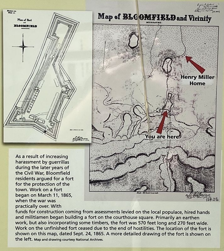
(Caption under the Maps):
As a result of increasing harassment by guerrillas during the later years of the Civil War, Bloomfield residents argued for a fort for the protection of the town. Work on a fort began on March 11, 1865, when the war was practically over.
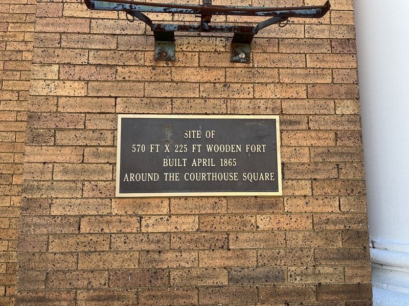
With funds for construction coming from assessments levied on the local populace, hired hands and militiamen began building a fort on the courthouse square. Primarily an earthen work, but also incorporating some timbers, the fort was 570 feet long and 270 feet wide. Work on the unfinished fort ceased due to the end of hostilities. The location of the fort is shown on this map, dated Sept. 24, 1865. A more detailed drawing of the fort is shown on the left.
(Lower Right Sidebar):
The Bloomfield Mutiny
Maj. Samuel Montgomery, 6th Missouri Cavalry Regiment (Union), commanded the post of Bloomfield in 1863. During his assignment, Montgomery associated freely with the local populace and eventually married Martha Owen Walker, a Confederate sympathizer.
Some of Montgomery's officers were offended by his associations and courtship. They believed he was a traitor who might not hold the town against the Confederates. During the evening of Oct. 21, 1863 the dissatisfied officers plotted to arrest Montgomery and forward their complaints regarding his conduct to district headquarters. The following morning soldiers forcibly took Montgomery's headquarters and placed him in custody, although he refused to recognize their authority.
When the mutineers reported their actions to Col. J.B. Rogers at Cape Girardeau, he dispatched an officer to
Bloomfield to assume command and to arrest the mutiny participants. Military authorities summarily dismissed the ringleader of the mutiny from the army and court-martialed four additional officers.
As for Montgomery, he continued in command at Bloomfield. After the war, he remained in the community with his "rebel" wife, where he served as a judge of the county court, a school board member, and as town mayor.
Erected by Missouri Department of Natural Resources.
Topics and series. This historical marker is listed in this topic list: War, US Civil. In addition, it is included in the Missouri - A State Divided: The Civil War in Missouri series list. A significant historical month for this entry is January 1862.
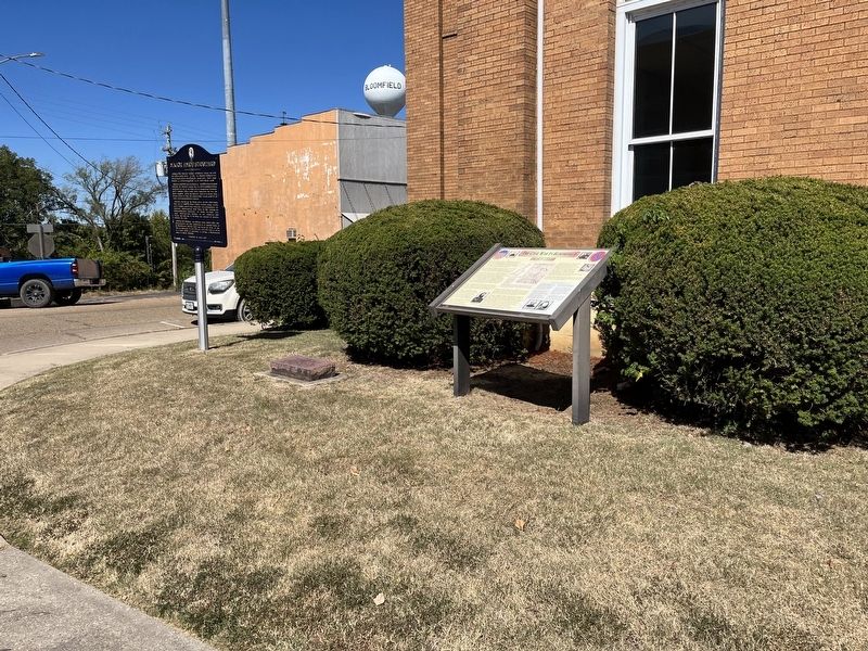
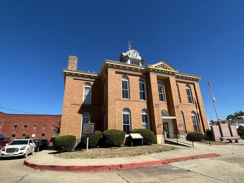
Location. 36° 53.071′ N, 89° 55.758′ W. Marker is in Bloomfield, Missouri, in Stoddard County. Marker is at the intersection of South Prairie Street (County Highway AA) and Court Street, on the left when traveling south on South Prairie Street. Located on the south side of the Stoddard County Courthouse. Touch for map. Marker is at or near this postal address: 403 South Prairie Street, Bloomfield MO 63825, United States of America. Touch for directions.
Other nearby markers. At least 8 other markers are within walking distance of this marker. Major Amos Stoddard (here, next to this marker); The Execution of Asa V. Ladd (within shouting distance of this marker); Stoddard Countians Aboard the C.S. Arkansas (within shouting distance of this marker); The First Stars and Stripes (within shouting distance of this marker); Mutiny in Bloomfield (about 300 feet away, measured in a direct line); The History of Bloomfield High School (approx. 0.2 miles away); The Bloomfield Academy (approx. 0.2 miles away); The Civil War Hospitals of Bloomfield (approx. 0.2 miles away). Touch for a list and map of all markers in Bloomfield.
Credits. This page was last revised on October 10, 2022. It was originally submitted on October 10, 2022, by Craig Swain of Leesburg, Virginia. This page has been viewed 598 times since then and 186 times this year. Photos: 1, 2, 3, 4, 5. submitted on October 10, 2022, by Craig Swain of Leesburg, Virginia.
