Windsor Terrace in Brooklyn in Kings County, New York — The American Northeast (Mid-Atlantic)
Vanderbilt Street
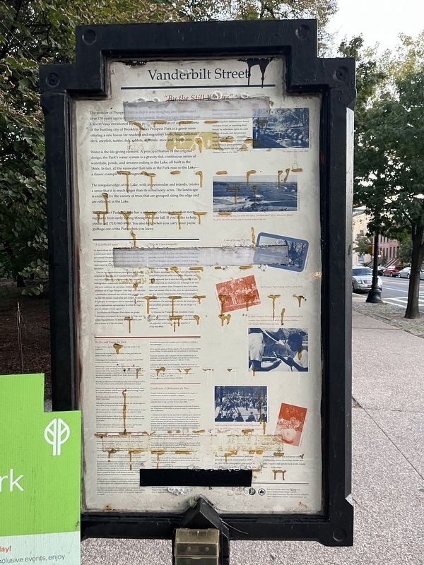
"By the Still Waters"
The wonder of Prospect Park is that it was designed and constructed over 130 years ago to appear to be natural. Frederick Law Olmsted and Calvert Vaux envisioned a public park as a rural retreat for the citizens of the bustling city of Brooklyn. Today Prospect Park is a green oasis offering a safe haven for resident and migratory birds, frogs, salamanders, crayfish, turtles, fish, rabbits, squirrels, mice and chipmunks.
Water is the life giving element. A principal feature of the original design, the Park's water system is a gravity-fed, continuous series of waterfalls, ponds, and streams ending in the Lake, all built in the 1860s. In fact all the rainwater that falls in the Park runs to the Lake—a classic example of the designers' genius.
The irregular edge of the Lake, with its peninsulas and islands, creates a sense that it is much larger than its actual sixty acres. The landscape is enriched by the variety of trees that are grouped along the edge and are reflected in the Lake.
The Prospect Park Alliance has a volunteer cleanup crew that meets regularly from early spring through the late fall. If you'd like to help, please call (718) 965-8960. You also help when you carry your picnic garbage out of the Park when you leave.
[Sidebar:]
The Vanderbilt Street entrance and playground were first constructed in 1929. In 1991-92 the playground was rebuilt to serve the communities of Brooklyn. The trace wooded landscape was enhanced with wildflowers, native flowering shrubs and trees. Falcons and hawks hunt in the woods here… in Brooklyn.
[Marker reverse:]
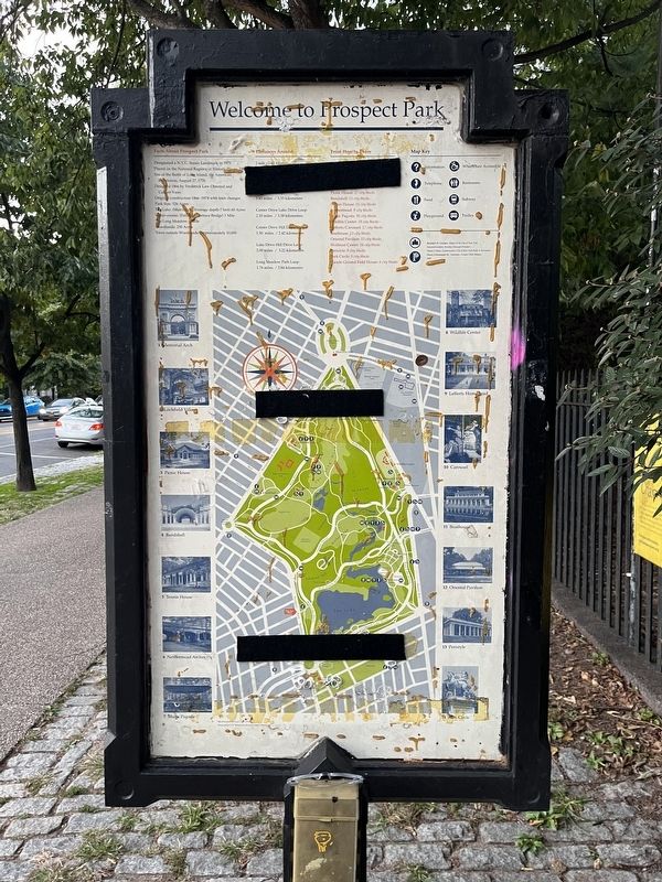
Facts About Prospect Park
• Designated a N.Y.C. Scenic Landmark in 1975
• Placed on the National Register of Historic Places, 1980
• Site of the Battle of Long Island, the American Revolution, August 27, 1776
• Designed 1866 by Frederick Law Olmsted and Cavert Vaux
• Original construction 1866 - 1874 with later changes
• Park Size: 526 Acres
• The Lake: (Man-made. Average depth-7 feet) 60 Acres
• Water-course: (Falling Terrace Bridge) 1 Mile
• The Long Meadow: 1 Mile
• Woodlands: 250 Acres
• Trees outside Woodlands: Approximately 10,000
Erected by Prospect Park Alliance, NYC Parks.
Topics and series. This historical marker is listed in these topic lists: Architecture • Horticulture & Forestry • Landmarks

Photographed By Devry Becker Jones (CC0), October 8, 2022
2. Welcome to Prospect Park side of the marker
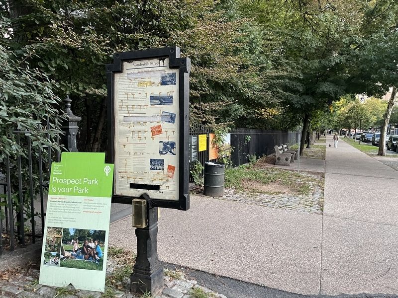
Location. 40° 39.291′ N, 73° 58.393′ W. Marker is in Brooklyn, New York, in Kings County. It is in Windsor Terrace. Marker is at the intersection of Prospect Park Southwest and Vanderbilt Street, on the right when traveling north on Prospect Park Southwest. Touch for map. Marker is at or near this postal address: 159 Prospect Park Southwest, Brooklyn NY 11218, United States of America. Touch for directions.
Other nearby markers. At least 8 other markers are within walking distance of this marker. Sixteenth Street (approx. 0.2 miles away); The Wellhouse (approx. 0.2 miles away); How Does this Garden Save Water? (approx. 0.2 miles away); Lookout Hill Woodland Restoration (approx. 0.2 miles away); Maryland Monument (approx. 0.3 miles away); Immaculate Heart of Mary Parish WWII Memorial (approx. 0.4 miles away); For Valor and Sacrifice (approx. 0.6 miles away); Henry Bergh-Monument (approx. 0.6 miles away). Touch for a list and map of all markers in Brooklyn.
Also see . . . Prospect Park - National Archives. National Register of Historic Places documentation (Submitted on March 3, 2024, by Anton Schwarzmueller of Wilson, New York.)

Photographed By Devry Becker Jones (CC0), October 8, 2022
3. Vanderbilt Street Marker
The marker has been covered with this sign. It is adhered with Velcro and is removable.
Additional keywords. landscape architecture
Credits. This page was last revised on March 3, 2024. It was originally submitted on October 10, 2022, by Devry Becker Jones of Washington, District of Columbia. This page has been viewed 100 times since then and 34 times this year. Photos: 1, 2, 3, 4. submitted on October 10, 2022, by Devry Becker Jones of Washington, District of Columbia.

