Athens in Athens-Clarke County, Georgia — The American South (South Atlantic)
A City Gets on Track
Industry and Neighborhoods Expand

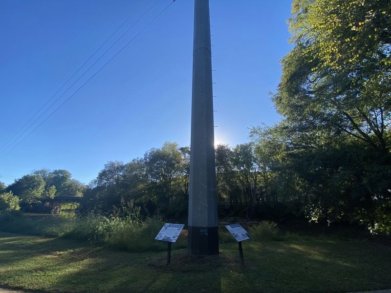
Photographed by Darren Jefferson Clay, September 23, 2022
1. A City Gets on Track Marker
Commercial hubs outside of downtown, such as Five Points and Normaltown, were generated along the tracks. The University of Georgia began to expand southward from North Campus. In the 1890s, a 300-acre streetcar suburb was developed on Boulevard. In 1902, Southern Manufacturing Company and its mill housing was built on the west end of the Boulevard neighborhood, adjacent to the streetcar tracks.
(captions)
(above): This building - built in the mid-1870s - was originally the offices of the Southern Mutual Insurance Co. Southern Mutual later built a "skyscraper" on this site in 1908, moving the original building two blocks away to the NE corner of Hancock and College, where it became the second home for the electric company. It was demolished by urban renewal programs in the 1960s. (inset): Early 1900s nighttime view of a spectacular electric sign for th offices of the Athens Railway and Electric Co. located in the Shackleford Building
this page online
Expansion of Neighborhoods Outside of Downtown
Woodlawn historic District adjacent to the Mileage Ave. trolley line
Cobham Historic District adjacent to the Prince Ave. trolley line
Boulevard Historic District, Athens' first streetcar suburb.
(right): Boulevard streetcar barn, conductors, and engineers.
(above): Ca. 1910 view of streetcar on Prince Ave. (left): Ca. 1910 view of streetcar on Milledge Ave.
Expansion of Industry Outside of Downtown Warehouse Historic District in the early 1900s
Empire State Chemical Co. on Winterville Rd.
Southern Manufacturing Co. Boulevard area.
Harden & Phinizy cotton warehouses on Chase St.
R.L. Moss Manufacturing Co. on Cleveland Ave.
(left): Early 1900s cast-iron toy trolley car.
Topics. This historical marker is listed in this topic list: Industry & Commerce.
Location. 33° 57.32′ N, 83° 22.051′ W. Marker is in Athens, Georgia, in Athens-Clarke County. It can be reached from East Broad Street west of Mulberry Street, on the left when traveling west. Located in Dudley Park along the
Photographed by Darren Jefferson Clay, September 23, 2022
2. A City Gets on Track Marker

Regionally, this marker is in the Classic City Area and in the Piedmont. It is also in the American South and specifically in the Deep South. Globally, it is in North America, the Western Hemisphere, the Western World, and the Anglosphere. Historically, it finds itself in what was once the territory of the Mississippian Culture, one of the original Thirteen Colonies, one of the Confederate States of America, and the Antebellum South.
Other nearby markers. At least 8 other markers are within walking distance of this marker: A different marker also named A City Gets on Track (here, next to this marker); Railroad Heritage (within shouting distance of this marker); a different marker also named Railroad Heritage (within shouting distance of this marker); a different marker also named Railroad Heritage (within shouting distance of this marker); a different marker also named Railroad Heritage (within shouting distance of this marker); Dudley Park (within shouting distance of this marker); a different marker also named Dudley Park (within shouting distance of this marker); Oconee River (within shouting distance of this marker). Touch for a list and map of all markers in Athens.
Credits. This page was last revised on October 12, 2022. It was originally submitted on October 11, 2022, by Darren Jefferson Clay of Duluth, Georgia. This page has been viewed 410 times since then and 62 times this year. Photos: 1, 2. submitted on October 11, 2022, by Darren Jefferson Clay of Duluth, Georgia. • Bernard Fisher was the editor who published this page.
