Athens in Athens-Clarke County, Georgia — The American South (South Atlantic)
Modern Development
Automobiles and Sprawl
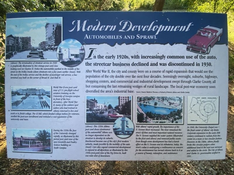
After World War II, the city and county were on a course of rapid expansion that would see the population of the city double over the next four decades. Seemingly overnight, suburbs, highways, shopping centers, and commercial and industrial development swept through Clarke County, all but consuming the last remaining vestiges of rural landscape. The local post-war economy soon diversified the area's industrial base.
(captions)
(above): The termination of streetcar service in 1930 is graphically illustrated by this vintage post card view looking west on Clayton St. Notice the automobiles parked in the middle of the street on the trolley tracks where streetcars ran a few years earlier. (inset): With the end of the trolley service and the decline of passenger rail service, a bus terminal was built on the corner of Broad St. and Hull St.
World War II-era post card view of U.S. pre-flight school aviators training on the University of Georgia campus in front of the boys dormitory. After World War II, many of the soldiers and sailors who had trained in Athens returned to live and work or to finish college. The GI Bill, which funded college tuition for veterans, swelled the post-war enrollment and initiated a vast expansion of the university and town.
During the 1950s the face of the University changed rapidly, as illustrated by this period post card view of the new Livestock and Poultry Science building on South Campus.
(above): This 1950s Athens post card shows dominance of the automobile. Athens was no longer dependent on the streetcar to develop its suburbs. Beechwood became one of the city's first modern suburbs, made possible by the mobility of the auto. (inset): Cars also caused commercial development to expand in all directions as illustrated by this 1950s post card view of the Pig Drive-In, built one mile west of downtown.
Image caption: With Athens' rapid growth, the importance of the N. Oconee River increased The river remained the area's lifeline and dos important natural resource. The N. Oconee supplied the war system (illustrated by the post card above) and removed public waste. Even though some development has had a harsh effect on the N. Oconee and its tributaries, today, the river's value is undergoing a renaissance as concern for the environment has turned citizens back to it as a source of beauty, relaxation, and sustenance.
In 1840, the University of Georgia was the fixed center of Athens' city limits. Corporate expansion in the early 20th century continued to radiate from this center in a more or less circular fashion. However, in the 1980s, Athens finally broke this circular pattern when additional land to the west was surveyed and added to the circle. The City of Athens and Clarke Co. governments unified in 1991.
Topics. This historical marker is listed in these topic lists: Industry & Commerce • Railroads & Streetcars • Roads & Vehicles.
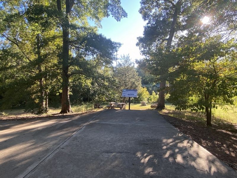
Location. 33° 57.278′ N, 83° 22.039′ W. Marker is in Athens, Georgia, in Athens-Clarke County. Marker can be reached from South Poplar Street north of Oak Street, on the left when traveling north. Located in Dudley Park along the Athens-North Oconee River Greenway. Touch for map. Marker is at or near this postal address: 286 S Poplar St, Athens GA 30601, United States of America. Touch for directions.
Other nearby markers. At least 8 other markers are within walking distance of this marker. Oconee River (a few steps from this marker); A City Gets on Track (within shouting distance of this marker); a different marker also named A City Gets on Track (about 300 feet away, measured in a direct line); Dudley Park (about 300 feet away); a different marker also named Dudley Park (about 300 feet away); Railroad Heritage (about 400 feet away); a different marker also named Railroad Heritage (about 400 feet away); a different marker also named Railroad Heritage (about 400 feet away). Touch for a list and map of all markers in Athens.
Credits. This page was last revised on October 13, 2022. It was originally submitted on October 11, 2022, by Darren Jefferson Clay of Duluth, Georgia. This page has been viewed 68 times since then and 8 times this year. Photos: 1, 2. submitted on October 11, 2022, by Darren Jefferson Clay of Duluth, Georgia. • Bernard Fisher was the editor who published this page.

