Township of Rideau Lakes in Leeds and Grenville United Counties, Ontario — Central Canada (North America)
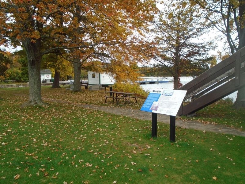
Blockhaus de Narrows Blockhouse
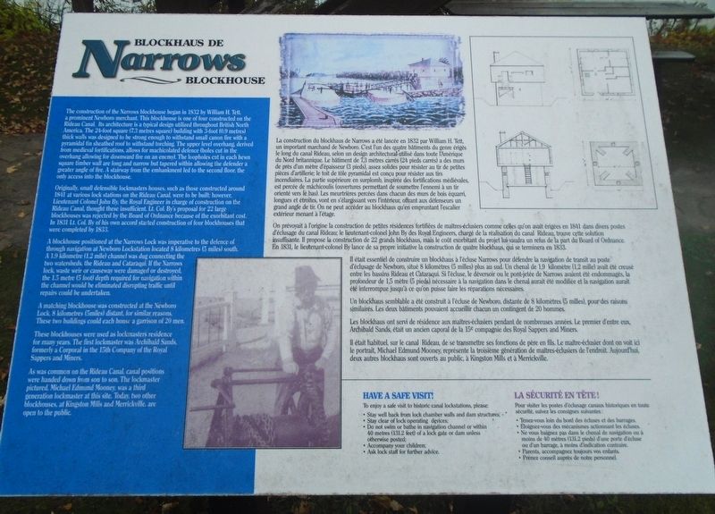
Originally, small defensible lockmasters houses, such as those constructed around 1841 at various lock stations on the Rideau Canal, were to be built; however, Lieutenant Colonel John By, the Royal Engineer in charge of construction on the Rideau Canal, thought these insufficient. Lt. Col. By's proposal for 22 large blockhouses was rejected by the Board of Ordnance because of the exorbitant cost. In 1831 Lt. Col. By of his own accord started construction of four blockhouses that were completed by 1833.
A blockhouse positioned at the Narrows Lock was imperative to the defence of through navigation at Newboro Lockstation located 8 kilometres (5 miles) south. A 1.9 kilometre (1.2 mile) channel was dug connecting the two watersheds, the Rideau and Cataraqui. If the Narrows lock, waste weir or causeway were damaged or destroyed, the 1.5 metre (5 foot) depth required for navigation within the channel would be eliminated disrupting traffic until repairs could be undertaken.
A matching blockhouse was constructed at the Newboro Lock, 8 kilometres (5miles) distant, for similar reasons. These two buildings could each house a garrison of 20 men.
These blockhouses were used as lockmasters residence for many years. The first lockmaster was Archibald Sands, formerly a Corporal in the 15th Company of the Royal Sappers and Miners.
As was common on the Rideau Canal, canal positions were handed down from son to son. The lockmaster pictured, Michael Edmund Mooney, was a third generation lockmaster at this site. Today, two other blockhouses, at Kingston Mills and Merrickville, are open to the public.
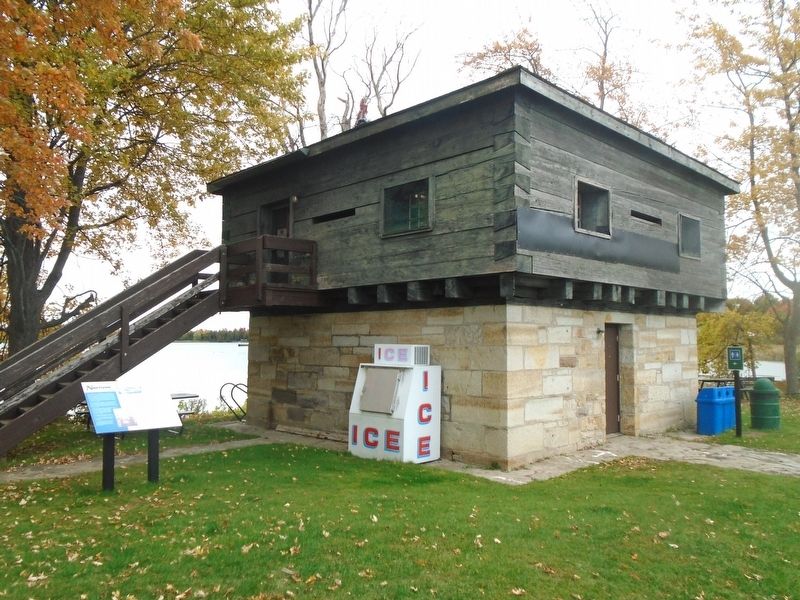
construction du blockhaus de Narrows a été lancée en 1832 par William H. Tett, un important marchand de Newboro. C'est l'un des quartre bâtiments du genre érigés le long du canal Rideau, selon un design architectural utilisé dans toute l'Amérique du Nord britannique. Le bâtiment de 7,3 mètres carrés (24 pieds carrés) a des murs de près d'un mètre d'épaisseur (3 pieds), assez solides pour résister au tir de petites pièces de mâchicoulis (ouvertures permettant de soumettre l'ennemi à un tir orienté vers le bas). Les meurtrières percées dans chacun des murs de bois équarri, longues et étroites, vont en s'élargissant vers l'intérieur, offrant aux défenseurs un grand angle de tir. On ne peut accéder au blockhaus qu'en empruntant l'escalier extérieur menant à l'étage.
On prévoyait à l'origine la construction de petites résidences fortifiées de maîtres-éclusiers comme celles qu'on avait érigées en 1841 dans divers postes d'éclusage du canal Rideau; le lieutenant-colonel John By des Royal Engineers, chargé de la réalisation du canal Rideau, trouve cette solution insuffisante. Il propose la construction de 22 grands blockhaus, mais le coût exorbitant du projet lui vaudra un refus de la part du Board of Ordnance. En 1831, le lieutenant-colonel By lance de sa propre initiative la construction de quatre blockhaus, qui se terminera en 1833.
Il était essentiel de construire un blockhaus à l'écluse Narrows pour défendre la navigation de transit au poste d'éclusage de Newboro, situé 8 kilomètres (5 milles) plus au sud. Un chenal de 1,9 kilomètre (1,2 mille) avait été creusé entre les bassins Rideau et Cataraqui. Si l'écluse, le déversoir ou le pont-jetée de Narrows avaient été endommagés, la profondeur de 1,5 mètre (5 pieds) nécessaire à la navigation dans le chenal aurait été modifiée et la navigation aurait été interrompue jusqu'à ce qu'on puisse faire les réparations nécessaires.
Un blockhaus semblable a été construit à l'écluse de Newboro, distante de 8 kilomètres (5 milles), pour des raisons similaires. Les deux bâtiments pouvaient accueillir chacun un contingent de 20 hommes.
Les blockhaus ont servi de résidence aux maîtres-éclusiers pendant de nombreuses années. Le premier d'entre eux, Archibald Sands, était un ancien caporal de la 15e compagnie des Royal Sappers and Miners.
Il était habituel, sur le canal Rideau, de se transmettre ses fonctions de père en fils. Le maître-éclusier dont on voit ici le portrait, Michael Edmund Mooney, représente la troisième génération de maîtres-éclusiers de l'endroit. Aujourd'hui, deux autres blockhaus sont ouverts au public, à Kingston Mills et à Merrickville.
Topics. This historical marker is listed in these topic lists: Forts and Castles • Waterways & Vessels. A significant historical year for this entry is 1832.
Location. 44° 42.162′ N, 76° 17.724′ W. Marker is in Township of Rideau Lakes, Ontario, in Leeds and Grenville United Counties. Marker is at the intersection of Narrows Lock Road (County Highway 14) and the Rideau Canal, on the right when traveling north on Narrows Lock Road. Marker and Blockhouse are at Lock 35 on the Rideau Canal. Touch for map. Marker is in this post office area: Township of Rideau Lakes ON K0G 1V0, Canada. Touch for directions.
Other nearby markers. At least 8 other markers are within 13 kilometers of this marker, measured as the crow flies. Narrows (here, next to this marker); Rivers, Lakes and Locks / Rivières, Lacs et Écluses (a few steps from this marker); The Enemy to the South / l'Ennemi du Sud (a few steps from this marker); Two Lakes from One / d'Une Pierre Deux Coups (a few steps from this marker); Crosby Methodist Church Bell (approx. 6.4 kilometers away); Blanche A. Thompson Leggett (approx. 6.5 kilometers away); The Methodist New Connection Church (approx. 6.5 kilometers away); Historic Elgin (approx. 12 kilometers away). Touch for a list and map of all markers in Township of Rideau Lakes.
Also see . . .
1. Blockhouse at Narrows Lockstation Recognized Federal Heritage Building. (Submitted on October 11, 2022, by William Fischer, Jr. of Scranton, Pennsylvania.)
2. Defensive Buildings of the Canal in The Architectural Heritage of the Rideau Corridor (Humphreys). (Submitted on October 11, 2022, by William Fischer, Jr. of Scranton, Pennsylvania.)
Credits. This page was last revised on October 11, 2022. It was originally submitted on October 11, 2022, by William Fischer, Jr. of Scranton, Pennsylvania. This page has been viewed 81 times since then and 14 times this year. Photos: 1, 2, 3. submitted on October 11, 2022, by William Fischer, Jr. of Scranton, Pennsylvania.


