Perth in Lanark County, Ontario — Central Canada (North America)
Hub of Activity & Change
Tay Basin
— Tay River Trail • Overland, Over Water, Over Time —
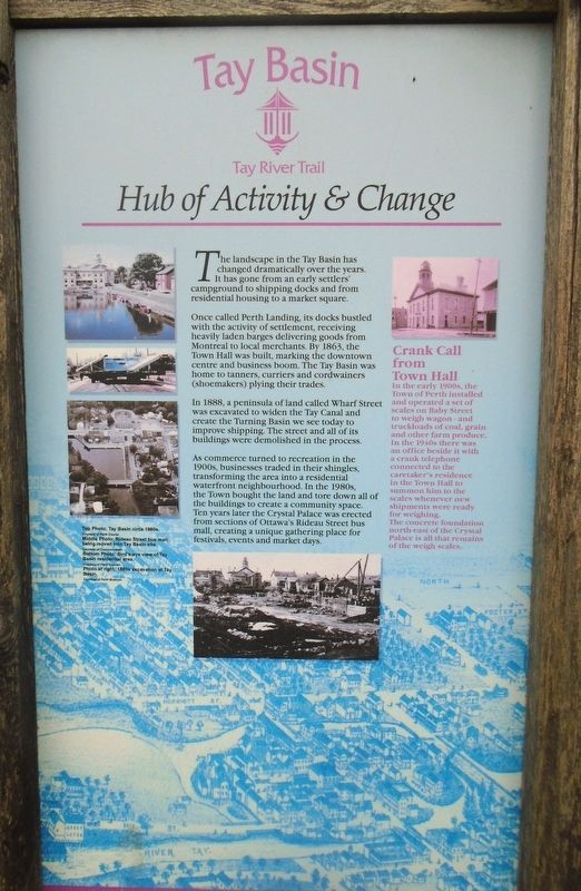
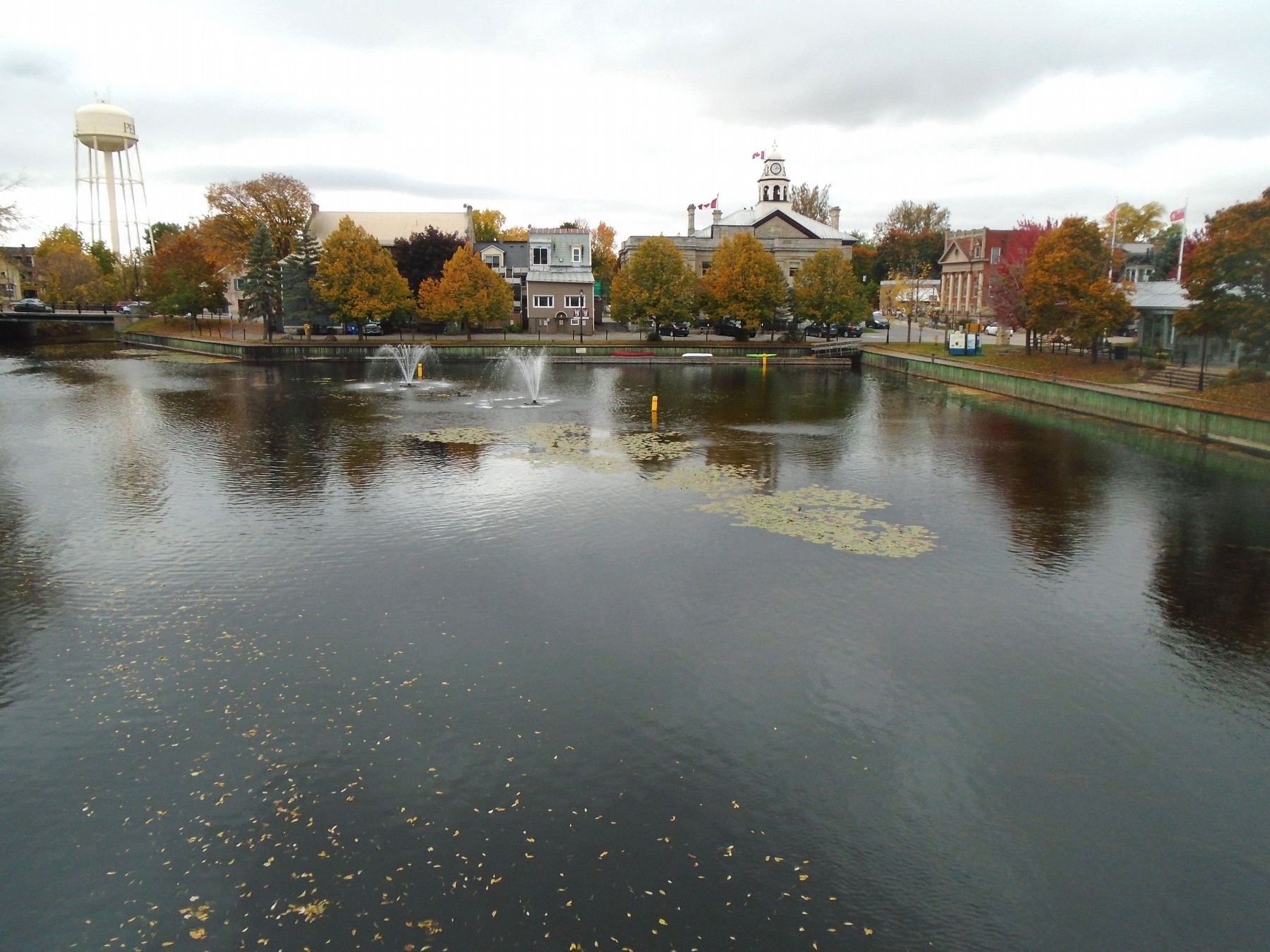
The landscape in the Tay Basin has changed dramatically over the years. It has gone from an early settlers' campground to shipping docks and from residential housing to a market square.
Once called Perth Landing, its docks bustled with the activity of settlement, receiving heavily laden barges delivering goods from Montreal to local merchants. By 1863, the Town Hall was built, marking the downtown centre and business boom. The Tay Basin was home to tanners, curriers and cordwainers (shoemakers) plying their trades.
In 1888, a peninsula of land called Wharf Street was excavated to widen the Tay Canal and create the Turning Basin we see today to improve shipping. The street and all of its buildings were demolished in the process.
As commerce turned to recreation in the 1900s, businesses traded in their shingles, transforming the area into a residential waterfront neighbourhood. In the 1980s, the Town bought the land and tore down all of the buildings to create a community space. Ten years later the Crystal Palace was erected from sections of Ottawa's Rideau Street bus mall, creating a unique gathering place for festivals, events and market days.
Crank Call from Town Hall
In the early 1900s, the Town of Perth installed and operated a set of scales on Baby Street to weigh wagon - and truckloads of coal, grain and other farm produce. In the 1940s there was an office beside it with a crank telephone connected to the caretaker's residence in the Town Hall to summon him to the scales whenever new shipments were ready for weighing. The concrete foundation north-east of the Crystal Palace is all that remains of the weigh scales.
Top Photo: Tay Basin circa 1980s.
Middle Photo: Rideau Street bus mall being moved into Tay Basin site.
Bottom Photo: Bird's-eye view of Tay Basin residential area.
Photo at right: 1880s excavation of Tay Basin.
Topics. This historical marker is listed in these topic lists: Charity & Public Work • Industry & Commerce • Settlements & Settlers • Waterways & Vessels. A significant historical year for this entry is 1863.
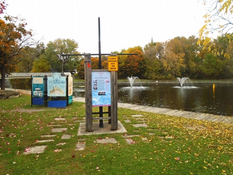
Location. 44° 53.975′ N, 76° 14.89′ W. Marker is in Perth, Ontario, in Lanark County. Marker is at the intersection of Basin Street and Tay Street, on the right when traveling north on Basin Street. Marker kiosk is just south of the "Crystal Palace". Touch for map. Marker is in this post office area: Perth ON K7H 1E9, Canada. Touch for directions.
Other nearby markers. At least 8 other markers are within walking distance of this marker. Boats, Boats, Boats (here, next to this marker); Welcome to the Tay River Trail (here, next to this marker); Perth Military Settlement
(here, next to this marker); Perth, A Unique Blend / Perth un mélange exceptionnel (here, next to this marker); The First Canal/ Le premier canal Tay (here, next to this marker); By Barge and Bateau / Par barges et chalands (here, next to this marker); Tay Canal Revival / Renaissance du canal Tay (here, next to this marker); The Canal Evolves / l'Évolution du canal (here, next to this marker). Touch for a list and map of all markers in Perth.
Also see . . .
1. The Tay Canal: Past, Present and 175th (Watson, 2009). (Submitted on October 14, 2022, by William Fischer, Jr. of Scranton, Pennsylvania.)
2. Tay River Basin. (Submitted on October 14, 2022, by William Fischer, Jr. of Scranton, Pennsylvania.)
Additional keywords. Hub of Activity & Change
Credits. This page was last revised on October 15, 2022. It was originally submitted on October 14, 2022, by William Fischer, Jr. of Scranton, Pennsylvania. This page has been viewed 85 times since then and 7 times this year. Photos: 1, 2, 3. submitted on October 14, 2022, by William Fischer, Jr. of Scranton, Pennsylvania.


