
Northwest Tampa in Hillsborough County, Florida — The American South (South Atlantic)
De Soto
Photographed by Mike Stroud, June 6, 2009
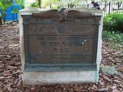
1. De Soto Marker
[ DAR Emblem ]
This Tablet Erected By
De Soto Chapter
D.A.R.
Marks the tree under which tradition say's
De Soto
Parleyed with the Indians
Erected 1926 by Daughters of the American Revolution.
Topics and series. This historical marker is listed in these topic lists: Exploration • Indigenous Peoples and Communities • Settlements & Settlers. In addition, it is included in the Daughters of the American Revolution (DAR) series list. A significant historical year for this entry is 1539.
Location. 27° 56.767′ N, 82° 27.826′ W. Marker is in Tampa, Florida, in Hillsborough County. It is in Northwest Tampa. It can be reached from University Drive near West Kennedy Boulevard.. Opposite Tampa Bay Hotel, University of Tampa Campus. Touch for map. Marker is in this post office area: Tampa FL 33606, United States of America. Touch for directions.

Regionally, this marker is on Florida’s Tampa Bay. It is also in the American South and on the Gulf Coast. Globally, it is in the North Atlantic Region, North America, a Gulf of Mexico state, the Western Hemisphere, the Western World, and the
this page online
Other nearby markers. At least 8 other markers are within walking distance of this marker: Tampa Bay Hotel (within shouting distance of this marker); a different marker also named Tampa Bay Hotel (within shouting distance of this marker); Tampa Bay Hotel, 1891 (within shouting distance of this marker); Fort Brooke Battery (about 300 feet away, measured in a direct line); United Spanish War Veterans (about 400 feet away); The Spanish Fort (about 400 feet away); 400th Anniversary of the Landing of Panfilo de Narvaez (about 500 feet away); Babe's Longest Homer (about 700 feet away). Touch for a list and map of all markers in Tampa.
Also see . . . DeSoto, Wikipedia entry. In May 1539, de Soto landed nine ships with over 620 men and 220 surviving horses at present day Shaw's Point, in Bradenton, Florida. He named it Espíritu Santo after the Holy Spirit. The ships brought priests, craftsmen, engineers, farmers, and merchants; some with their
Photographed by Mike Stroud, June 6, 2009
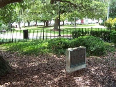
2. De Soto Marker, at Plant Park on the University of Tampa Campus
Library of Congress
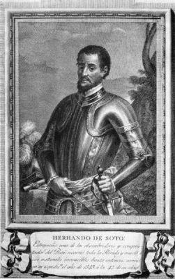
3. De Soto
Credits. This page was last revised on July 28, 2024. It was originally submitted on July 13, 2009, by Mike Stroud of Bluffton, South Carolina. This page has been viewed 2,304 times since then and 36 times this year. Photos: 1, 2, 3. submitted on July 13, 2009, by Mike Stroud of Bluffton, South Carolina. • Syd Whittle was the editor who published this page.
