Perth in Lanark County, Ontario — Central Canada (North America)
By Barge and Bateau / Par barges et chalands
Inscription.
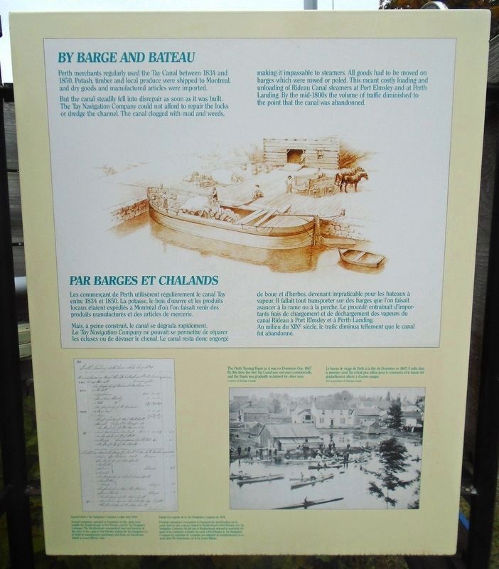
But the canal steadily fell into disrepair as soon as it was built. The Tay Navigation Company could not afford to repair the locks or dredge the channel. The canal clogged with mud and weeds, making it impassable to steamers. All goods had to be moved on barges which were rowed or poled. This meant costly loading and unloading of Rideau Canal steamers at Port Elmsley and at Perth Landing. By the mid-1800s the volume of traffic diminished to the point that the canal was abandonned.
[Photo captions, left to right, read]
• Excerpt from a Tay Navigation Company Ledger from 1834.
Several companies operated as forwarders on the canal, most notably the Weatherheads at Port Elmsley and the Tay Navigation Company. The Weatherheads monopolized land and business at the entry to the canal at Port Elmsley, forcing the Tay Navigation Co. to build its transhipment warehouses and docks on Stonehouse Island in Lower Rideau Lake.
• The Perth Turning Basin as it was on Dominion Day, 1867. By this time the first Tay Canal was not used commercially, and the Basin was gradually reclaimed for other uses.
Mais, à peine construit, le canal se dégrada rapidement. La Tay Navigation Company ne pouvait se permettre de réparer les écluses ou de dévaser le chenal. Le canal resta donc engorgé de boue et d'herbes, devenant impraticable pour les bateaux à vapeur. Il fallait tout transporter sur des barges que l'on faisait avancer à la rame ou à la perche. Le procédé entraînait d'importants frais de chargement et de déchargement des vapeurs du canal Rideau à Port Elmsley et à Perth Landing. Au milieu du XIXe siècle, le trafic diminua tellement que le canal fut abandonné.
[Légendes des photos, de gauche à droite, lire]
• Extrait d'un registre de la Tay Navigation Company de 1834.
Plusieurs entreprises s'occupaient du transport des marchandises sur le canal, dont les plus connues étaient la Weatherheads à Port Elmsley et la Tay Navigation Company. Du fait que la
Weatherheads détenait le monopole des quais et du commerce à l'entrée du canal, à Port Elmsley, la Tay Navigation Company fut contrainte de construire ses entrepôts de transbordement et ses quais dans l'ile Stonehouse, sur le lac Lower Rideau.
• Le bassin de virage de Perth à la fête du Dominion en 1867. À cette date, le premier canal Tay n'était plus utilisé pour le commerce et le bassin fut graduellement affecté à d'autres usages.
Topics. This historical marker is listed in these topic lists: Industry & Commerce • Settlements & Settlers • Waterways & Vessels. A significant historical year for this entry is 1834.
Location. 44° 53.976′ N, 76° 14.885′ W. Marker is in Perth, Ontario, in Lanark County. Marker is at the intersection of Basin Street and Tay Street, on the right when traveling north on Basin Street. Marker kiosk is just south of the "Crystal Palace". Touch for map. Marker is in this post office area: Perth ON K7H 1E9, Canada. Touch for directions.
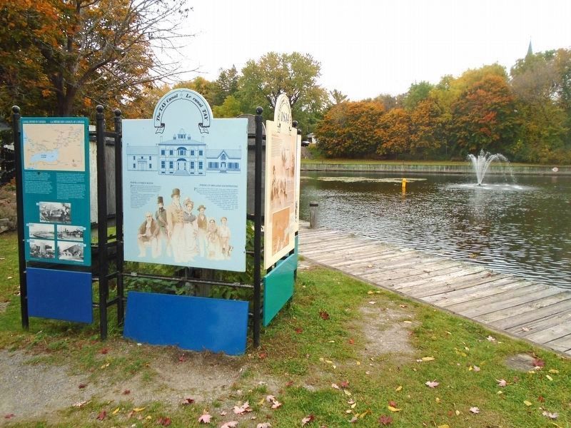
Other nearby markers. At least 8 other markers are within walking distance of this marker. Perth, A Unique Blend / Perth un mélange exceptionnel (here, next to this marker); The First Canal/ Le premier canal Tay (here, next to this marker); Tay Canal Revival / Renaissance du canal Tay (here, next to this marker); The Canal Evolves / l'Évolution du canal (here, next to this marker); Canal Fever / la Fièvre des canaux du Canada (here, next to this marker); Hub of Activity & Change (here, next to this marker); Boats, Boats, Boats (here, next to this marker); Welcome to the Tay River Trail (here, next to this marker). Touch for a list and map of all markers in Perth.
Additional keywords. By Barge and Bateau / Par barges et chalands
Credits. This page was last revised on October 16, 2022. It was originally submitted on October 16, 2022, by William Fischer, Jr. of Scranton, Pennsylvania. This page has been viewed 62 times since then and 9 times this year. Photos: 1, 2. submitted on October 16, 2022, by William Fischer, Jr. of Scranton, Pennsylvania.

