Ewing and Carroll in Trenton in Mercer County, New Jersey — The American Northeast (Mid-Atlantic)
The Trenton Connection
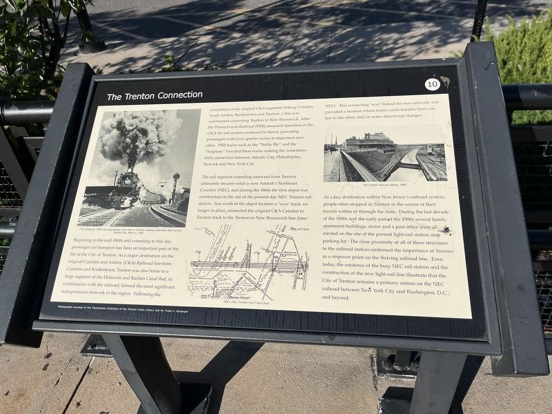
Beginning in the mid-1800s and extending to this day passenger rail transport has been an important part of the life of the City of Trenton. As a major destination on the original Camden and Amboy (C&A) Railroad line from Camden and Bordentown, Trenton was also home to a large segment of the Delaware and Raritan Canal that, in combination with the railroad, formed the most significant transportation network in the region. Following the completion of the original C&A segments linking Camden, South Amboy, Bordentown and Trenton, a line was constructed connecting Trenton to New Brunswick. After the Pennsylvania Railroad (PRR) assumed operation of the C&A the rail system continued to thrive, providing passengers with even greater access to important area cities. PRR trains such as the "Nelly Bly" and the "Seaplane" traveled these tracks making the sometimes daily connection between Atlantic City, Philadelphia, Newark and New York City.
The rail segment extending eastward from Trenton ultimately became what is now Amtrak's Northeast Corridor (NEC), and during the 1860s the first depot was constructed on the site of the present-day NEC Trenton rail station. Just south of the depot location a "wye" track, no longer in place, connected the original C&A Camden to Trenton track to the Trenton to New Brunswick line (later NEC). The connecting "wye" linked the two railroads and provided a location where trains could transfer from one line to the other and/or make directional changes.
As a key destination within New Jersey's railroad system, people often stopped in Trenton in the course of their travels or through the state. During the last decade of the 1800s and the early part of the 1900s several hotels, apartment buildings, stores and a post office were all erected on the site of the present light-rail station stop parking lot. The close proximity of all of these structures to the railroad station confirmed the importance of Trenton as a stopover point on the thriving railroad line. Even today, the existence of the busy NEC rail station and the construction of the new light-rail line illustrate that the City of Trenton remains a primary station on the NEC railroad between New York City and Washington, D.C., and beyond. (Marker Number 10.)
Topics and series. This historical marker is listed in these topic lists: Industry & Commerce • Railroads & Streetcars • Waterways & Vessels. In addition, it is included in the Pennsylvania Railroad (PRR) series list.
Location. 40° 13.097′ N, 74° 45.312′ W. Marker is in Trenton, New Jersey, in Mercer County. It is in Ewing and Carroll.
Other nearby markers. At least 8 other markers are within walking distance of this marker. Mercer Cemetery at Trenton (about 300 feet away, measured in a direct line); a different marker also named Mercer Cemetery at Trenton (about 700 feet away); a different marker also named Mercer Cemetery at Trenton (about 800 feet away); Rider College (approx. 0.2 miles away); Delaware and Raritan Canal (approx. ¼ mile away); Firemen’s Memorial (approx. ¼ mile away); Trenton Police (approx. ¼ mile away); First High School (approx. 0.3 miles away). Touch for a list and map of all markers in Trenton.
Credits. This page was last revised on February 16, 2023. It was originally submitted on October 17, 2022, by Devry Becker Jones of Washington, District of Columbia. This page has been viewed 144 times since then and 37 times this year. Photos: 1, 2. submitted on October 17, 2022, by Devry Becker Jones of Washington, District of Columbia.

