Indianola in Calhoun County, Texas — The American South (West South Central)
Old Town Cemetery
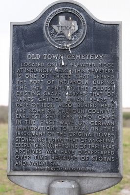
Located on the elevated ridge at Indianola Beach, this cemetery is one of three that served the port of Indianola during the 19th century. The oldest existing grave marker, that of James Chilton Allan, bears a date of 1851. Also buried here are some of Calhoun County's earliest settlers, who came in the first wave of German immigration to Texas in the 1840s. Many of the original tombstones, including that of Angelina Eberly (d. 1860), heroine of the Texas Archives War, have disappeared over time because of storms and vandalism.
Erected 1986 by Texas Historical Commission. (Marker Number 3825.)
Topics. This historical marker is listed in these topic lists: Cemeteries & Burial Sites • Settlements & Settlers. A significant historical year for this entry is 1851.
Location. 28° 32.666′ N, 96° 31.349′ W. Marker is in Indianola, Texas, in Calhoun County. Marker is on Zimmerman Road, on the left when traveling north. Touch for map. Marker is at or near this postal address: 305 Zimmerman Rd, Port Lavaca TX 77979, United States of America. Touch for directions.
Other nearby markers. At least 8 other markers are within walking distance of this marker. A Beef Canning Plant (about 700 feet away, measured in a direct line); The Plan (about 700 feet away); Harris & Morgan's Steamship Yacht (about 700 feet away); The Merchants of Indian Point (about 700 feet away); The German Emigration Company (about 700 feet away); Name Change (about 700 feet away); Brown's Addition (about 700 feet away); The Trade Routes (about 700 feet away). Touch for a list and map of all markers in Indianola.
Credits. This page was last revised on October 24, 2022. It was originally submitted on October 19, 2022, by Dave W of Co, Colorado. This page has been viewed 93 times since then and 11 times this year. Photo 1. submitted on October 19, 2022, by Dave W of Co, Colorado. • J. Makali Bruton was the editor who published this page.
