Bethany in Brooke County, West Virginia — The American South (Appalachia)
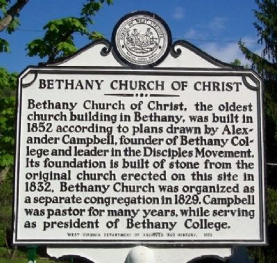
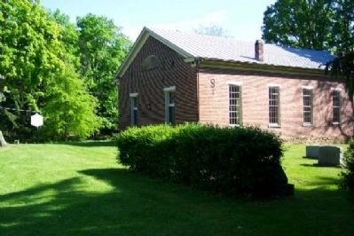
Bethany Church of Christ
Erected 1972 by West Virginia Department of Archives and History.
Topics and series. This historical marker is listed in these topic lists: Churches & Religion • Education. In addition, it is included in the West Virginia Archives and History series list. A significant historical year for this entry is 1852.
Location. 40° 12.384′ N, 80° 33.259′ W. Marker is in Bethany, West Virginia, in Brooke County. Marker is at the intersection of Main Street and Church Street, on the right when traveling east on Main Street. Touch for map. Marker is in this post office area: Bethany WV 26032, United States of America. Touch for directions.
Other nearby markers. At least 8 other markers are within 4 miles of this marker, measured as the crow flies. Delta Tau Delta Birthplace (approx. 0.2 miles away); Bethany / Rice's Fort (approx. 0.2 miles away); Renner Union - Bethany House (approx. 0.2 miles away); Thomas Campbell (approx. 0.4 miles away); Archibald McLean (approx. 0.4 miles away); Bethany / Bethany College (approx. 0.6 miles away); POW★MIA Memorial (approx. 3.3 miles away); Bethany Turnpike Tunnels (approx. 3.3 miles away). Touch for a list and map of all markers in Bethany.
Credits. This page was last revised on June 16, 2016. It was originally submitted on July 14, 2009, by William Fischer, Jr. of Scranton, Pennsylvania. This page has been viewed 1,154 times since then and 19 times this year. Photos: 1, 2, 3. submitted on July 14, 2009, by William Fischer, Jr. of Scranton, Pennsylvania. • Craig Swain was the editor who published this page.


