Westchester in Los Angeles in Los Angeles County, California — The American West (Pacific Coastal)
The Land and The People
Then and Now
— Ballona Discovery Park —
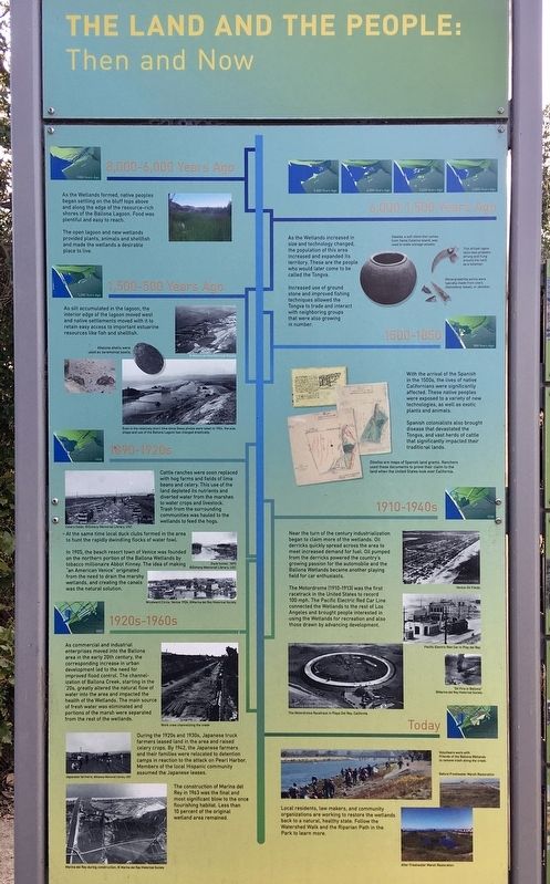
8,000-6,000 Years Ago
As the Wetlands formed, native peoples began settling on the bluff tops above and along the edge of the resource-rich shores of the Ballona Lagoon. Food was plentiful and easy to reach.
The open lagoon and new wetlands provided plants, animals and shellfish and made the wetlands a desirable place to live.
6,000-1,500 Years Ago
As the Wetlands increased in size and technology changed, the population of this area increased and expanded its territory. These are the people who would later come to be called the Tongva.
Increased use of ground stone and improved fishing techniques allowed the Tongva to trade and interact with neighboring groups that were also growing in number.
1,500-500 Years Ago
As silt accumulated in the lagoon, the interior edge of the lagoon moved west and native settlements moved with it to retain easy access to important estuarine resources like fish and shellfish.
1500-1850
With the arrival of the Spanish in the 1500s, the lives of native Californians were significantly affected. These native peoples were exposed to a variety of new technologies, as well as exotic plants and animals.
Spanish colonialists also brought disease that devastated the Tongva, and vast herds of cattle that significantly impacted their traditional lands.
1890-1920s
Cattle ranches were soon replaced with hog farms and fields of lima beans and celery. This use of the land depleted its nutrients and diverted water from the marshes to water crops and livestock. Trash from the surrounding communities was hauled to the wetlands to feed the hogs. At the same time local duck clubs formed in the area to hunt the rapidly dwindling flocks of water fowl.
In 1905, the beach resort town of Venice was founded on the northern portion of the Ballona Wetlands by tobacco millionaire Abbot Kinney. The idea of making "an American Venice" originated from the need to drain the marshy wetlands, and creating the canals was the natural solution.
1910-1940s
Near the turn of the century industrialization began to claim more of the wetlands. Oil derricks quickly spread across the area to meet increased demand for fuel. Oil pumped from the derricks powered the country's growing passion for the automobile and the Ballona Wetlands became another playing field for car enthusiasts.
The Motordrome (1910-1913) was the first racetrack in the United States to record 100 mph. The Pacific Electric Red Car Line connected the Wetlands to the rest of Los Angeles and brought people interested in using the Wetlands for recreation and also those drawn by advancing development.
1920s-1960s
As commercial and industrial enterprises moved into the Ballona area in the early 20th century, the corresponding increase in urban development led to the need for improved flood control. The channelization of Ballona Creek, starting in the '20s, greatly altered the natural flow of water into the area and impacted the health of the Wetlands. The main source of fresh water was eliminated and portions of the marsh were separated from the rest of the wetlands.
During the 1920s and 1930s, Japanese truck farmers leased land in the area and raised celery crops. By 1942, the Japanese farmers and their families were relocated to detention camps in reaction to the attack on Pearl Harbor. Members of the local Hispanic community assumed the Japanese leases.
The construction of Marina del Rey in 1963 was the final and most significant blow to the once flourishing habitat. Less than 10 percent of the original wetland area remained.
Today
Local residents, law makers, and community organizations are working to restore the wetlands back to a natural, healthy state. Follow the Watershed Walk and the Riparian Path in the Park to learn more.
side panel:
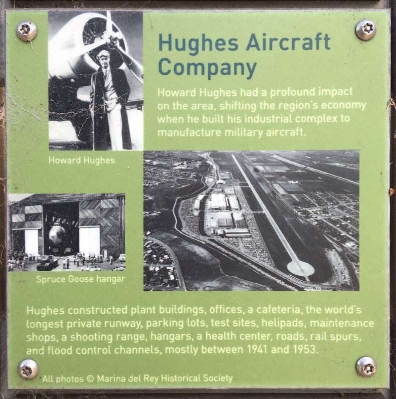
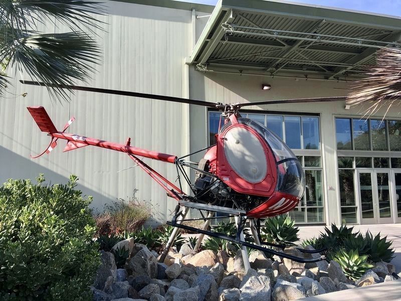
Hughes Aircraft Company
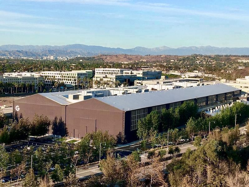
Howard Hughes had a profound impact on the area, shifting the region's economy when he built his industrial complex to manufacture military aircraft.
Hughes constructed plant buildings, offices, a cafeteria, the world's longest private runway, parking lots, test sites, helipads, maintenance shops, a shooting range, hangars, a health center, roads, rail spurs, and flood control channels, mostly between 1941 and 1953.
Topics. This historical marker is listed in these topic lists: Air & Space • Industry & Commerce • Native Americans • Settlements & Settlers.
Location. 33° 58.158′ N, 118° 25.441′ W. Marker is in Los Angeles, California, in Los Angeles County. It is in Westchester. Marker can be reached from Bluff Creek Drive, 0.2 miles east of Lincoln Boulevard (California Route 1), on the right when traveling east. Located in Ballona Discovery Park. Touch for map. Marker is at or near this postal address: 13110 Bluff Creek Dr, Playa Vista CA 90094, United States of America. Touch for directions.
Other nearby markers. At least 8 other markers are within 2 miles of this marker, measured as the crow flies. Tongva Memorial (about 700 feet away, measured in a direct line); Xavier Hall (approx. 0.4 miles away); Charles Elzy Morgan (approx. ¾ mile away); Lt. Col Roosevelt Hestle (approx. ¾ mile away); The Freedom Tree (approx. ¾ mile away); Dodd Playa Del Rey Residence (approx. 1.3 miles away); Marina del Rey Small Craft Harbor (approx. 1.3 miles away); The Helmsman (approx. 1.4 miles away). Touch for a list and map of all markers in Los Angeles.
Credits. This page was last revised on February 27, 2023. It was originally submitted on October 20, 2022, by Craig Baker of Sylmar, California. This page has been viewed 148 times since then and 32 times this year. Photos: 1, 2, 3, 4, 5. submitted on October 20, 2022, by Craig Baker of Sylmar, California.
