Oregon in Ogle County, Illinois — The American Midwest (Great Lakes)
Captain Joseph Ogle
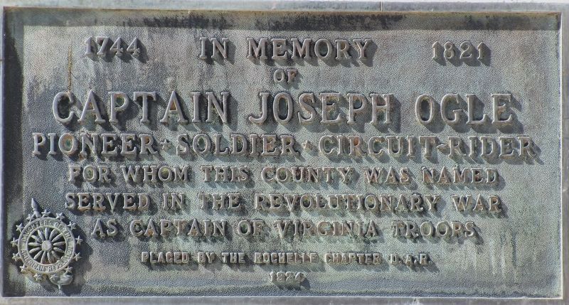
Photographed by Rev. Ronald Irick, October 7, 2022
1. Captain Joseph Ogle Marker
1744 1821 in memory of Captain Joseph Ogle pioneer*soldier*circuit rider for whom this county was named served in the Revolutionary War as Captain of Virginia Troops Placed by the Rochelle Chapter D.A.R. 1924
Erected 1924 by Rochelle Chapter DAR.
Topics and series. This memorial is listed in these topic lists: Settlements & Settlers • War, US Revolutionary. In addition, it is included in the Daughters of the American Revolution (DAR) series list.
Location. 42° 0.836′ N, 89° 19.977′ W. Memorial is in Oregon, Illinois, in Ogle County. It is at the intersection of 4th Street (Illinois Route 2) and West Washington ( Route 64), on the right when traveling south on 4th Street. The marker is at the front door of the Ogle County Courthouse. Touch for map. Memorial is at or near this postal address: 105 S 4th St, Oregon IL 61061, United States of America. Touch for directions.

Regionally, this memorial is in the American Midwest and in the Corn Belt. Globally, it is in North America, the Western Hemisphere, the Western World, and the Anglosphere. Historically,
this page online
Other nearby markers. At least 8 other markers are within 2 miles of this marker, measured as the crow flies: Fallen Soldiers Memorial (within shouting distance of this marker); Illinois Lincoln Highway (within shouting distance of this marker); The Lincoln Highway - The nation's first coast-to-coast highway! (within shouting distance of this marker); a different marker also named Illinois Lincoln Highway (within shouting distance of this marker); Lincoln Highway (within shouting distance of this marker); The Black Hawk War (approx. 1.4 miles away); The Black Hawk Statue (approx. 1.4 miles away); Lorado Taft (approx. 1.4 miles away). Touch for a list and map of all markers in Oregon.
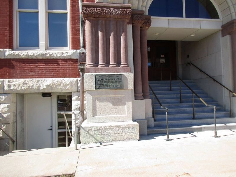
Photographed by Rev. Ronald Irick, October 7, 2022
2. Captain Joseph Ogle Marker
Credits. This page was last revised on February 6, 2023. It was originally submitted on October 22, 2022, by Rev. Ronald Irick of West Liberty, Ohio. This page has been viewed 687 times since then and 100 times this year. Photos: 1, 2. submitted on October 22, 2022, by Rev. Ronald Irick of West Liberty, Ohio. • Bill Pfingsten was the editor who published this page.
