Independence Township near Avella in Washington County, Pennsylvania — The American Northeast (Mid-Atlantic)
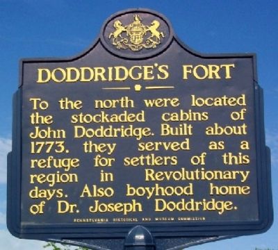
Doddridge's Fort
Erected 1947 by Pennsylvania Historical and Museum Commission.
Topics and series. This historical marker is listed in these topic lists: Colonial Era • Forts and Castles • Settlements & Settlers • War, US Revolutionary. In addition, it is included in the Pennsylvania Historical and Museum Commission series list. A significant historical year for this entry is 1773.
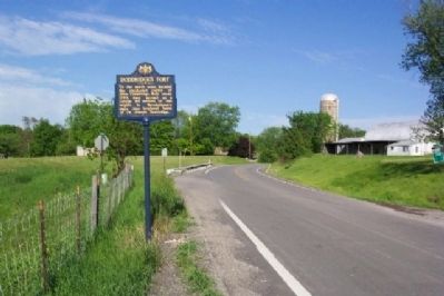
Location. 40° 14.908′ N, 80° 28.335′ W. Marker is near Avella, Pennsylvania, in Washington County. It is in Independence Township. Marker is at the intersection of Washington Pike (Pennsylvania Route 844) and Sugar Run Road, on the left when traveling west on Washington Pike. Marker is about 2 miles south of Avella. Touch for map. Marker is at or near this postal address: 545 Washington Pike, Avella PA 15312, United States of America. Touch for directions.
Other nearby markers. At least 8 other markers are within 3 miles of this marker, measured as the crow flies. Avella War Memorial (approx. 1.9 miles away); Independence Community Honor Roll (approx. 1.9 miles away); Revolutionary War Soldiers (approx. 1.9 miles away); Mt. Hope United Presbyterian Church (approx. 1.9 miles away); Ralston Thresher (approx. 2.3 miles away); West Middletown Soldiers Memorial (approx. 2.7 miles away); Meadowcroft Rockshelter (approx. 2.8 miles away); a different marker also named Revolutionary War Soldiers (approx. 2.9 miles away). Touch for a list and map of all markers in Avella.
Credits. This page was last revised on February 7, 2023. It was originally submitted on July 15, 2009, by William Fischer, Jr. of Scranton, Pennsylvania. This page has been viewed 1,755 times since then and 67 times this year. Photos: 1, 2. submitted on July 15, 2009, by William Fischer, Jr. of Scranton, Pennsylvania. • Craig Swain was the editor who published this page.

