Latchford in Timiskaming District, Ontario — Central Canada (North America)
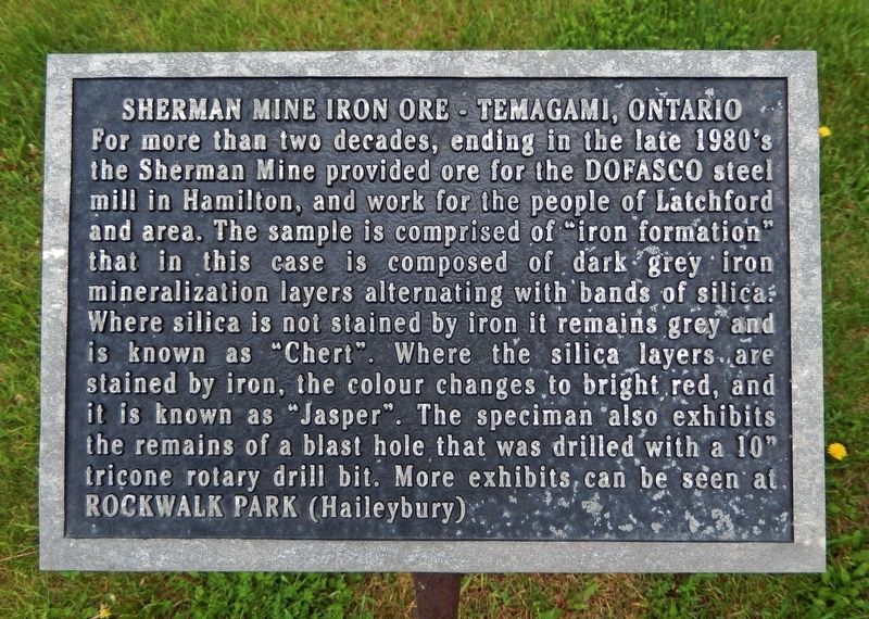
Sherman Mine Iron Ore
Temagami, Ontario
Photographed by Cosmos Mariner, June 1, 2022
1. Sherman Mine Iron Ore Marker
Topics. This historical marker is listed in this topic list: Industry & Commerce.
Location. 47° 19.45′ N, 79° 48.631′ W. Marker is in Latchford, Ontario, in Timiskaming District. It is on Main Street (Trans-Canada Highway) (Provincial Highway 11) 0.1 kilometers McLeod Avenue, on the right when traveling north. Marker is located near the wayside parking area on the south side of the Latchford Town Office. Touch for map.
this page online

Regionally, this marker is in Northeastern Ontario and specifically in Northern Ontario. It is also in Central Canada. Globally, it is in North America, the Great North Woods, the Western Hemisphere, the Western World, and the Anglosphere. Historically, it finds itself in what was once a British colony, the Viceroyalty of New France, the Haudenosaunee (Iroquois) Confederacy, and Rupert’s Land.
Other nearby markers. At least 8 other markers are within 13 kilometers of this marker, measured as the crow flies: The Ferguson Highway (a few steps from this marker); Founding of the Town of Latchford / Fondation de la Ville de Latchford (within shouting distance of this marker); Sergeant Aubrey Cosens, V.C. (within shouting distance of this marker); Nipissing Vein No. 96 (approx. 11.4 kilometers away); The McKinley-Darragh Story (approx. 11.5 kilometers away); Tri-town Trolleys (approx. 11.5 kilometers away); Tunnel to Riches (approx. 11.6 kilometers away); Cart Lake (approx. 11.6 kilometers away). Touch for a list and map
Photographed by Cosmos Mariner, June 1, 2022
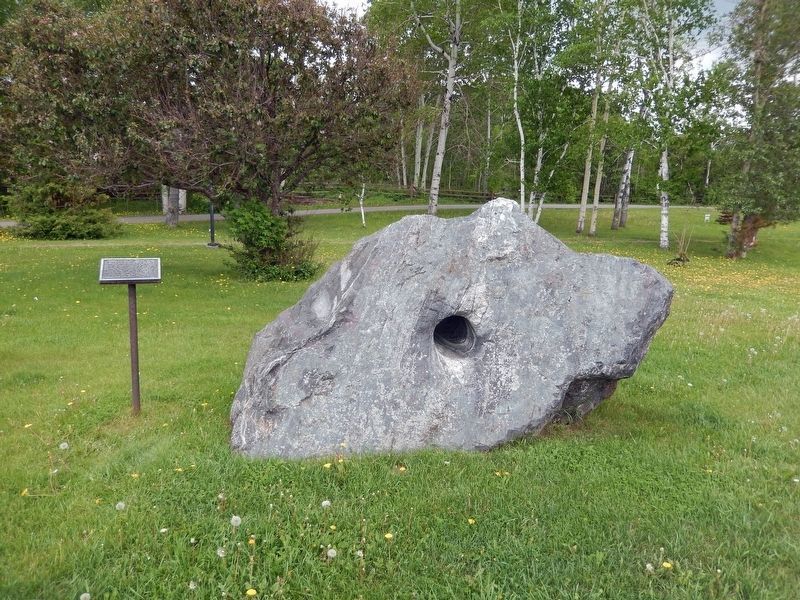
2. Sherman Mine Iron Ore Marker & Exhibit
Also see . . . Sherman Mine.
It was a major producer of iron ore, starting production in 1968 and closing in 1990. Sherman was the largest open pit mine in Temagami, consisting of seven open Pits. The mine was discovered in the early part of the twentieth century, however interest was limited as a result of silver and gold discoveries in northeastern Ontario. It was only in the 1950s that Canadian steel producers started to investigate domestic supplies of iron ore. This would lead to the re-opening of the Moose Mountain Mine and development of the Adams, Sherman and Bruce Lake mines in Northern Ontario. The Sherman Mine operated in tandem with the Adams Mine in Kirkland Lake, and when the Adams Mine approached exhaustion of its economic ore reserves, the decision was made to also close the Sherman Mine. The surface infrastructure was removed and the site was abandoned. The waste piles are currently used by the municipality as a source of crushed stone for road works.(Submitted on October 22, 2022, by Cosmos Mariner of Cape Canaveral, Florida.)
Credits. This page was last revised on October 22, 2022. It was originally submitted on October 22, 2022, by Cosmos Mariner of Cape Canaveral, Florida. This page has been viewed 1,871 times since then and 412 times this year. Photos: 1, 2. submitted on October 22, 2022, by Cosmos Mariner of Cape Canaveral, Florida.
