Manchester in Washtenaw County, Michigan — The American Midwest (Great Lakes)
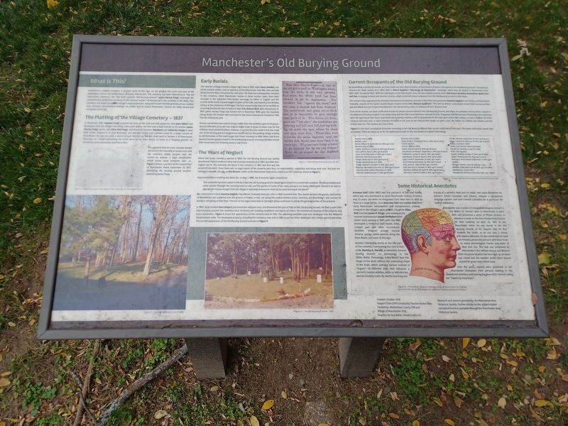
Manchester's Old Burying Ground
What is This?
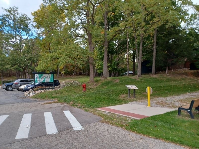
Manchester's original cemetery is located north of this sign, on the gradual hill north and east of the Washington Street and condominium driveway intersection. This cemetery has been referred to as "the old Manchester Cemetery", the "Old Yard", and the "Old Burying Ground." James Harvey Fargo undertook the establishment of this first cemetery as the nominal "leader" of Manchester's civic activities in the 1830s. This cemetery still holds many of the village's original pioneers, along with some interesting history of our earliest days. Remains of tombstone footings are visible, but no stones themselves. Several are likely buried and overgrown in the soil.
The Platting of the Village Cemetery — 1837
In November 1835, Stephen Fargo acquired the bulk of the land and mill properties that John Gilbert had developed since the Village's founding a few years before. He then sold a half-interest to his brother James Harvey Fargo, James' wife Eliza Kief Fargo, and financial investors Shepherd and Catherine Knapp in June 1836. James stepped in as lead developer, and laid out streets and common areas for a larger version of Manchester. He also set aside a parcel of land 165 feet by 165 feet (0.63 acre) in Section 2 of Manchester Township, on a bluff overlooking the north bend of the River Raisin, to serve as a "burying ground", as cemeteries were commonly called back then.
It is apparent that he never actually deeded this land to the township or anyone else, and the cemetery simply became land not owned by anyone, a legal complication which would cause problems later on. Figure 1 shows a portion of the Second Plat of Manchester dated September 27, 1837, identifying the burying ground location defined by James Fargo.
Figure 1 — The Manchester Plat Map of 1837, Showing the Burying Ground
Early Burials
The need for a village cemetery began right away in 1833, when Henry Annibal, one of the earliest settlers and an operator at the Manchester Saw Mill, died and was buried on Ann Arbor Hill above the mill pond. His body was subsequently removed to the cemetery. Other Manchester deaths in these earliest years have been recorded in the published Manchester necrology by Albert D. English and the records of the Sarah Caswell Angell Chapter of the DAR, maintained at the Bentley Library at the University of Michigan. The first actual burial that can be verified as occurring directly into the cemetery is that of Dr. Eleazer Root, who died January 31, 1837. James Harvey Fargo was buried here in November 1840 upon his relatively young death. His remains were removed to Oak Grove Cemetery in November 1885 into the Kief family plot.
A hand-carried bier was used to bring a coffin from the cemetery gate to the grave. Several attempts to locate any original ledger book or grave location map for the cemetery have proved fruitless. However, it quickly became evident that the small size of the burying ground would prove insufficient for the growing village, leading to the formation of the much larger Oak Grove Cemetery in 1856. When Oak Grove opened, burials quickly ceased in the Old Burying Ground, and many families moved their loved ones over to family plots in Oak Grove.
The Years of Neglect
When Oak Grove Cemetery opened in 1856, the Old Burying Ground was quietly abandoned. There is evidence a few more burials occurred up to 1860, but after that, neglect set in. The township did fence in the cemetery in 1861, but that was the extent of the work. Since there was no legal owner of the property and, thus, no responsibility, vegetation and decay took over. This was not without complaint, though, as Mat Blosser, editor of the Manchester Enterprise, noted in an 1871 editorial, shown in Figure 2.
Figure 2 — Manchester Enterprise, June 29, 1871
Apparently little or nothing was done, for, on May 1, 1884, the Enterprise again complained:
"Our attention has been called to the fact that the old burying ground in Washington Street is in a wretched condition. The fence is down and cattle wander through the sacred ground at will, and the graves of some of our early pioneers are being obliterated. Would it be well to appropriate money enough from the village or township treasury to clean up the yard and repair the fence?"Our next record is from Annetta English, Manchester Township historian, who in 1930 recorded that "lilac bushes protect the graves, and bushes of snowberries are scattered over the ground. A maple, or two, set along central division of the cemetery, are flourishing." She counted 35 markers remaining at that time. The lack of any legal ownership or oversight group continued to add to the general decline of the property.
In 1964, local resident Don Limpert purchased the adjacent land, and discovered the lack of title on the Old Burying Ground. He filed a quiet title claim and was granted the cemetery land. He found one standing headstone and pieces of others. He commenced cleanup of the property and some restoration. Figure 3 shows the appearance of the restored land in 1972. The adjoining buildable land was developed into the Millpond Condominium units. The developed property, including the cemetery, was sold in 1982 to an Ann Arbor developer, who retains possession today. The current appearance of the Old Burying Ground is shown in Figure 4.
Figure 3 — The Old Burying Ground — 1972
Figure 4 — The Old Burying Ground Today
Current Occupants of the Old Burying Ground
By assembling a variety of records, we have made our best determination of Manchester pioneers still buried in the Old Burying Ground. The primary resource for likely burials from 1833-1855 is Albert English's "Necrology of Manchester" notebook, which lists all deaths in Manchester from 1833-1928. The period 1833-1855 lists 198 deaths in the Manchester area. We also utilized records of the Oak Grove Cemetery Association, Books One and Two, including removal and reburial records, which record 88 known removals from the Old Burying Ground to Oak Grove.
The research was augmented by cemetery tombstone inscriptions recorded in the 1930 time period by Annetta English in her History of Manchester Township, records of the Sarah Caswell Angell Chapter of the DAR, Richard Spafford's "The Old Cemetery", and people known from various written and anecdotal sources to have been buried in the old cemetery, with no evidence of their disinterment.
From these records, we have confirmed at least 42 people remain buried in the Old Burying Ground, and there are probably several others, based on the difference between English's necrology total and the Oak Grove Cemetery removal records. It appears that the persons remaining in the cemetery after the opening of Oak Grove may have had no family members left in Manchester in the later part of the 19th century, or were children of whom memory had been lost, or were itinerant travelers in the area at the time of their death. In some cases, the father of a family was moved, and the mother was not. The reasons are lost in time.
Figure 5 is the best compilation of burials remaining in the Old Burying Ground that can be confirmed at this date. The name and known death date are shown. There are likely up to 40-50 additional burials on this site based on English's Necrology.
Figure 5 — Known Burials Remaining in the Old Burying Ground
Some Historical Anecdotes
Artemus Kief (1780-1857) was the patriarch of the Kief family which was very prominent in early Manchester history. Artemus was 53 years old when he emigrated from New York in 1833 as head of a large family. Sons John Dey Kief and Lucien Kief were early Manchester businessmen and entrepreneurs actively involved in the village's early growth. Daughter Eliza Kief married James H. Fargo, and subsequently married businessman Joseph McMahon after James' early passing in 1840. John Dey Kief developed a medicinal bath house, hotel, croquet yard and other recreational facilities, designed around natural mineral springs which existed along the River Raisin, just west of this sign.
Another interesting burial at the top part of the cemetery overlooking the river is that of Dr. Buckley A. Parnell, a nationally famous touring lecturer on phrenology in the 1830s-1840s. Phrenology is the belief that the shape of the skull reflects the underlying shape of the brain, which contains various nodules or "organs" of different sizes that influence a person's mental abilities, skills or deficiencies, and personality traits. By careful touching and tracing of a person's head and its shape, one could determine the person's future successes and failures, analyze a prospective marriage partner, and one's overall suitability for a particular life style or occupation.
Manchester was a center of strong phrenological interest in the 1840s. Dr. Parnell came to Manchester in April, 1847, and presented a series of fifteen lectures to attentive crowds at the First Presbyterian Church. He died suddenly on April 22, 1847 at the Manchester Hotel. He was buried in the Old Burying Ground, at his request, with his feet towards the South, as he was also a strong anti-slavery advocate. He also asked that his head be removed, preserved and sent with intact brain to noted phrenologists Fowler and Wells of New York City. This task was completed by Manchester's Drs. William Bessac and Bennett Root. His grave location has been lost, as no stone was raised and the wooden picket fence placed around his grave soon rotted away.
Over the years, reports were presented in the Manchester Enterprise from persons walking in the abandoned cemetery and hearing the ghost of Dr. Parnell calling out "I want my head back."
Figure 6 — Phrenology diagram showing areas of brain traits. Dr. Parnell practices the study of Manchester residents' abilities using such a chart.
Created: October 2016
Support from 2016 Community Tourism Action Plan
Funded by: Washtenaw County CVB and Village of Manchester DDA
Graphics by Sue Maher, Moxie Grafix LLC
Research and content provided by the Manchester Area Historical Society. Further details on the subject matter contained herein is available through the Manchester Area Historical Society.
Erected 2017.
Topics. This historical marker is listed in these topic lists: Cemeteries & Burial Sites • Settlements & Settlers. A significant historical date for this entry is January 31, 1837.
Location. 42° 9.026′ N, 84° 2.546′ W. Marker is in Manchester, Michigan, in Washtenaw County. Marker is at the intersection of North Washington Street and Railroad Street, on the right when traveling north on North Washington Street. Marker is along the Manchester Shared-Use Trail. Touch for map. Marker is at or near this postal address: 215 North Washington Street, Manchester MI 48158, United States of America. Touch for directions.
Other nearby markers. At least 8 other markers are within walking distance of this marker. Manchester Township Library / James A. Lynch House (about 500 feet away, measured in a direct line); Saint Mary Church (about 600 feet away); Manchester's Village Green (about 600 feet away); Fountain-Bessac House (about 600 feet away); Veteran's Memorial (about 600 feet away); George Washington (about 800 feet away); The Manchester Hotel and the Clinton Street Corner (about 800 feet away); Founding Members of Immanuel United Evangelical Church (approx. 0.2 miles away). Touch for a list and map of all markers in Manchester.
Credits. This page was last revised on June 22, 2023. It was originally submitted on October 24, 2022, by Joel Seewald of Madison Heights, Michigan. This page has been viewed 171 times since then and 50 times this year. Photos: 1, 2. submitted on October 24, 2022, by Joel Seewald of Madison Heights, Michigan.

