Manchester in Washtenaw County, Michigan — The American Midwest (Great Lakes)
Kirk Park
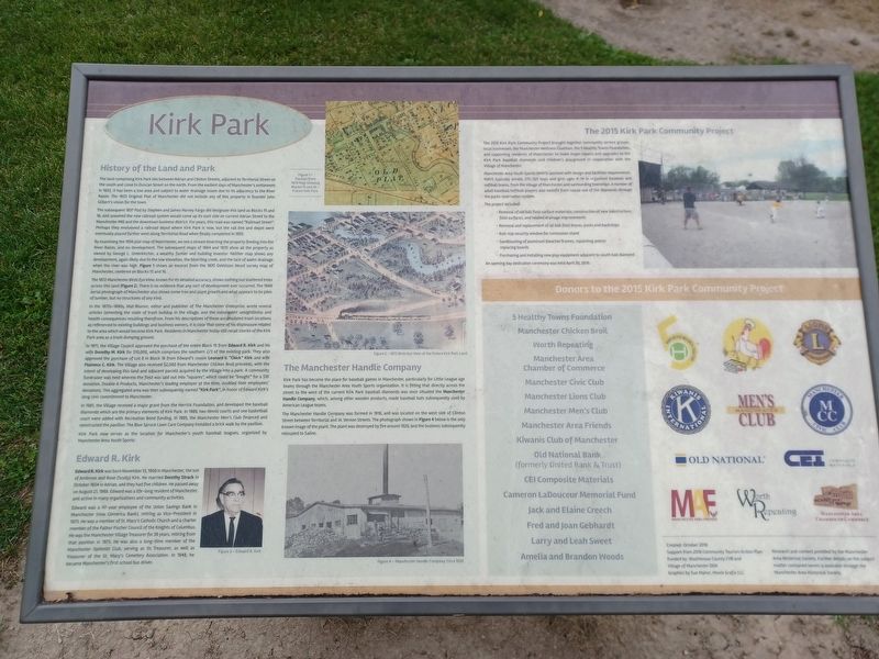
History of the Land and Park
The land comprising Kirk Park lies between Adrian and Clinton Streets, adjacent to Territorial Street on the south and close to Duncan Street on the north. From the earliest days of Manchester's settlement in 1833, it has been a low area and subject to water drainage issues due to its adjacency to the River Raisin. The 1833 Original Plat of Manchester did not include any of this property in founder John Gilbert's vision for the town.
The subsequent 1837 Plat by Stephen and James Harvey Fargo did designate this land as Blocks 15 and 16, and assumed the new railroad system would come up its east side on current Adrian Street to the Manchester Mill and the downtown business district. For years, this road was named "Railroad Street". Perhaps they envisioned a railroad depot where Kirk Park is now, but the rail line and depot were eventually placed farther west along Territorial Road when finally completed in 1855.
By examining the 1856 plat map of Manchester, we see a stream bisecting the property feeding into the River Raisin, and no development. The subsequent maps of 1864 and 1870 show all the property as owned by George L. Unterkircher, a wealthy farmer and building investor. Neither map shows any development, again likely due to the low elevation, the bisecting creek, and the lack of water drainage when the river was high. Figure 1 shows an excerpt from the 1870 DeVolson Wood survey map of Manchester, centered on Blocks 15 and 16.
Figure 1 — Excerpt from 1870 Map Showing Blocks 15 and 16 — Future Kirk Park
The 1872 Manchester Birds Eye View, known for its detailed accuracy, shows nothing but scattered trees across this land (Figure 2). There is no evidence that any sort of development ever occurred. The 1949 aerial photograph of Manchester also shows some tree and plant growth and what appears to be piles of lumber, but no structures of any kind.
Figure 2 — 1872 Birds Eye View of the Future Kirk Park Land
In the 1870s-1890s, Mat Blosser, editor and publisher of The Manchester Enterprise, wrote several articles lamenting the state of trash buildup in the village, and the subsequent unsightliness and health consequences resulting therefrom. From his descriptions of these accumulated trash locations as referenced to existing buildings and business owners, it is clear that some of his displeasure related to the area which would become Kirk Park. Residents in Manchester today still recall stories of the Kirk Park area as a trash dumping ground.
In 1971, the Village Council approved the purchase of the entire Block 15 from Edward R. Kirk and his wife Dorothy M. Kirk for $10,000, which comprises the southern 2/3 of the existing park. They also approved the purchase of Lot 8 in Block 16 from Edward's cousin Leonard V. "Chick" Kirk and wife Florence C. Kirk. The Village also received $2,000 from Manchester Chicken Broil proceeds, with the intent of developing this land and adjacent parcels acquired by the Village into a park. A community fundraiser was held wherein the field was laid out into "squares", which could be "bought" for a $10 donation. Double A Products, Manchester's leading employer at the time, doubled their employees' donations. This aggregated area was then subsequently named "Kirk Park", in honor of Edward Kirk's long civic commitment to Manchester.
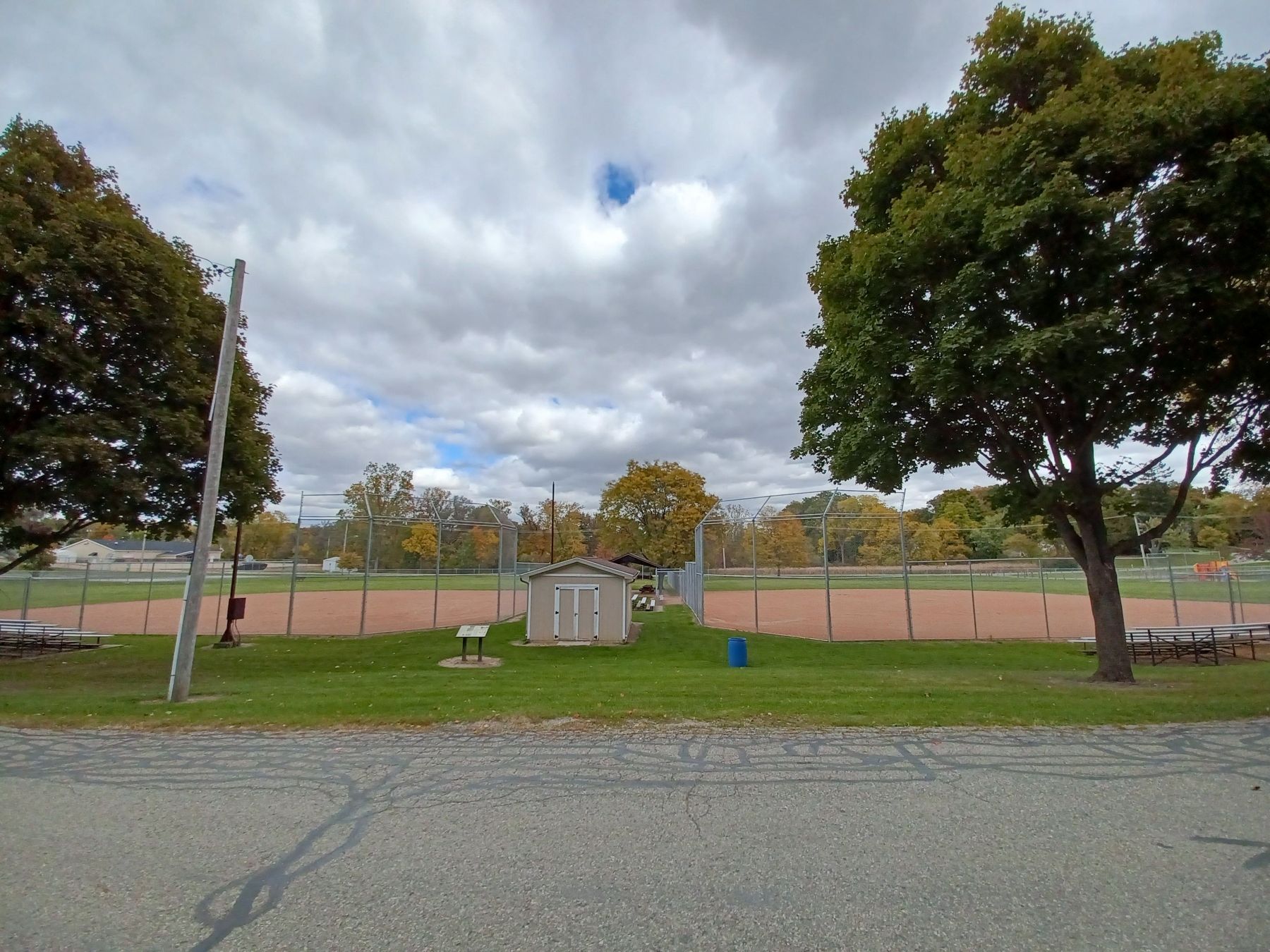
In 1981, the Village received a major grant from the Herrick Foundation, and developed the baseball diamonds which are the primary elements of Kirk Park. In 1989, two tennis courts and one basketball court were added with Recreation Bond funding. In 1995, the Manchester Men's Club financed and constructed the pavilion. The Blue Spruce Lawn Care Company installed a brick walk by the pavilion.
Kirk Park now serves as the location for Manchester's youth baseball leagues, organized by Manchester Area Youth Sports.
Edward R. Kirk
Edward R. Kirk was born November 13, 1908 in Manchester, the son of Ambrose and Rose (Scully) Kirk. He married Dorothy Strack in October 1934 in Adrian, and they had five children. He passed away on August 21, 1988. Edward was a life-long resident of Manchester, and active in many organizations and community activities.
Edward was a 47-year employee of the Union Savings Bank in Manchester (now Comerica Bank), retiring as Vice-President in 1973. He was a member of St. Mary's Catholic Church and a charter member of the Father Fischer Council of the Knights of Columbus. He was the Manchester Village Treasurer for 39 years, retiring from that position in 1973. He was also a long-time member of the Manchester Optimist Club, serving as its Treasurer, as well as Treasurer of the St. Mary's Cemetery Association. In 1948, he became Manchester's first school bus driver.
Figure 3 &mdash Edward R. Kirk
The Manchester Handle Company
Kirk Park has become the place for baseball games in Manchester, particularly for Little League age teams through the Manchester Area Youth Sports organization. It is fitting that directly across the street to the west of the current Kirk Park baseball diamonds was once situated the Manchester Handle Company, which, among other wooden products, made baseball bats subsequently used by American League teams.
The Manchester Handle Company was formed in 1916, and was located on the west side of Clinton Street between Territorial and W. Vernon Streets. The photograph in Figure 4 below is the only known image of the plant. The plant was destroyed by fire around 1929, and the business subsequently relocated to Saline.
The 2015 Kirk Park Community Project
The 2015 Kirk Park Community Project brought together community service groups, local businesses, the Manchester Wellness Coalition, the 5 Healthy Towns Foundation and supporting residents of Manchester to make major repairs and upgrades to the Kirk Park baseball diamonds and children's playground in cooperation with the Village of Manchester.
Manchester Area Youth Sports (MAYS) assisted with design and facilities requirements. MAYS typically enrolls 275-325 boys and girls ages 4-14 in organized baseball and softball teams, from the Village of Manchester and surrounding townships. A number of adult baseball/softball players also benefit from casual use of the diamonds through the parks reservation system.
The project included:
- Removal of old ball field surface materials; construction of new substructure, field surfaces, and related drainage improvements
- Removal and replacement of all ball field fences, posts and backstops
- Roll-top security window for concession stand
- Sandblasting of aluminum bleacher frames, repainting and/or replacing boards
- Purchasing and installing new play equipment adjacent to south ball diamond
Donors to the 2015 Kirk Park Community Project
5 Healthy Towns Foundation, Manchester Chicken Boil, Worth Repeating, Manchester Area Chamber of Commerce, Manchester Civic Club, Manchester Lions Club, Manchester Men's Club, Manchester Area Friends, Kiwanis Club of Manchester, Old National Bank (formerly United Bank & Trust), CEI Composite Materials, Cameron La Douceur Memorial Fund, Jack and Elaine Creech, Fred and Joan Gebhardt, Larry and Leah Sweet, Amelia and Brandon Woods
Created: October 2016
Support from 2016 Community Tourism Action Plan
Funded by: Washtenaw County CVB and Village of Manchester DDA
Graphics by Sue Maher, Moxie Grafix LLC
Research and content provided by the Manchester Area Historical Society. Further details on the subject matter contained herein is available through the Manchester Area Historical Society.
Erected 2017.
Topics. This historical marker is listed in this topic list: Parks & Recreational Areas. A significant historical date for this entry is April 30, 2016.
Location. 42° 8.808′ N, 84° 2.278′ W. Marker is in Manchester, Michigan, in Washtenaw County. Marker is on Clinton Street south of West Vernon Street, on the left when traveling south. Touch for map. Marker is in this post office area: Manchester MI 48158, United States of America. Touch for directions.
Other nearby markers. At least 8 other markers are within walking distance of this marker. M-60 Tank (about 500 feet away, measured in a direct line); The Manchester Hotel and the Clinton Street Corner (approx. 0.2 miles away); History of the Manchester Mill (approx. 0.2 miles away); The Founding of Manchester (approx. 0.2 miles away); Exchange Place (approx. ¼ mile away); Fountain-Bessac House (approx. ¼ mile away); Manchester's Village Green (approx. ¼ mile away); George Washington (approx. ¼ mile away). Touch for a list and map of all markers in Manchester.
Credits. This page was last revised on October 25, 2022. It was originally submitted on October 25, 2022, by Joel Seewald of Madison Heights, Michigan. This page has been viewed 108 times since then and 20 times this year. Photos: 1, 2. submitted on October 25, 2022, by Joel Seewald of Madison Heights, Michigan.

