Spring Hill in Maury County, Tennessee — The American South (East South Central)
Rippa Villa
An American Story in Maury County
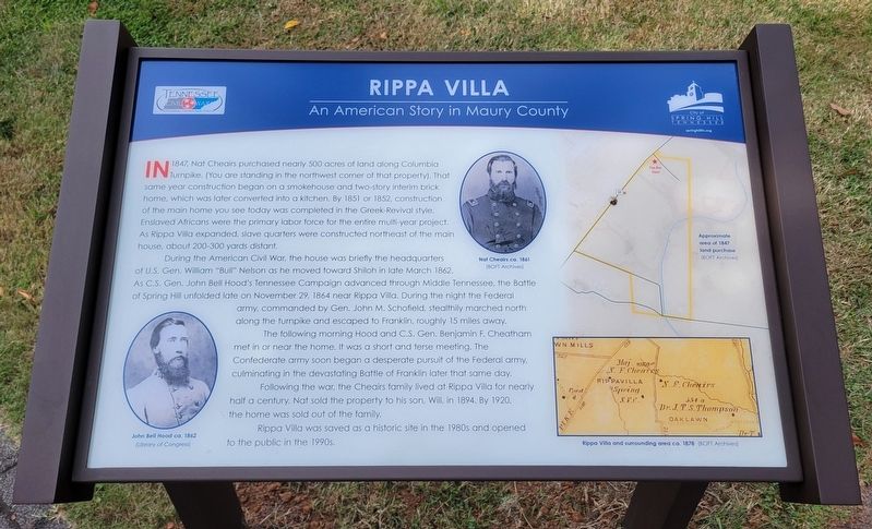
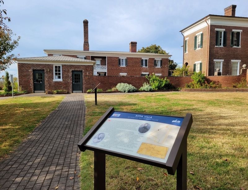
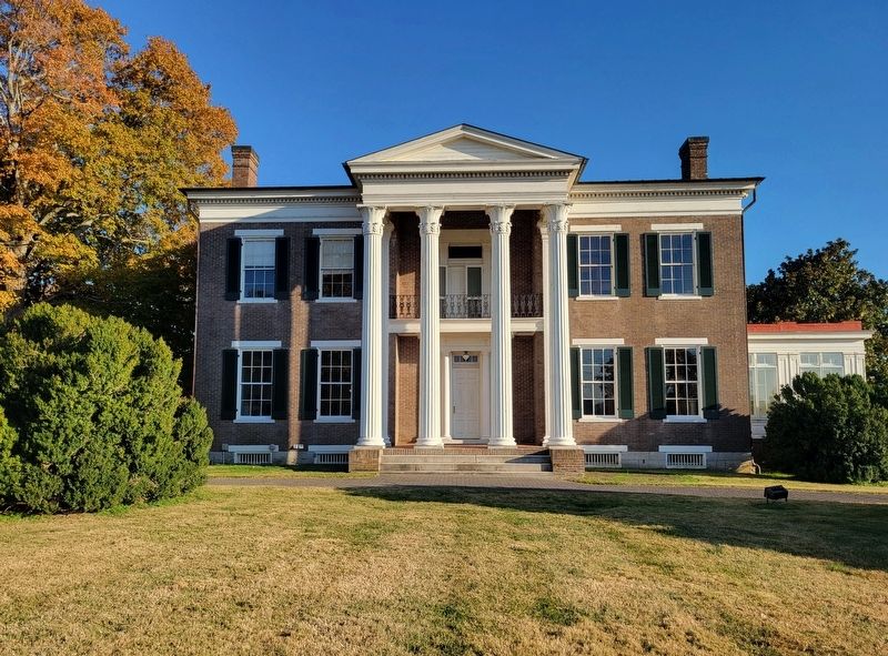
In 1847, Nat Cheairs purchased nearly 500 acres of land along Columbia Turpike. (You are standing in the northwest corner of that property). That same year construction began on a smokehouse and two-story interim brick home, which was later converted into a kitchen. By 1851 or 1852, construction of the main home you see today was completed in the Greek-Revival style. Enslaved Africans were the primary labor force for the entire multi-year project. As Rippa Villa expanded, slave quarters were constructed northeast of the main house, about 200-300 yards distant.
During the American Civil War, the house was briefly the headquarters of U.S. Gen. William "Bull" Nelson as he moved toward Shiloh in late March 1862. As C.S. Gen. John Bell Hood's Tennessee Campaign advanced through Middle Tennessee, the Battle of Spring Hill unfolded late on November 29, 1864 near Rippa Villa. During the night the Federal army, commanded by Gen. John M. Schofield, stealthily marched north along the turnpike and escaped to Franklin, roughly 15 miles away.
The following morning Hood and C.S. Gen. Benjamin F. Cheatham met in or near the home. It was a short and terse meeting. The Confederate army soon began a desperate pursuit of the Federal army, culminating in the devastating Battle of Franklin later that same day.
Following the war, the Cheairs family lived at Rippa Villa for nearly half a century. Nat sold the property to his son, Will, in 1894. By 1920, the home was sold out of the family.
Rippa Villa was saved as a historic site in the 1980s and opened to the public in the 1990s.
(Captions):
John Bell Hood ca. 1862
(Library of Congress)
Nat Cheairs ca. 1861
(BOFT Archives)
Approximate area of 1847 land purchase
(BOFT Archives)
Rippa Villa and surrounding area ca. 1878
(BOFT Archives)
Erected 2022 by City of Spring Hill, Tennessee.
Topics. This historical marker is listed in these topic lists: African Americans • War, US Civil. A significant historical month for this entry is March 1862.
Location. 35° 43.921′ N, 86° 57.21′ W. Marker is in Spring Hill, Tennessee, in Maury County. Marker can be reached from Main Street (U.S. 31) north of Northfield Lane, on the left when traveling south. Located on the east side of the Rippa Villa Plantation House. Touch for map. Marker is at or near this postal address: 5700 Main St, Spring Hill TN 37174, United States of America. Touch for directions.
Other nearby markers. At least 8 other markers are within walking distance of this marker. A different marker also named Rippa Villa (a few steps from this marker); The Battle of Spring Hill (within shouting distance of this marker); Slave Fields To Battlegrounds (within shouting distance of this marker); Rippavilla Plantation (about 500 feet away, measured in a direct line); a different marker also named The Battle of Spring Hill (approx. 0.2 miles away); a different marker also named The Battle of Spring Hill (approx. 0.2 miles away); Billy Direct (approx. 0.6 miles away); Hood's Command Post (approx. 0.9 miles away). Touch for a list and map of all markers in Spring Hill.
Credits. This page was last revised on October 26, 2022. It was originally submitted on October 25, 2022, by Bradley Owen of Morgantown, West Virginia. This page has been viewed 156 times since then and 16 times this year. Photos: 1, 2, 3. submitted on October 25, 2022, by Bradley Owen of Morgantown, West Virginia. • Mark Hilton was the editor who published this page.


