Maurertown in Shenandoah County, Virginia — The American South (Mid-Atlantic)
Toms Brook
"... to spew forth cavalry."
— 1864 Valley Campaign —
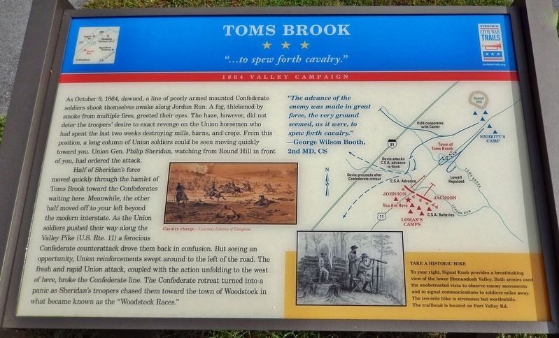
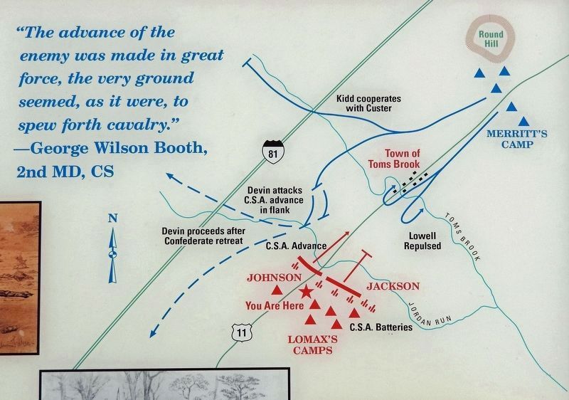
As October 9, 1864, dawned, a line of poorly armed mounted Confederate soldiers shook themselves awake along Jordan Run. A fog, thickened by smoke from multiple fires, greeted their eyes. The haze, however, did not deter the troopers' desire to exact revenge on the Union horsemen who had spent the last two weeks destroying mills, barns, and crops. From this position, a long column of Union soldiers could be seen moving quickly toward you. Union Gen. Philip Sheridan, watching from Round Hill in front of you, had ordered the attack.
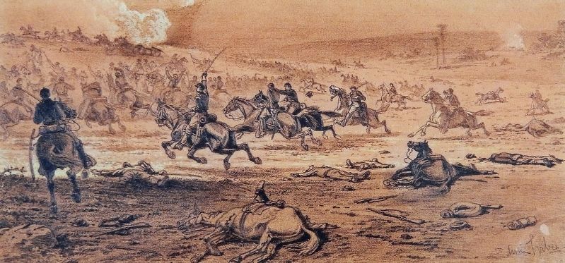
Half of Sheridan's force moved quickly through the hamlet of Toms Brook toward the Confederates waiting here. Meanwhile, the other half moved off to your left beyond the modern interstate. As the Union soldiers pushed their way along the Valley Pike (U.S. Rte. 11) a ferocious Confederate counterattack drove them back in confusion. But seeing an opportunity, Union reinforcements swept around to the left of the road. The fresh and rapid Union attack, coupled with the action unfolding to the west of here, broke the Confederate line. The Confederate retreat turned into a panic as Sheridan's troopers chased them toward the town of Woodstock in what became known as the "Woodstock Races."
"The advance of the enemy was made in great force, the very ground seemed, as it were, to spew forth cavalry."
—George Wilson Booth,
2nd MD, CS
Erected by Virginia Civil War Trails.
Topics and series. This historical marker is listed in this topic list: War, US Civil. In addition, it is included in the Virginia Civil War Trails series list. A significant historical date for this entry is October 9, 1864.
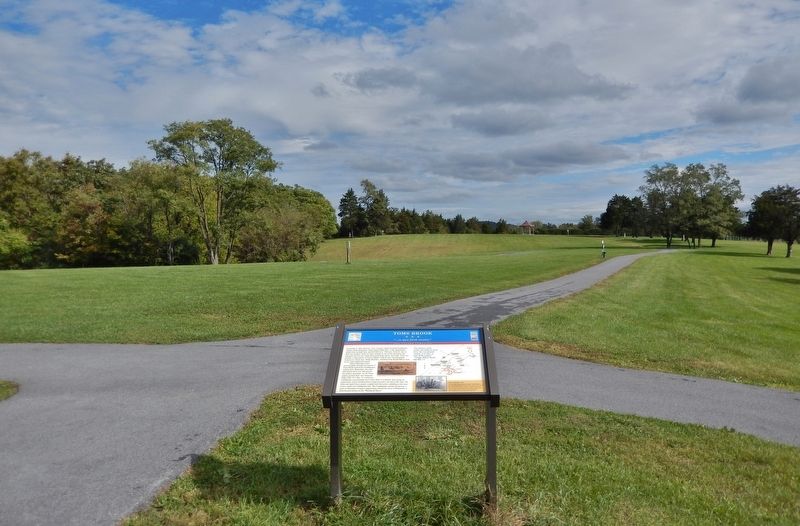
Location. 38° 56.117′ N, 78° 27.135′ W. Marker is in Maurertown, Virginia, in Shenandoah County. Marker can be reached from Park Lane just east of Old Valley Pike (U.S. 11). Marker is located on the north side of the north parking lot in Shenandoah County Park. Touch for map. Marker is at or near this postal address: 380 Park Lane, Maurertown VA 22644, United States of America. Touch for directions.
Other nearby markers. At least 8 other markers are within 4 miles of this marker, measured as the crow flies. Shenandoah County Farm and Alms House (approx. ¼ mile away); a different marker also named Toms Brook (approx. ¼ mile away); Action of Toms Brook (approx. 0.6 miles away); "Snapp House" (approx. 3 miles away); Battle of Fisher's Hill (approx. 3.1 miles away); a different marker also named Battle of Fisher's Hill (approx. 3.7 miles away); a different marker also named Battle of Fisher's Hill (approx. 3.9 miles away); Fisher’s Hill (approx. 3.9 miles away).
Also see . . .
1. Wesley Merritt and the Battle of Tom’s Brook.
By the late afternoon of October 8, Sheridan was fed up with the annoying Confederates. That night, he ordered his cavalry chief, Maj. Gen. Alfred Torbert to head out in the morning and whip the Rebels “or get whipped yourself”. The resulting Battle of Tom’s Brook was a decisive Union victory. It was fought on two fronts, along the Back Road (modern 623) and the Valley Turnpike (modern Route 11).(Submitted on October 26, 2022, by Cosmos Mariner of Cape Canaveral, Florida.)
2. Tom's Brook (Woodstock Races).
The Union had about 6,300 men, the Confederates about 3,500. Casualties were light, but one-sided. The Union lost about 60, the South about six times as many. The Confederates were taken by surprise, fought for a bit, then collapsed and galloped away for 10 miles. The Union horsemen chased after, capturing eleven of the dozen Rebel horse guns and rounding up about 300 prisoners. Not a particularly large battle, but thanks to fighting and winning, the Union cavalry finally achieved superiority in the Valley.(Submitted on October 26, 2022, by Cosmos Mariner of Cape Canaveral, Florida.)
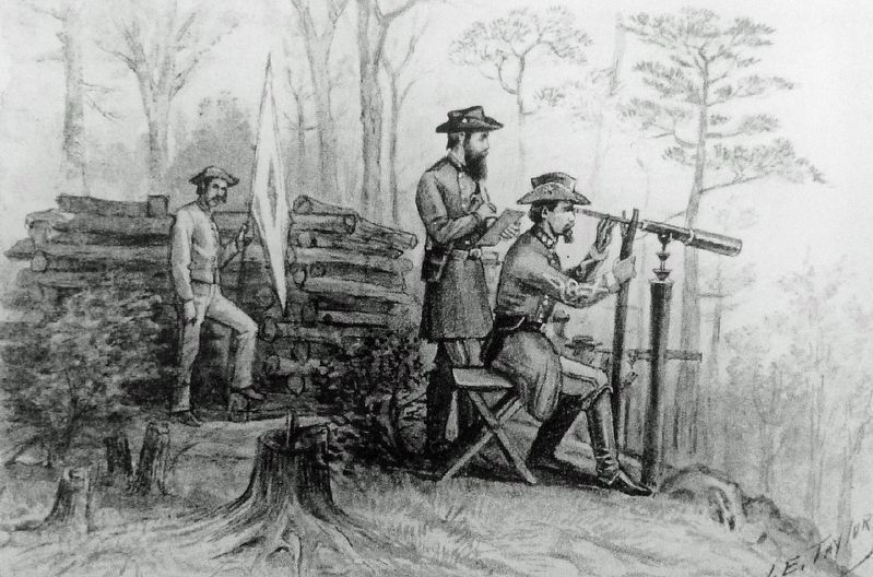
4. Marker detail: Signal Knob (illustration)
Take a Historic Hike
To your right, Signal Knob provides a breathtaking view of the lower Shenandoah Valley. Both armies used the unobstructed vista to observe enemy movements and to signal communications to soldiers miles away. The ten-mile hike is strenuous but worthwhile. The trailhead is located on Fort Valley Rd.
Credits. This page was last revised on October 26, 2022. It was originally submitted on October 26, 2022, by Cosmos Mariner of Cape Canaveral, Florida. This page has been viewed 170 times since then and 31 times this year. Photos: 1, 2, 3, 4, 5. submitted on October 26, 2022, by Cosmos Mariner of Cape Canaveral, Florida.
