Doniphan in Ripley County, Missouri — The American Midwest (Upper Plains)
Tribute to Current River
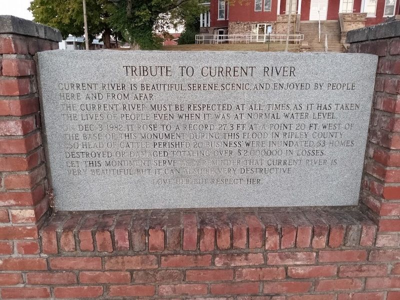
The Current River must be respected at all times as it has taken the lives of people even when it was at normal water level.
On Dec. 3, 1982, it rose to a record 27.3 ft at a point 20 ft. west of the base of this monument. During this flood in Ripley County 250 head of cattle perished 20 businesses' were inundated, 53 homes destroyed or damaged totaling over $2,000,000 in losses.
Let this monument serve as a reminder that Current River is very beautiful, but, it can also be very destructive.
Love her, but respect her.
Topics. This historical marker is listed in these topic lists: Disasters • Waterways & Vessels. A significant historical date for this entry is December 3, 1982.
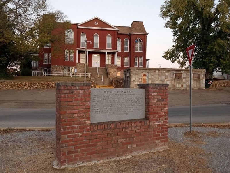
Location. 36° 37.055′ N, 90° 49.676′ W. Marker is in Doniphan, Missouri, in Ripley County. Marker is at the intersection of Jefferson Street and Court House Square, in the median on Jefferson Street. Marker is located behind Ripley County Courthouse. Touch for map. Marker is at or near this postal address: 118 Jefferson St, Doniphan MO 63935, United States of America. Touch for directions.
Other nearby markers. At least 8 other markers are within walking distance of this marker. Doniphan (within shouting distance of this marker); War Memorial (within shouting distance of this marker); Ripley County Veterans Memorial (within shouting distance of this marker); Zebedee Washington Stephens (about 400 feet away, measured in a direct line); Pioneer Log Cabin (about 400 feet away); a different marker also named Pioneer Log Cabin (about 400 feet away); Heritage Homestead (about 400 feet away); Old Time Cemetery (about 400 feet away). Touch for a list and map of all markers in Doniphan.
More about this marker. Marker repeats on both sides.
Credits. This page was last revised on March 20, 2024. It was originally submitted on October 28, 2022, by Jason Voigt of Glen Carbon, Illinois. This page has been viewed 58 times since then and 9 times this year. Photos: 1, 2. submitted on October 28, 2022, by Jason Voigt of Glen Carbon, Illinois. 3. submitted on March 20, 2024, by Craig Swain of Leesburg, Virginia.


