Overlook in Little Rock in Pulaski County, Arkansas — The American South (West South Central)
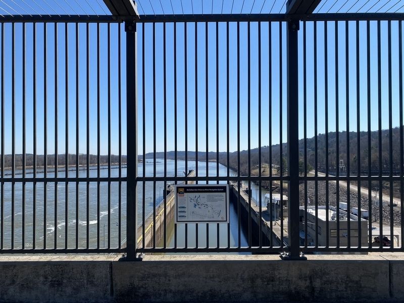
McClellan-Kerr Arkansas River Navigation System

Photographed by Darren Jefferson Clay, February 19, 2022
1. McClellan-Kerr Arkansas River Navigation System Marker
How the Locks Work
When a boat enters the lock the gates close and the water level inside the lock is raised to the upstream level or lowered to the downstream level, depending on which way the boat is moving. The locks are filled and emptied by gravity- no pumps are used.
•The navigation of the Arkansas River was the largest Corps of Engineers public works project at the time of its completion in 1971, costing $1.2 billion
•It is named for the US Senators who sponsored the appropriation bill, McClellan of Arkansas and Kerr of Oklahoma
•The project addressed navigation, flood control, hydroelectric power generation, bank stabilization, recreational opportunities and environmental issues
•The navigation channel is 445 miles long, beginning at the Arkansas Post Canal which connects to the White and Mississippi Rivers
Topics. This historical marker is listed in this topic list: Bridges & Viaducts.
Location. 34° 47.458′ N, 92° 21.553′ W. Marker is in Little Rock, Arkansas, in Pulaski County. It is in Overlook. It can be reached from Rebsamen Park Road.
this page online

Regionally, this marker is in the Quapaw Homeland. It is also in the American South and specifically in the Upper South. Globally, it is in North America, the Western Hemisphere, the Western World, and the Anglosphere. Historically, it finds itself in what was once the territory of the Mississippian Culture, the Louisiana Purchase, one of the Confederate States of America, and the Antebellum South.
Other nearby markers. At least 8 other markers are within 3 miles of this marker, measured as the crow flies: Looking Down the Arkansas River to the West (about 600 feet away, measured in a direct line); Looking Down the Arkansas River to the East (about 600 feet away); The Farmers Home Cemetery (about 800 feet away); The Story of the Big Dam Bridge Monoliths (approx. ¼ mile away); The Arkansas River Trail Story (approx. 0.4 miles away); Four Bridges (approx. 0.4 miles away); The Heights • A History (approx. 1.8 miles away); Block Realty-Baker House (approx. 2½ miles away). Touch for a list and map
Photographed by Darren Jefferson Clay, February 19, 2022
2. McClellan-Kerr Arkansas River Navigation System Marker

Photographed by Darren Jefferson Clay, February 19, 2022
3. The lock at the Big Dam Bridge
Credits. This page was last revised on February 10, 2023. It was originally submitted on October 29, 2022, by Darren Jefferson Clay of Duluth, Georgia. This page has been viewed 435 times since then and 52 times this year. Photos: 1, 2, 3. submitted on October 29, 2022, by Darren Jefferson Clay of Duluth, Georgia. • J. Makali Bruton was the editor who published this page.
