Sheridan in Madison County, Montana — The American West (Mountains)
William O'Brien House
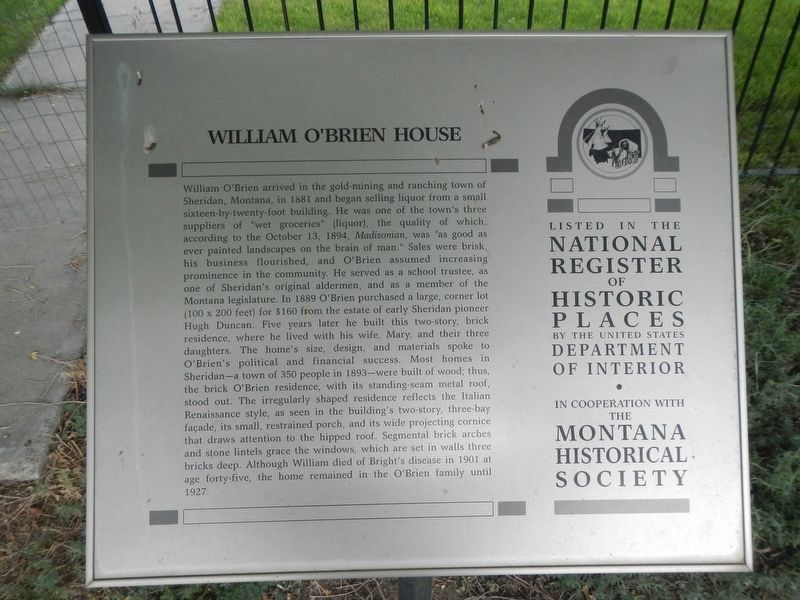
Photographed by Barry Swackhamer, August 5, 2022
1. William O'Brien House Marker
this page online
Erected by Montana Historical Society.
Topics and series. This historical marker is listed in these topic lists: Notable Buildings • Settlements & Settlers. In addition, it is included in the Montana National Register Sign Program series list.
Location. 45° 27.267′ N, 112° 11.671′ W. Marker is in Sheridan, Montana, in Madison County. It is at the intersection of East Poppleton Street and Jefferson Street on East Poppleton Street. Touch for map. Marker is at or near this postal address: 114 East Poppleton Street, Sheridan MT 59749, United States of America. Touch for directions.

Regionally, this marker is in Southwest Montana, in Gold West Country, in Mining Country and in Greater Bozeman.

Photographed by Barry Swackhamer, August 5, 2022
2. William O'Brien House and Marker
Other nearby markers. At least 8 other markers are within 10 miles of this marker, measured as the crow flies: Bethel United Methodist Church (about 500 feet away, measured in a direct line); Sheridan Montana - The Heart of the Ruby Valley (approx. 0.2 miles away); Robber's Roost (approx. 4.9 miles away); Pavilion (approx. 9.1 miles away); Which way did they go? (approx. 9.1 miles away); Recognizing her people's land (approx. 9.1 miles away); Jefferson River - Beaverhead River (approx. 9.1 miles away); "...a handsome little river..." (approx. 9.1 miles away). Touch for a list and map of all markers in Sheridan.
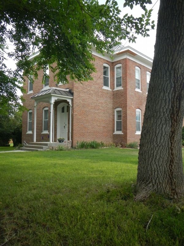
Photographed by Barry Swackhamer, August 5, 2022
3. William O'Brien House
Credits. This page was last revised on November 4, 2022. It was originally submitted on November 4, 2022, by Barry Swackhamer of Brentwood, California. This page has been viewed 275 times since then and 24 times this year. Photos: 1, 2, 3. submitted on November 4, 2022, by Barry Swackhamer of Brentwood, California.
