Spring Hill in Maury County, Tennessee — The American South (East South Central)
Slave Fields To Battlegrounds
Rippavilla's Enslaved who Fought for Freedom
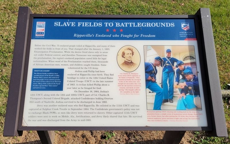
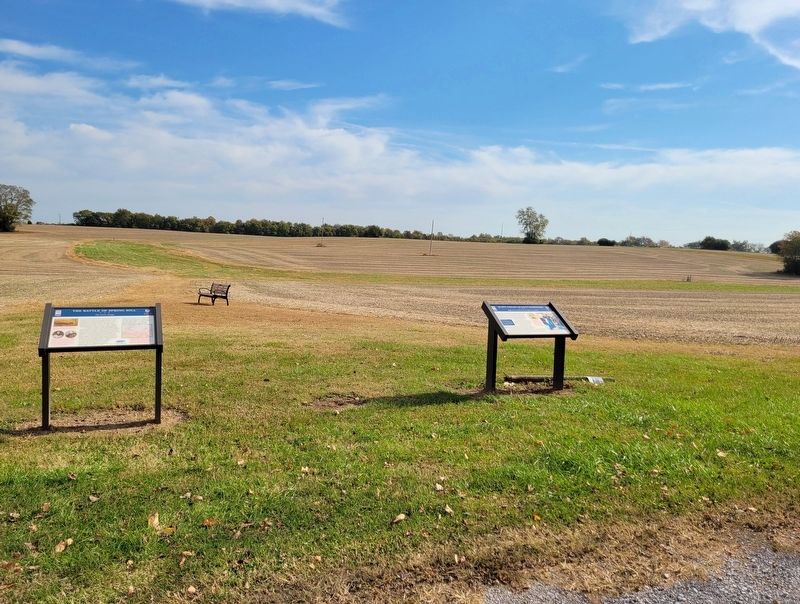
Before the Civil War, 75 enslaved people toiled at Rippavilla, and many of them worked the fields in front of you. That changed after the January 1, 1863, Emancipation Proclamation. While the decree freed slaves only in areas not under Federal control, and therefore Tennessee was exempted from the proclamation, the region's enslaved population cared little for legal technicalities. When word of the Proclamation reached them, thousands of African American men, women, and children sought freedom. Some volunteered for the US Army.
Joshua and Phillip had been enslaved at Rippavilla since birth. They fled bondage to enlist in the 12th United States Colored Troops (USCT) in the late summer of 1863. A civilian killed Phillip about a year later as he foraged for food.
On December 16, 1864, Joshua's 12th USCT, along with the 13th and 100th USCT, part of Col. Charles R. Thompson's Second Colored Brigade, attacked Confederates holding Overton Hill south of Nashville. Joshua survived to be discharged in June 1865.
Jerry was another enslaved man who fled Rippavilla. He enlisted in the 111th USCT and was captured at Sulphur Creek Trestle in September 1864. The Confederate government's policy was not to exchange Black POWs, so men like Jerry were returned to slavery. Other captured 111th USCT soldiers were sent to work on Mobile, Ala., fortifications, and Jerry likely shared that fate. He survived the war and was discharged from the Army in mid-1865.
(sidebar)
What's In A Name?
The Cheairs family would have been considered part of the South's wealthy Planter Class, owners who enslaved at least 20 people. It was common practice for owners to force slaves to use their last names. Many of the enslaved who found freedom rejected their "slave names" and took new ones.
(captions)
Col. Charles R. Thompson wrote of his USCT regiments at the Battle of Nashville, "They assaulted probably the strongest works on the entire line, and, though not successful, they vied with the old warriors in bravery, tenacity, and deeds of noble daring." The brigade suffered. 25% casualties at the fight. Courtesy Maine State Archives
Reenactors portray USCT relaxing and reading mail on the steps of a plantation house, a simple scene of momentous social change. Many USCT were former slaves, but after joining the US Army, they became free Federal employees, given sanction to fight and occupy the land where they once worked as slaves. - Courtesy Hannibal Guards
Erected by Civil War Trails and American Battlefield Trust.
Topics. This historical marker is listed in these topic lists:
African Americans • War, US Civil.
Location. 35° 43.919′ N, 86° 57.176′ W. Marker is in Spring Hill, Tennessee, in Maury County. Marker is on Main Street (U.S. 31) half a mile south of Saturn Parkway (Tennessee Route 396), on the left when traveling south. Located on the left side of the entrance road to the Rippa Villa Plantation and is at the trailhead of the battlefield hiking trail. Touch for map. Marker is at or near this postal address: 5700 Main Street, Spring Hill TN 37174, United States of America. Touch for directions.
Other nearby markers. At least 8 other markers are within walking distance of this marker. The Battle of Spring Hill (here, next to this marker); Rippa Villa (within shouting distance of this marker); a different marker also named Rippa Villa (within shouting distance of this marker); Rippavilla Plantation (about 600 feet away, measured in a direct line); a different marker also named The Battle of Spring Hill (approx. 0.2 miles away); a different marker also named The Battle of Spring Hill (approx. 0.2 miles away); Billy Direct (approx. 0.6 miles away); Hood's Command Post (approx. 0.9 miles away). Touch for a list and map of all markers in Spring Hill.
Also see . . . Tours at Rippa Villa. The Battle of Franklin Trust (Submitted on November 7, 2022.)
Credits. This page was last revised on November 7, 2022. It was originally submitted on November 6, 2022, by Bradley Owen of Morgantown, West Virginia. This page has been viewed 165 times since then and 20 times this year. Photos: 1, 2. submitted on November 6, 2022, by Bradley Owen of Morgantown, West Virginia. • Bernard Fisher was the editor who published this page.

