Deer Lodge in Powell County, Montana — The American West (Mountains)
Capt. John Mullan Trail
1853 - 1868
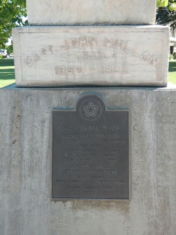
Photographed by Barry Swackhamer, August 7, 2022
1. Capt. John Mullan Trail Marker
of The Military Road
from Fort Benton, Montana
to Walla Walla, Wash
completed 1862
Erected under the Auspices of
Montana Society of Pioneers
Contributed by The son and daughters of
Captain James H. Mills of Deer Lodge City b in honor of Their Father's intimacy and
Friendship with and for Captain John
Mullan Road Builder and Frontiersman
Deerlodge City -- (missing) 1916
Erected by Montana Society of Pioneers.
Topics. This historical marker is listed in this topic list: Roads & Vehicles.
Location. 46° 23.943′ N, 112° 44.001′ W. Marker is in Deer Lodge, Montana, in Powell County. It is at the intersection of Missouri Avenue and 4th Street, on the left when traveling east on Missouri Avenue. Touch for map. Marker is at or near this postal address: 400 Missouri Avenue, Deer Lodge MT 59722, United States of America. Touch for directions.

Regionally, this marker is in andspecifically outhwest Montana, in Gold West Country, in Mining Country. It is also in the American Mountain West and in the Lewis & Clark Corridor.
this page online
Other nearby markers. At least 8 other markers are within walking distance of this marker: 304 Cottonwood (about 400 feet away, measured in a direct line); William E. Coleman House (about 400 feet away); Larabie Brothers Bank (about 400 feet away); William K. Kohrs Memorial Library (about 500 feet away); Thompson Photo Shop (about 500 feet away); U.S. Post Office (about 500 feet away); Mitchell Block (about 600 feet away); Deer Lodge Central Business Historic District (about 600 feet away). Touch for a list and map of all markers in Deer Lodge.
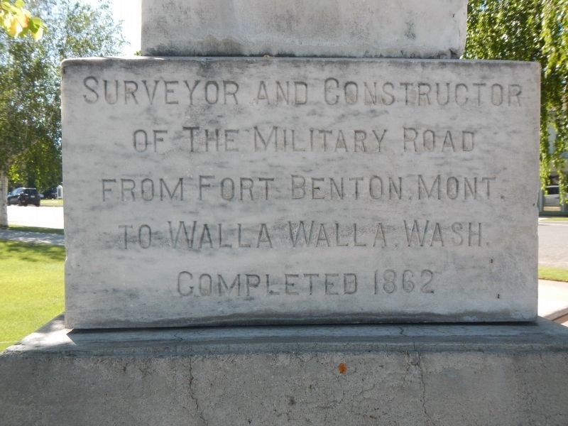
Photographed by Barry Swackhamer, August 7, 2022
2. Capt. John Mullan Trail Marker
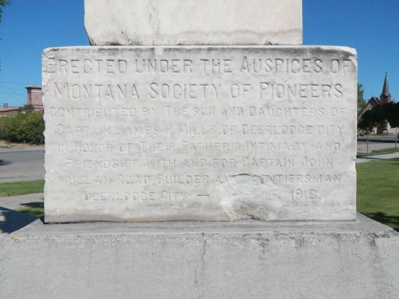
Photographed by Barry Swackhamer, August 7, 2022
3. Capt. John Mullan Trail Marker
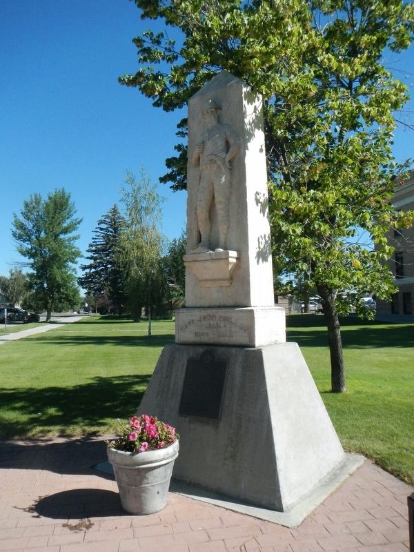
Photographed by Barry Swackhamer, August 7, 2022
4. Capt. John Mullan Trail Marker
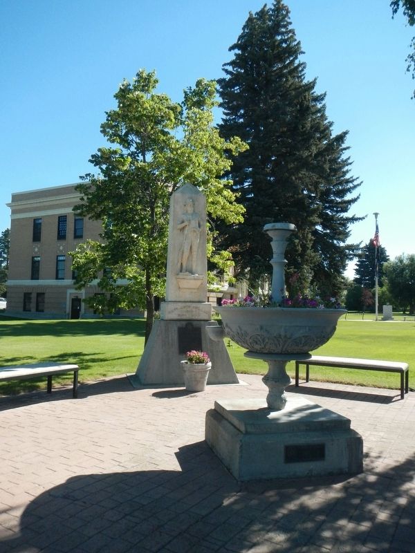
Photographed by Barry Swackhamer, August 7, 2022
5. Capt. John Mullan Trail Marker
Credits. This page was last revised on November 15, 2022. It was originally submitted on November 6, 2022, by Barry Swackhamer of Brentwood, California. This page has been viewed 261 times since then and 48 times this year. Photos: 1, 2, 3, 4, 5. submitted on November 6, 2022, by Barry Swackhamer of Brentwood, California. • Bill Pfingsten was the editor who published this page.
