Radford, Virginia — The American South (Mid-Atlantic)
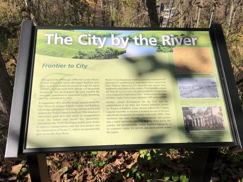
The City by the River
Frontier to City
In September 1891, a traffic bridge opened across the New River to connect Pulaski County and Radford. The bridge operated as a toll bridge and ran in line with modern day Walker Street in Radford. This structure's importance grew as a new mode of transportation swept the nation and world – the automobile. Throughout the 1920s developers made great strides to improve transportation, and one such project was the construction of Route 11, which incorporated the span across the New River.
Route 11 was the primary roadway until the construction of Interstate 81 surpassed it in importance. Now connecting New York to Tennessee, I-81 provides easy access from Radford to other parts of the country. The interstate crosses the New River just west of Radford with two bridges that were originally completed in 1965 – within a short distance of where Ingles Ferry began operation 200 years earlier.
Another critical development for the City was the establishment of the State and Normal Industrial School for Women at Radford. Local citizens lobbied the Virginia General Assembly to become a location for one of the new educational institutions for women in the early 1900s. That institution has since become coeducational and grown into a major university, drawing students from across the country and internationally. Today, Radford University is an economic engine for growth and development within the region.
Captions (top to bottom)
• Late 19th century plan showing the layout of the western portion of Radford.
• The original 1891 traffic bridge connecting Radford with Pulaski County. The area to the left is mow Bisset Park, and the structure to the right was for Norfolk and Western offices. Courtesy Tom Starnes
• Founders Hall, the first building constructed for what is now Radford University. It was demolished to make way for Muse Hall. Courtesy McConnell Library Archives and Special Collections, Radford University, Radford, VA
Topics. This historical marker is listed in these topic lists: Bridges & Viaducts • Education • Industry & Commerce • Roads & Vehicles. A significant historical year for this entry is 1892.
Location. 37° 7.987′ N, 80° 34.822′ W. Marker is in Radford, Virginia. Marker is on Unruh Drive, 0.1 miles Robertson Street, on the left when traveling
east. Marker is in Mary Draper Ingles Cultural Heritage Park. Touch for map. Marker is at or near this postal address: 601 Unruh Dr, Radford VA 24141, United States of America. Touch for directions.
Other nearby markers. At least 8 other markers are within walking distance of this marker. The Railroad Arrives (within shouting distance of this marker); Westward Migration (within shouting distance of this marker); Mary Draper Ingles (within shouting distance of this marker); Home Guards (about 300 feet away, measured in a direct line); New River Bridge (about 400 feet away); Montgomery County / Pulaski County (approx. half a mile away); The New River (approx. half a mile away); Starnes (approx. 0.6 miles away). Touch for a list and map of all markers in Radford.
Credits. This page was last revised on November 6, 2022. It was originally submitted on November 6, 2022, by Duane and Tracy Marsteller of Murfreesboro, Tennessee. This page has been viewed 328 times since then and 33 times this year. Photos: 1, 2. submitted on November 6, 2022, by Duane and Tracy Marsteller of Murfreesboro, Tennessee.

