Robbinsville in Graham County, North Carolina — The American South (South Atlantic)
Junaluska
Junaluska, the Cherokee who saved Andrew Jackson;s life and made him a national hero, lived to regret it. Born in North Carolina mountains around 1776, he made his name and his fame among his own people in the War of 1812 when the mighty tribe of Creek Indians allied themselves with the British against the United States. At the start of the Creek War, Junaluska recruited some 800 Cherokee warriors to go to the aid of Andrew Jackson in northern Alabama. Joined by reinforcements from Tennessee, including more Cherokees, the Cherokee spent the early months of 1814 performing duties in the rear, while Jackson and his Tennessee militia moved like a scythe through the Creek towns. However, that March word came that the Creek Indians were massed behind fortifications at Horseshoe Bend. Jackson, with an army of 2,000 men, including 500 Cherokee led by Junaluska, set out for the Bend, 70 miles away. There, the Tallapoosa River made a bend that enclosed 100 acres in a narrow peninsula opening to the north. On the lower side was an island in the river. Across the neck of the peninsula the Creek had built a strong breastwork of logs and hidden dozens of canoes for use if retreat became necessary.
Storming the fort
The fort was defended by 1,000 warriors. There also were 300 women and children. As cannon fire bombarded the fort, the Cherokee crossed the river three miles below and surrounded the bend to block the Creek escape route. They took position where the Creek fort was separated from them by water. The battle raged throughout the morning. There were dead and wounded on both sides. Among the frontiersmen fighting for Jackson that day were Sam Houston & Davy Crockett.
Saving Jackson's Life and His Reputation
A few prisoners were brought in, and while officers were attempting to question them in the presence ion Jackson, one broke loose, snatched up a knife, and lunged for the general. Junaluska, who had seen the move, responded quickly, sticking out a foot and tripping the Creek warrior, saving Jackson's life. As the battle wore on, Junaluska conceived a brilliant plan. Without notifying Jackson, he gathered a dozen Cherokees, sneaked to the rivers edge behind the effort, plunged into the water, and swam over to where the Creek canoes were moored. Junaluska and his braves freed the canoes and maneuvered them to the opposite bank where other Cherokee warriors piled into them and, under the cover of a steady fire frothier own companions, returned to the opposite bank., thus breaching Creek defenses. When more than half the Creeks lay dead, the rest turned and plunged into the river, only to find the banks of the opposite side lined with blazing guns and escape cut off in every direction. Of the 1,300 Creeks inside the stockade, including women and children, not more than 20 escaped. Of 300 prisoners, only three were men. Two weeks after the decisive battle, Billy Weatherford, the greatest of the Creek chiefs, surrendered to Jackson, turning the general into a national hero.
Another Promise Broken
When the battle of Horseshoe Bend was over, Jackson is reported to have told Junaluska: "As log as the sun shines and the grass grows, there shall be friendship between us, and the feet of the Cherokee shall be toward the east." In a few short years Junaluska would have occasion to recall those words with bitterness. When the great removal of the Cherokee began, Junaluska said: "If I hd known that Jackson would drive us from our homes, I would have killed him that day at the Horseshoe."
The Great Chief Returns
Junaluska was among the Cherokee removed to the West. But he returned to the mountains of his birth in 1842., walking all the way from what is now Oklahoma. And when he returned, the state of North Carolina stepped in and recognized the debt that America owed him. By a special act of the state legislature in 1847, North Carolina conferred upon him the right of citizenship and granted him a tract of land at what is now Robbinsville, in Graham County. Junaluska died in 1858 and was buried on a hill above the town where, in 1910, the Daughters of the American Revolution erected a monument to his memory.
A Tribute to Junaluska
The script on the bronze plaque, bolted to a great hunk of native stone, says in part: "Here lie the bodies of the Cherokee Chief, Junaluska and Nicie, his wife. Together with his warriors he saved the life of General Jackson at the Battle of Horseshoe Bend, and for his bravery and faithfulness North Carolina made him a citizen and gave him land in Graham County." An organization known as "Junaluska's Friends" was organized, and restored the Junaluska grave site. Their work will be primarily devoted to keeping alive the memory of this Chief.
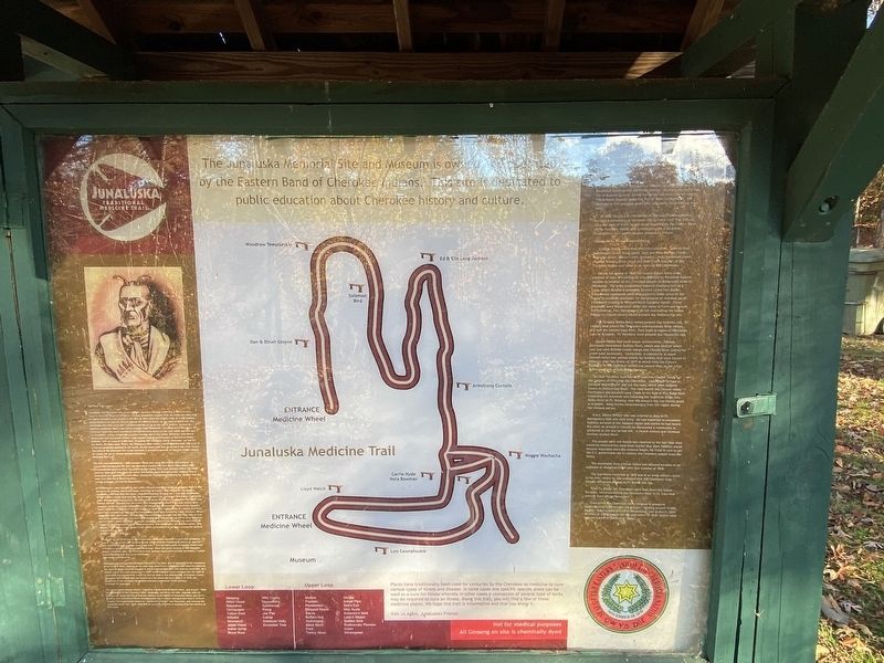
Junaluska Memorial Site & Museum
Junaluska Memorial Site and Museum located in Robbinsville, N.C> is the burial site of Chief Junaluska, one of th great Cherokee leaders that lived in this region during the late 17th and early 18th Century.
Junaluska fought with Andrew Jackson forces at the battle of Horseshoe Bend against the Creek Indians. He allegedly saved the life of Andrew Jackson during the battle, but later had to endure The Arduous Journey along the Trail of Tears to Oklahoma. He returned to this area two years later and spent his remains days here.
In 1910, the (D.A>R>) Daughters of the American Revolution erected a monument at his burial site to honor him. The site and adjacent area of three to four acres is owned by the Eastern Band of the Cherokee Nation and is maintained by a volunteer Organization (non-profit) named Junaluska's Friends.
Cheoah Valley During Removal Period
Cheoah Valley watershed which encompasses, Talluah River, Sweetwater Creek, Long Creek, East and West Buffalo Creeks, Mountain Creek, Yellow Creek, Snowbird Creek, Santeelah Creek, Meadow Branch, Deep Creek, and Bear Creek was part of the Cherokee Nation and home to as many as 500 Cherokees.
During the spring of 1838 the United States Army under command of Gen. Winfield Scott was directed by President Andrew Jackson to remove all the Cherokee people to designated lands in Oklahoma. The Army established regional Headquarters at a camp where Murphy is presently located called Fort Butler. Subordinate commands were dispatched to other areas of the region to establish stockades for the purpose of rounding up all Cherokee's residing in Western North Carolina region. These stockades were established under the name of Forts and include the following: Fort Montgomery on hill overlooking the Indian Village of Cheoah (otter) where present day Robbinsville sits.
Fort Delaney Valley River where present day Andrews sits. Ft. Lindsey near where the Tennessee and Nantahala River merge, this was the eastern most Fort. Fort Scott in region of Nantahala Lake at Acquone. Ft. Hembrey where present day Hayesville sits.
Cheoah Valley had three major communities. Cheoah previously mentioned: Buffalo Town, which was located where east and west Buffalo Creeks merge into Cheoah River (presently under Lake Santeelah). Connichele, a community in upper Tallulah which was settled mostly by families that ere forced to relocate after the Treaty of 1819 at which time the Eastern Boundary of the Cherokee Nation was moved West to the Little Tennessee River, Wayah Ridge Line area.
In 1838 The Army built the first road into Cheoah Valley for the purpose of removing the Cherokees. Lieutenant Tatham a surveyor and engineer laid out th road, which later became known as Tatham Gap Road. The road leaves the Cheoah valley confluence and parallels Long Creek to the foot of Pile Ridge then traversing the mountain and following the Southside Ridge into Valley River at Ft. Delaney, near the present day Lee textile plant in Andrews. Many stories have emerged from the region during the removal period.
A N.C. Militia Officer who was ordered to duty to Ft. Montgomery tells one such story. he had expected to encounter hostility because of the isolate region and stories he had heard. But when he arrived in Cheoah, he discovered a community as advanced as the one he had left. A church existed and Christian families resided there.
The people were not hostile but resorted to the fact that they would be removed but were out fearful that their families would become separated once the removal began. He tried in vain to get the U.S. government not to remove the Cherokee people from the valley.
The movement from Cheoah Valley was delayed because of an outbreak of whooping cough until later summer of 1838.
The last memo recorded in 1838 was in an Army officer's letter to his wife, where he had indicated that 200 Cherokees from Cheoah Valley had arrived at Ft. Butler this day.
From Ft. Butler the Cherokees were sent down the Unicoi Turnpike, which parallel the Hiawasee River to Ft. Cass near present day Calhoun Tennessee.
From there the Cherokees were removed in groups of approximately 1,000 people (15 groups). Totaling around 15,000 people. Some groups arrived ito Oklahoma as late as March 1839. As many of 5,000 died in the fall and winter of 1838-1839 in what became known as the Trail of Tears.
Topics. This historical marker is listed in these topic lists: Forts and Castles • Native Americans.
Location. 35° 19.198′ N, 83° 48.515′ W. Marker is in Robbinsville, North Carolina, in Graham County. Marker can be reached from Junaluska Road north of Morphew Street, on the right when traveling north. Touch for map. Marker is at or near this postal address: 181 Junaluska Rd, Robbinsville NC 28771, United States of America. Touch for directions.
Other nearby markers. At least 8 other markers are within walking distance of this marker. Junaluska and the Trail of Tears (here, next to this marker); Junaluska's Distingusihed Service (here, next to this marker); Cherokee Chief Junaluska DAR Monument (a few steps from this marker); Junaluska's Birth Site (a few steps from this marker); Junaluska and The Battle of Horseshoe Bend (a few steps from this marker); 1819 Treaty with the United States (a few steps from this marker); Junaluska's Names (a few steps from this marker); Junaluska's Meeting With Tecumseh at Soco Gap (a few steps from this marker). Touch for a list and map of all markers in Robbinsville.
Credits. This page was last revised on November 9, 2022. It was originally submitted on November 7, 2022, by Darren Jefferson Clay of Duluth, Georgia. This page has been viewed 202 times since then and 63 times this year. Photos: 1, 2. submitted on November 8, 2022, by Darren Jefferson Clay of Duluth, Georgia. • Bernard Fisher was the editor who published this page.

