
Marker Logo
THE HISTORICAL
MARKER DATABASE
“Bite-Size Bits of Local, National, and Global History”
Raynham in Bristol County, Massachusetts — The American Northeast (New England)
 

Raynham World War I Memorial
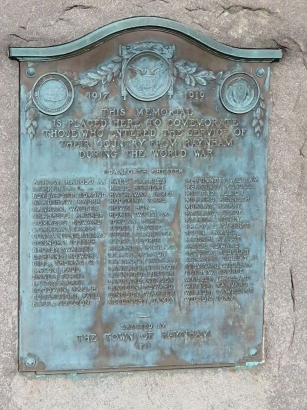
 
 
Raynham World War I Memorial image. Click for full size.
Photographed by Michael Herrick, October 27, 2022
1. Raynham World War I Memorial
Inscription.
1917     1919
This Memorial
Is Placed Here to Commemorate
Those Who Entered the Service
Of Their Country from Raynham
During the World War
★Danforth Chester
Ashley, Harold A. · Barker, A. L. · Bombardier, Edmond · Bradshaw.Rh · Canham, Walter · Chappel, Arthur · Commeau, Edward · Commeau, James · Constantine, Israel · Connors, Joseph · Crosby, Walter · Darling, Howard · Dill, Thomas G. · Eaton, Paul · Ennes, Frank · Estey, Harry · Goodwin, Ralph · Guerreschi, Paul · Hall, Clifton · Hall, Charles · Hall, Herbert · Hathaway, James · Hodgkins, Earl · Howe, Roy · Hoxie, William · Jordan, Percy · Judge, Alfred · Judge, Clarence · Judge, George · Kempner, Michael · Leach, Morton · Leonard, Benjamin · Leonard, Clinton · Leonard, Linton · Leonard, Nelson · Lincoln, Edward · Lincoln, Warren · McGlinchy, James · McGuinness, William · McKenney, Mendell · Millerd, Albion · Millerdke · Murray, Harry · Packard, Clyde · Palmer, Sidney · Prado, Lawrence · Rubin, Samuel · Sabsch, August · Smith, Edward · Spousta, Rudolph · Strange, Ellery · Sullivan, William · Tetlow, George · Weller, Wallace · Wilbur, Harvard · Wilbur, Lawrence
Paid Advertisement
Click or scan to see
this page online
· Wilson, John
erected by
the Town of Raynham
1928

 
Erected 1928 by the Town of Raynham.
 
Topics. This historical marker and memorial is listed in this topic list: War, World I. A significant day of the year for for this entry is May 31.
 
Location. 41° 55.367′ N, 71° 3.171′ W. Marker is in Raynham, Massachusetts, in Bristol County. It is on S Main Street (Massachusetts Route 104) south of Orchard Street, on the left when traveling north. Located in front of the Raynham Public Library. Touch for map. Marker is at or near this postal address: 760 S Main Street, Raynham MA 02767, United States of America. Touch for directions.

Regionally, this marker and memorial is in Greater Providence. It is also in the American Northeast and in New England. Globally, it is in the North Atlantic Region, North America, the Western Hemisphere, the Western World, and the Anglosphere. Historically, it finds itself in what was once one of the original Thirteen Colonies.

Other nearby markers. At least 8 other markers are within 3 miles of this marker, measured as the crow flies: Raynham Civil War Monument (a few steps from this marker); Raynham World War II Memorial
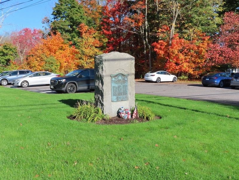
Raynham World War I Memorial image. Click for full size.
Photographed by Michael Herrick, October 27, 2022
2. Raynham World War I Memorial
(a few steps from this marker); Raynham Veterans Monument (approx. 0.4 miles away); Site of the First Successful Iron Works in the Old Colony (approx. Ύ mile away); Taunton Colonial Militiamen Memorial (approx. 2.3 miles away); Taunton Vietnam Veterans Memorial (approx. 2.3 miles away); Memorial for Soldiers against Terrorism (approx. 2.3 miles away); Desert Storm Desert Shield Memorial (approx. 2.3 miles away). Touch for a list and map of all markers in Raynham.
 
 
Credits. This page was last revised on November 7, 2022. It was originally submitted on November 7, 2022, by Michael Herrick of Southbury, Connecticut. This page has been viewed 185 times since then and 18 times this year. Photos:   1, 2. submitted on November 7, 2022, by Michael Herrick of Southbury, Connecticut.

m=209712

CeraNet Cloud Computing sponsors the Historical Marker Database.
This website earns income from purchases you make after using our links to Amazon.com. We appreciate your support.
Paid Advertisement
Jul. 9, 2026