Spring Hill in Maury County, Tennessee — The American South (East South Central)
The Battle of Spring Hill
Opportunity Lost
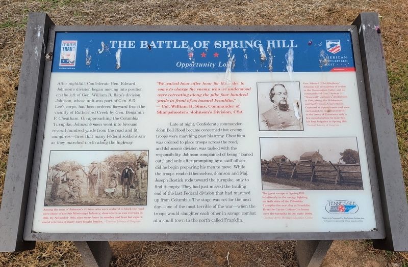
After nightfall, Confederate Gen. Edward Johnson's division began moving into position on the left of Gen. William B. Bate's division. Johnson, whose unit was part of Gen. S.D. Lee's corps, had been ordered forward from the vicinity of Rutherford Creek by Gen. Benjamin F. Cheatham. On approaching the Columbia Turnpike, Johnson's men went into bivouac several hundred yards from the road and lit campfires—fires that many Federal soldiers saw as they marched north along the highway.
Late at night, Confederate commander John Bell Hood became concerned that enemy troops were marching past his army. Cheatham was ordered to place troops across the road, and Johnson's division was tasked with the responsibility. Johnson complained of being "loaned out," and only after prompting by a staff officer did he begin preparing his men to move. While the troops readied themselves, Johnson and Maj. Joseph Bostick rode toward the turnpike, only to find it empty. They had just missed the trailing end of the last Federal division that had marched up from Columbia. The stage was set for the next day—one of the most terrible of the war—when the troops would slaughter each other in savage combat at a small town to the north called Franklin.
"We waited hour after hour for the order to come to charge the enemy, who we understood were retreating along the pike four hundred yards in front of us toward Franklin."
—Col. William H. Sims, Commander of Sharpshooters, Johnson's Division, CSA
(captions)
Among the men of Johnson's division who were ordered to block the road were those of the 9th Mississippi Infantry, shown here as raw recruits in 1861. By November 1864, they were fewer in number and lean but experienced veterans of many hard-fought battles. - Courtesy Library of Congress
Gen. Edward "Old Allegheny" Johnson had seen plenty of action in the Shenandoah Valley and as commander of Gen. Thomas J. "Stonewall" Jackson's old division at Gettysburg, the Wilderness, and Spotsylvania Court House. Captured at Spotsylvania and soon exchanged, he was transferred to the Army of Tennessee only a few months before he marched his four brigades to Spring Hill. Courtesy Library of Congress
The great escape at Spring Hill led directly to the savage fighting on both sides of the Columbia Turnpike the next day at Franklin. Here the Carter Cotton Gin looms over the turnpike in the early 1880s. Courtesy Army Heritage Education Center
Erected by Civil War Trails & American Battlefield Trust.
Topics. This historical marker is listed in this topic list: War, US Civil. A significant historical date for this entry is November 28, 1864.
Location.
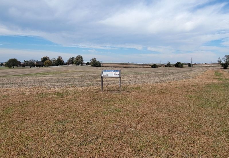
35° 43.922′ N, 86° 56.977′ W. Marker is in Spring Hill, Tennessee, in Maury County. Marker can be reached from Main Street (U.S. 31) half a mile south of Saturn Parkway (Tennessee Route 396), on the left when traveling south. Located along the battlefield hiking trail at Rippa Villa Plantation. Touch for map. Marker is at or near this postal address: 5700 Main Street, Spring Hill TN 37174, United States of America. Touch for directions.
Other nearby markers. At least 8 other markers are within one mile of this marker, measured as the crow flies. A different marker also named The Battle of Spring Hill (about 700 feet away, measured in a direct line); Slave Fields To Battlegrounds (approx. 0.2 miles away); a different marker also named The Battle of Spring Hill (approx. 0.2 miles away); Rippa Villa (approx. 0.2 miles away); a different marker also named Rippa Villa (approx. 0.2 miles away); Rippavilla Plantation (approx. 0.3 miles away); Billy Direct (approx. ¾ mile away); Hood's Command Post (approx. 1.1 miles away). Touch for a list and map of all markers in Spring Hill.
Related marker. Click here for another marker that is related to this marker. Old CWT Marker At This Location also titled “The Battle of Spring Hill"
Credits. This page was last revised on November 10, 2022. It was originally submitted on November 10, 2022, by Bradley Owen of Morgantown, West Virginia. This page has been viewed 179 times since then and 27 times this year. Photos: 1, 2. submitted on November 8, 2022, by Bradley Owen of Morgantown, West Virginia. • Bernard Fisher was the editor who published this page.

