Abingdon in Washington County, Virginia — The American South (Mid-Atlantic)
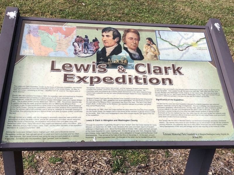
Lewis & Clark Expedition
Shortly after Louisiana Purchase in 1803, the expedition was commissioned by President Thomas Jefferson and consisted of a select group of US Army volunteers and backwoodsmen, under the joint command of Captain Meriwether Lewis and Captain William Clark. The duration of their journey lasted from 1804 through 1806. The primary objective was to explore and map the newly acquired territory and, by following the Missouri River northwest, to see if it was connected or came close to the Columbia River, which flowed on to the Pacific Ocean. During this exploration, Lewes and Clark aimed to find a practical route across the western half of the continent, and in doing so, establish an American presence in this territory, thus securing the territory before Britain and other European powers could claim the land.
Although formed as a military unit, the campaign's secondary objectives were scientific and economical: to study the area's plants, animal life, geography, and other natural resources. During the course of the journey, the expedition discovered rivers and lakes along with numerous Indian tribes, many with whom they traded and obtained useful information. With maps, sketches and journals in hand, Lewis Clark, and the other members of the expedition returned to St. Louis in September 1806.
Among the Corps were William Clark's “manservant”, York, and a Shoshone woman, Sacagawea (written as “Sah-cah-gah-we-ah” in Lewis and Clark's journals) and her infant son, Jean Baptiste. York saved several lives along the way and participated as a member of the crew. Sometime after the expedition, Clark “granted” York his freedom.
Sacagawea, whose name means “bird woman”, and her husband, Toussaint Charbonneau, a trapper from Quebec, joined the Corps of Discovery as interpreters and guides. Her interpretive skills and presence as a women helped demonstrate to the native tribes the Corps mission was a peaceful one and her native Shoshone tongue helped the Corps negotiate with the Indians.
Sergeant Charles Foy was the only member of the expedition to die during their long journey. He died on August 20, 1804, apparently of acute appendicitis. He was buried on a bluff on the east side of the Missouri River near present-day Sioux City, Iowa. The site is now called Floyd's Bluff. A mile further up the Missouri, the expedition camped at a smaller river which they named Floyd's River.
On November 24, 1805, when the Corps reached the place where the Columbia River emptied into the Pacific Ocean, the leaders held a vote among all the members to decide where to settle for the winter. Both York's and Sacagawea's votes were counted equally with those of the rest of the expedition.
Lewis & Clark in Abingdon and Washington County
Although the expedition is generally thought to have “ended” when the Corps reached St. Louis, Missouri, on September 23, 1806, it was necessary that Lewis and Clark report to President Jefferson in Washington, D.C. About the third week of October, 1806, Lewis and Clark and part of the Corps departed St. Louis, beading east. Among this group were York, Sergeants Gass and Ordway, Indian Agent Pierre Chouteau, and a delegation of Osages and the Mandan Chief Shehekeshore. They arrived at the Falls of the Ohio on November 5. At this point, around November 9, Lewis preceeded Clark. On this part of the return trip he traveled through the Cumberland Gap and arrived in the Abingdon area of Washington County, Virginia, in late November or early December. Clark passed through this area a few days later. Both Lewis and Clark came through Abingdon and Washington County, Virginia, on their return route. Both men are thought to have stayed with the Col. John Preston family in Washington County. Clark again traveled through this area in 1809 and recorded in his diary his stay with the Prestons at that time.
Significance of the Expedition
The fact that the Lewis and Clark Expedition was part of a scientific expedition was extremely important, especially during the Age of Enlightenment. The new knowledge they obtained about the Northwest's geography, natural resources, animals, trees, plants and native inhabitants sparked American interest in the west, and strengthened the nation's claim to the area. It also gave Americans a sense of pride as at a time when they badly needed symbols of national triumph. Americans at this time realized that their new nation was still very much divided and relatively weak. Lewis and Clark's adventure offered Americans proof that the new United States could accomplish great deeds amidst enormous hardships.
Also spread was the idea of “Manifest Destiny” as Americans increasingly assumed a continental destiny. This opened many doors for poor families to go out and prosper through the late nineteenth century. However, this expansion also led to many Native Americans and earlier Hispanic settlers being dispossessed of their land and heritage and the near extinction of the American buffalo.
Erected 2013 by Veterans Park Memorial Foundation.
Topics. This historical marker is listed in these topic lists: Exploration • Native Americans. A significant historical date for this entry is May 14, 1804.
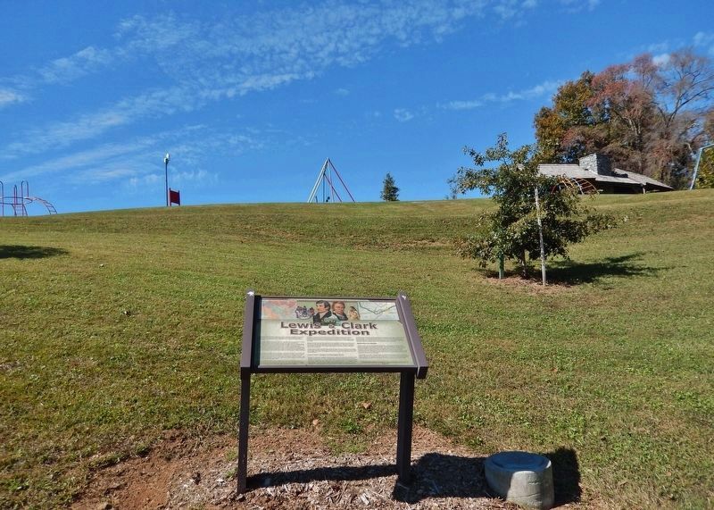
Location. 36° 42.279′ N, 81° 58.515′ W. Marker is in Abingdon, Virginia, in Washington County. Marker can be reached from Lt Billy Webb Avenue, 0.1 miles north of Cook Street. Marker is in Veterans Memorial Park. Touch for map. Marker is at or near this postal address: 425 Lt Billy Webb Ave, Abingdon VA 24210, United States of America. Touch for directions.
Other nearby markers. At least 8 other markers are within walking distance of this marker. War of 1812 (here, next to this marker); Purple Heart (here, next to this marker); Star-Spangled Banner (here, next to this marker); Pvt. Michael Widener (a few steps from this marker); Spirit of 1776 (within shouting distance of this marker); Overmountain Men (within shouting distance of this marker); U.S.-Mexican War (within shouting distance of this marker); Medal of Honor (within shouting distance of this marker). Touch for a list and map of all markers in Abingdon.
Credits. This page was last revised on February 2, 2023. It was originally submitted on November 10, 2022, by Duane and Tracy Marsteller of Murfreesboro, Tennessee. This page has been viewed 161 times since then and 22 times this year. Photos: 1. submitted on November 10, 2022, by Duane and Tracy Marsteller of Murfreesboro, Tennessee. 2. submitted on November 14, 2022, by Cosmos Mariner of Cape Canaveral, Florida.

