Greenville in Wayne County, Missouri — The American Midwest (Upper Plains)
Keep Right!
Traffic Control on the Streets of Old Greenville
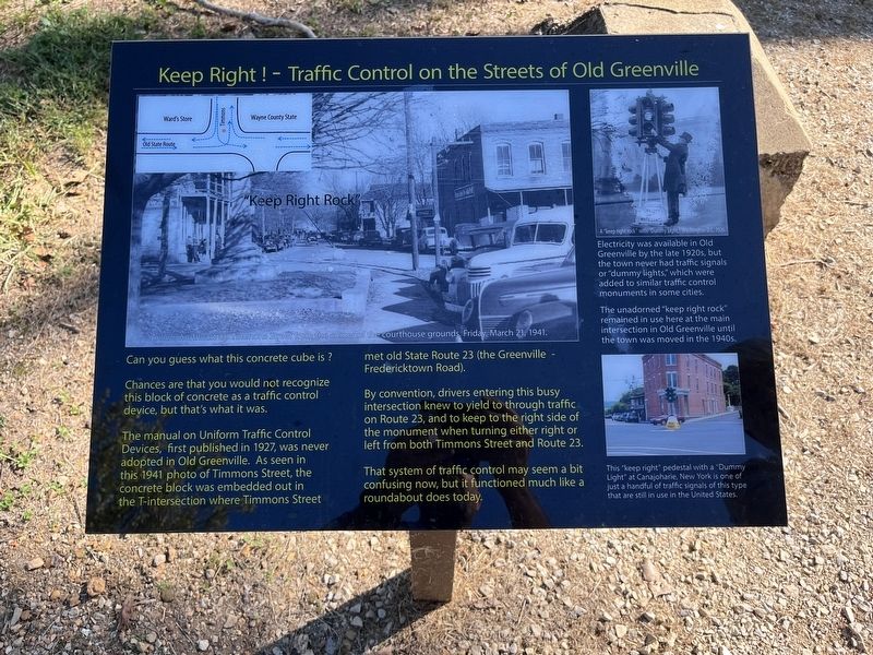
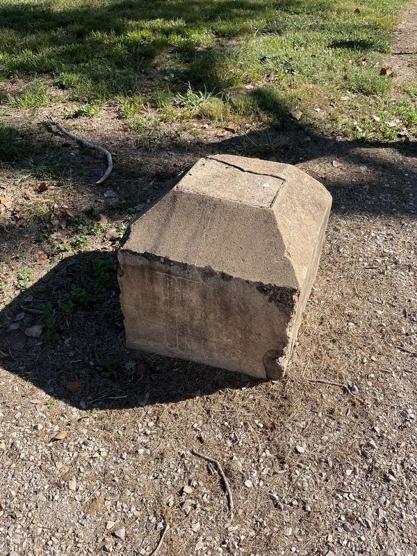
Chances are that you would not recognize this block of concrete as a traffic control device, but that is what it was.
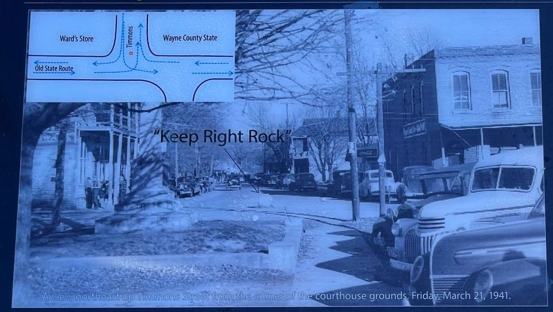
The manual on Uniform Traffic Control Devices, first published in 1927, was never adopted in Old Greenville. As seen in this 1941 photo of Timmons Street, the concrete block was embedded out in the T-intersection where Timmons Street met old State Route 23 (the Greenville - Fredericktown Road).
By convention, drivers entering this busy intersection knew to yield to through traffic on Route 23, and to keep to the right side of the monument when turning either right or left from both Timmons Street and Route 23.
That system of traffic control may seem a bit confusing now, but it function much like a roundabout does today.
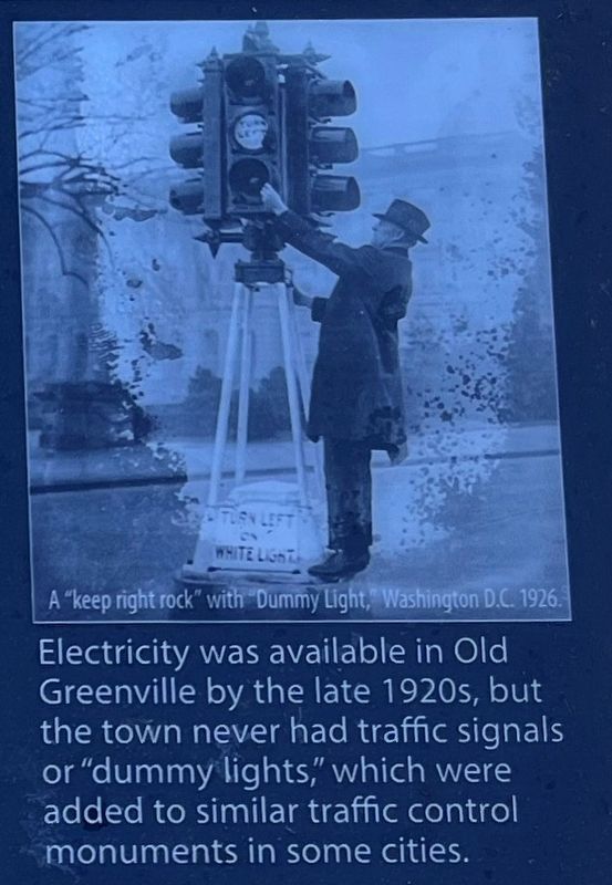
(Upper Right Photo Caption):
Electricity was available in Old Greenville by the late 1920s, but the town never had traffic signals or "dummy lights," which were added to similar traffic control monuments in some cities.
The unadorned "keep right rock" remained in use here at the main intersection in Old Greenville until the town was moved in the 1940s.
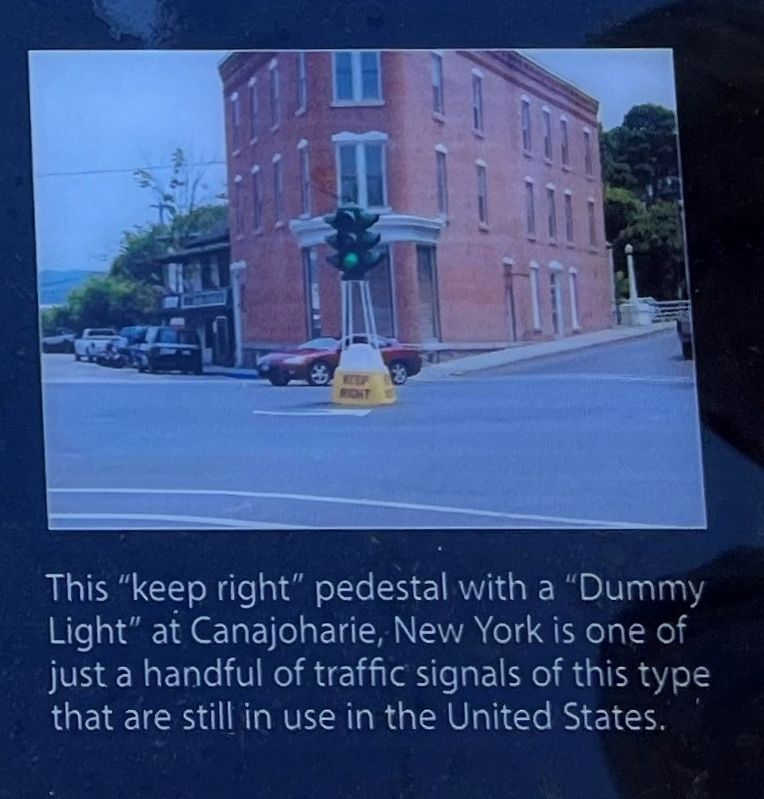
(Lower Right Photo Caption):
This "keep right" pedestal with a "Dummy Light" at Canajoharie, New York is one of just a handful of traffic signals of this type that are still in use in the United States.
Topics. This historical marker is listed in this topic list: Roads & Vehicles. A significant historical year for this entry is 1927.
Location. 37° 6.014′ N, 90° 27.384′ W. Marker is in Greenville, Missouri, in Wayne County. Marker can be reached from Highway 67, on the right when traveling south. Located on the "Memory Lane" trail through Old Greenville, inside the Greenville Recreation Area, Wappapello Lake. Touch for map. Marker is in this post office area: Greenville MO 63944, United States of America. Touch for directions.
Other nearby markers. At least 8 other markers are within walking distance of this marker. Ward's Store (here, next to this marker); Wayne County Courthouse (a few steps from this marker); She Poisoned His Tomato Wine (a few steps from this marker); Harry S. Truman (a few steps from this marker); Wayne County Bank (a few steps from this marker); The Wayne County Courthouse At Old Greenville (a few steps from this marker); St. Francis Hotel (within shouting distance of this marker); Wilcox Service Station (within shouting distance of this marker). Touch for a list and map of all markers in Greenville.
Photographed By Craig Swain, September 28, 2022
3. Keep Right Rock
A view northeast up Timmons Street from the corner of the courthouse grounds, Friday, March 21, 1941.
Note the inset diagram on the upper left illustrating the traffic flow around the "rock." In the foreground of the photo is a blocked in area where the county's World War I memorial stood, before relocated to the present day courthouse in "new" Greenville.
Note the inset diagram on the upper left illustrating the traffic flow around the "rock." In the foreground of the photo is a blocked in area where the county's World War I memorial stood, before relocated to the present day courthouse in "new" Greenville.
Photographed By Craig Swain, September 28, 2022
6. Intersection of Timmons and Third Street
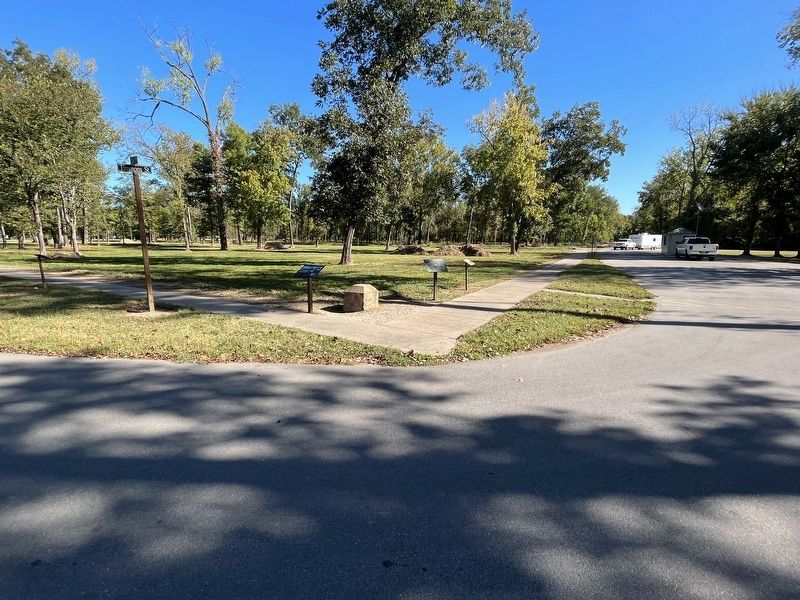
The once busy intersection of Timmons Street and Third Street (or the Fredericktown Road). The Keep Right marker is on the left of the traffic monument. To the right is a locator map (repeated at several stations on the trail) and the Ward's Store marker.
Credits. This page was last revised on November 10, 2022. It was originally submitted on November 10, 2022, by Craig Swain of Leesburg, Virginia. This page has been viewed 56 times since then and 15 times this year. Photos: 1, 2, 3, 4, 5, 6. submitted on November 10, 2022, by Craig Swain of Leesburg, Virginia.
