Middle Brook in Iron County, Missouri — The American Midwest (Upper Plains)
The Power of Water...
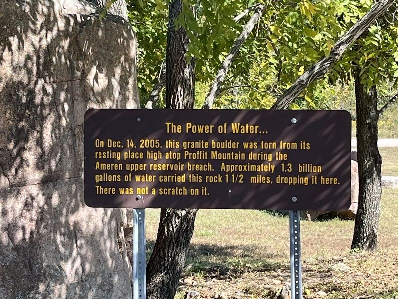
Photographed by Craig Swain, September 27, 2022
1. The Power of Water... Marker
Topics. This historical marker is listed in this topic list: Disasters. A significant historical date for this entry is December 14, 2005.
Location. 37° 32.866′ N, 90° 50.766′ W. Marker is in Middle Brook, Missouri, in Iron County. It is on Taum Sauk Trail. Touch for map. Marker is in this post office area: Middle Brook MO 63656, United States of America. Touch for directions.

Regionally, this marker is in Southeast Missouri. It is also in the American Ozarks, in the Lewis & Clark Corridor, and in the Corn Belt. Globally, it is in North America, the Western Hemisphere, the Western World, and the Anglosphere. Historically, it finds itself in what was once the territory of the Mississippian Culture, the Louisiana Purchase, and the Antebellum South.
Other nearby markers. At least 7 other markers are within 13 miles of this marker, measured as the crow flies: St. Francois Mountain Glades
this page online
Also see . . .
1. The Wild Story of the Taum Sauk Dam Failure. Practical Engineering website entry (Submitted on July 11, 2025, by Larry Gertner of New York, New York.)
2. Assessment of the Reservoir Failure. PDF from the National Weather Service. (Submitted on November 12, 2022, by Craig Swain of Leesburg, Virginia.)
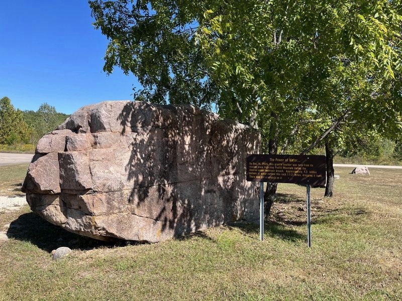
Photographed by Craig Swain, September 27, 2022
2. Marker and Granite Boulder
Ten-year anniversary of reservoir breach that flooded Johnson's Shut-ins State Park:
St. Louis Public Radio website entry (2015)
Click for more information.
St. Louis Public Radio website entry (2015)
Click for more information.
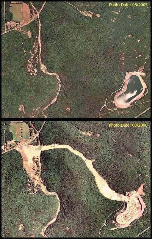
By USDA - USDA, Public Domain
3. Reservoir, Scour, and Path of the Boulder
The Taum Sauk Hydroelectric Power Plant is on the lower right of these two photos. In the lower photo, the impact of the breach can be seen from the ribbon of land scoured out by the rushing waters. The boulder followed that path to its present location, in the middle of the washed out area on the upper left. Please use the map feature on this page to see the exact location of the boulder, the scour, and the reservoir.
By USDA - USDA, Public Domain, Link
Credits. This page was last revised on July 11, 2025. It was originally submitted on November 11, 2022, by Craig Swain of Leesburg, Virginia. This page has been viewed 247 times since then and 15 times this year. Photos: 1, 2. submitted on November 11, 2022, by Craig Swain of Leesburg, Virginia. 3. submitted on November 12, 2022, by Craig Swain of Leesburg, Virginia.
