New Braunfels in Comal County, Texas — The American South (West South Central)
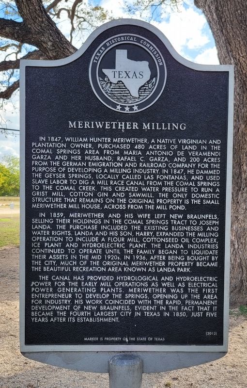
Meriwether Milling
In 1859, Meriwether and his wife left New Braunfels, selling their holdings in the Comal Springs tract to Joseph Landa. The purchase included the existing businesses and water rights. Landa and his son, Harry, expanded the milling operation to include a flour mill, cottonseed oil complex, ice plant and hydroelectric plant. The Landa Industries continued to operate until the family began to liquidate their assets in the mid 1920s. In 1936, after being bought by the city, much of the original Meriwether property became the beautiful recreation area known as Landa Park.
The canal has provided hydrological and hydroelectric power for the early mill operations as well as electrical power generating plants. Meriwether was the first entrepreneur to develop the springs, opening up the area for industry. His work coincided with the rapid, permanent development of New Braunfels, evident in the fact that it became the fourth largest city in Texas in 1850, just five years after its establishment.
Erected 2012 by Texas Historical Commission. (Marker Number 17085.)
Topics. This historical marker is listed in these topic lists: African Americans • Industry & Commerce • Settlements & Settlers • Waterways & Vessels. A significant historical year for this entry is 1847.
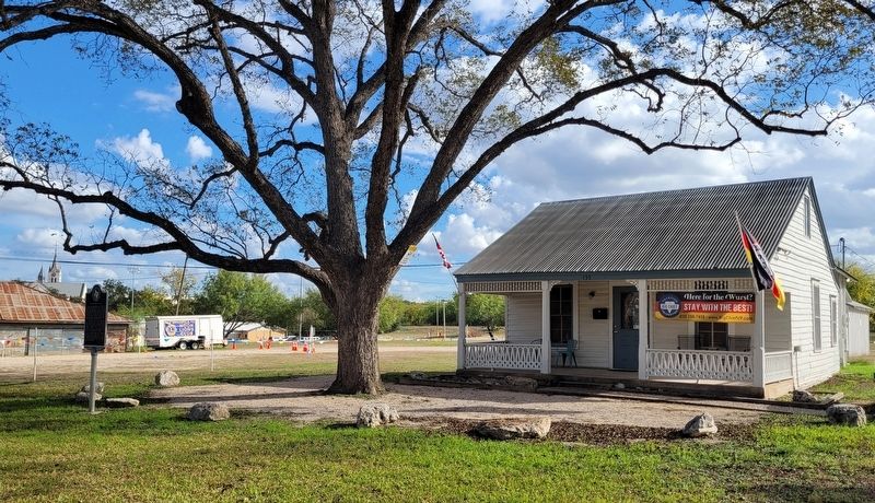
Location. 29° 42.314′ N, 98° 7.905′ W. Marker is in New Braunfels, Texas, in Comal County. Marker is at the intersection of Landa Street and Landa Park Drive, on the right when traveling east on Landa Street. The marker is located on the south side of Landa Street. Touch for map. Marker is at or near this postal address: 133 Landa Street, New Braunfels TX 78130, United States of America. Touch for directions.
Other nearby markers. At least 8 other markers are within walking distance of this marker. First Patented Wire Fence (about 300 feet away, measured in a direct line); Wurstfest (approx. ¼ mile away); The Grotto (approx. ¼ mile away); The Church of Saints Peter and Paul (approx. ¼ mile away); Old New Braunfels High School
(approx. 0.3 miles away); The New Braunfels Academy (approx. 0.4 miles away); 1915 New Braunfels Post Office (approx. 0.4 miles away); Site of New Braunfels Academy (approx. 0.4 miles away). Touch for a list and map of all markers in New Braunfels.
Also see . . . Landa Park. Texas State Historical Association
In 1927 Harry Landa sold his property in accordance with his mother's will, which stipulated that the Landa estate be liquidated ten years after her death. Jarrett Investment Company purchased the property with a loan from Trinity Universal Insurance Company, which took over the park after Jarrett suffered financial losses during the Great Depression. The park was closed in 1933 and surrounded by a barbed-wire fence. Concerned community citizens led by E. P. Nowotny and the New Braunfels Junior Chamber of Commerce called for a petition for the city to purchase the property. In a bond election citizens voted three to one to save the park, and on May 25, 1936, the city purchased 128 acres that included the headwaters, adjoining springs and property, and the De Paw Farm for $80,000. After the purchase, on May 30, 1936, more than a thousand citizens volunteered to clean up the park, plant flowers, and begin renovation of facilities.(Submitted on November 14, 2022, by James Hulse of Medina, Texas.)
Credits. This page was last revised on November 14, 2022. It was originally submitted on November 14, 2022, by James Hulse of Medina, Texas. This page has been viewed 82 times since then and 11 times this year. Photos: 1, 2. submitted on November 14, 2022, by James Hulse of Medina, Texas.

