Morganton in Burke County, North Carolina — The American South (South Atlantic)
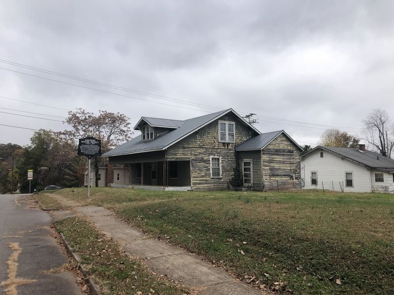
Jonesboro Historic District
c. 1895 - c. 1935

Photographed by Duane and Tracy Marsteller, October 29, 2022
1. Jonesboro Historic District Marker
Erected 2022 by Morganton Historic Preservation Commission.
Topics. This historical marker is listed in these topic lists: African Americans • Architecture. A significant historical year for this entry is 1895.
Location. 35° 44.394′ N, 81° 41.424′ W. Marker is in Morganton, North Carolina, in Burke County. It is on West Concord Street west of South Anderson Street, on the right when traveling east. Touch for map. Marker is at or near this postal address: 323 W Concord St, Morganton NC 28655, United States of America. Touch for directions.

Regionally, this marker is in the Mountains. It is also in the American South, specifically in the Upper South, in Appalachia, and specifically in Southern Appalachia. Globally, it is in North America, the Western Hemisphere, the Western World, and the Anglosphere. Historically, it finds itself in what was once the territory of the Mississippian Culture, one of the original Thirteen
this page online
Other nearby markers. At least 8 other markers are within walking distance of this marker: Franklin Pierce Tate House (approx. ¼ mile away); Etta Baker (approx. ¼ mile away); “Sacred Dance & the Muses” – 2004 (approx. 0.3 miles away); Tate House (approx. 0.3 miles away); Morganton (approx. 0.4 miles away); Burke Courthouse (approx. 0.4 miles away); Our Confederate Soldiers (approx. 0.4 miles away); Burke County Veterans K.I.A. Memorial (approx. 0.4 miles away). Touch for a list and map of all markers in Morganton.
Regarding Jonesboro Historic District. Excerpt from the district's National Register of Historic Places nomination:
As early as 1880, census records show a large concentration of blacks that is believed to be the Jonesboro area because of family names long associated with Jonesboro are included in the list. While the origin of the name Jonesboro is not clear, it was almost certainly derived from several people in the area with the first names Jones. Black residents Jones Avery and Jones Erwin and a white Jones Erwin who lived in the oldErwin House on West Union must certainly share credit for the name. The Jonesboro area was owned by a few large black property owners who sold off lots to friends and family. They included Jones Erwin, Jones Avery, Delia Scott, Henry Moore and Philo Harbison. Considering the number of families in the area named Erwin and the proximity of the Erwin House on West Union, it is likely that some of the residents of Jonesboro had been associated with the Erwin family as slaves. Former slaves residing near the homes of their former masters was a relatively common settlement pattern in the years just after the Civil War.Photographed by Duane and Tracy Marsteller, October 29, 20222. Jonesboro Historic District Marker
Also see . . . Jonesboro Historic District (PDF). National Register of Historic Places nomination for the district, which was listed in 1987. (National Archives) (Submitted on November 14, 2022, by Duane and Tracy Marsteller of Murfreesboro, Tennessee.)
Credits. This page was last revised on November 14, 2022. It was originally submitted on November 14, 2022, by Duane and Tracy Marsteller of Murfreesboro, Tennessee. This page has been viewed 565 times since then and 66 times this year. Photos: 1, 2. submitted on November 14, 2022, by Duane and Tracy Marsteller of Murfreesboro, Tennessee.
