Hickory in Catawba County, North Carolina — The American South (South Atlantic)
Saint Andrew's Lutheran Church
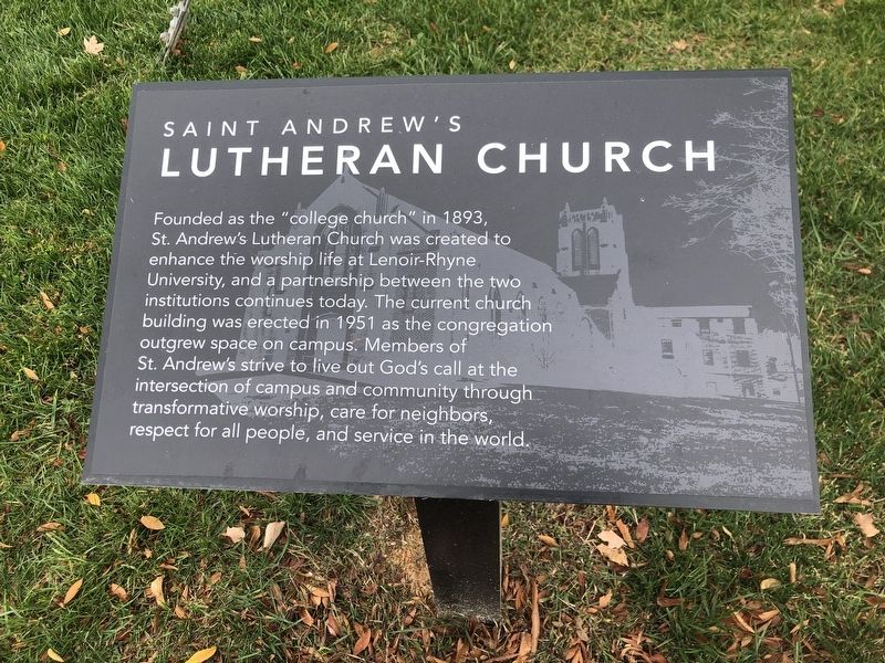
Photographed by Duane and Tracy Marsteller, October 29, 2022
1. Saint Andrew's Lutheran Church Marker
Topics. This historical marker is listed in this topic list: Religion & Religious Structures. A significant historical year for this entry is 1893.
Location. 35° 44.232′ N, 81° 19.541′ W. Marker is in Hickory, North Carolina, in Catawba County. It is at the intersection of 8th Street Northeast and 7th Avenue Northeast, on the right when traveling south on 8th Street Northeast. Marker is on the Hickory City Walk trail. Touch for map. Marker is at or near this postal address: 629 8th St NE, Hickory NC 28601, United States of America. Touch for directions.

Regionally, this marker is in North Carolina’s Piedmont. It is also in the American
this page online
Other nearby markers. At least 8 other markers are within walking distance of this marker: Lenoir-Rhyne University (here, next to this marker); Lenoir Rhyne (within shouting distance of this marker); Oakview Hall (about 600 feet away, measured in a direct line); University Mill District (about 700 feet away); Russell House (approx. ¼ mile away); Cline Gym (approx. ¼ mile away); Marshall G. Crouch House (approx. 0.4 miles away); George W. Hall House (approx. 0.4 miles away). Touch for a list and map of all markers in Hickory.
Also see . . . About. The church was founded on January 29, 1893, organizing in the chapel of Lenoir-Rhyne College's (now Lenoir-Rhyne University's) "Old Main" during its second academic year. (St. Andrew's Lutheran Church) (Submitted on November 14, 2022, by Duane and Tracy Marsteller of Murfreesboro, Tennessee.)
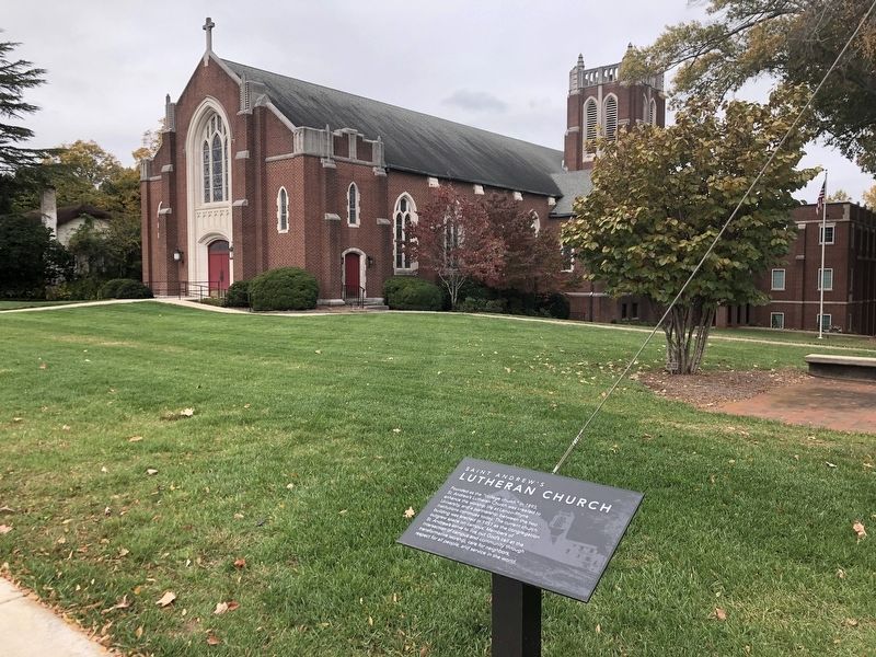
Photographed by Duane and Tracy Marsteller, October 29, 2022
2. Saint Andrew's Lutheran Church Marker
Credits. This page was last revised on April 7, 2023. It was originally submitted on November 14, 2022, by Duane and Tracy Marsteller of Murfreesboro, Tennessee. This page has been viewed 251 times since then and 33 times this year. Photos: 1, 2. submitted on November 14, 2022, by Duane and Tracy Marsteller of Murfreesboro, Tennessee.
