Near Palm Springs in Riverside County, California — The American West (Pacific Coastal)
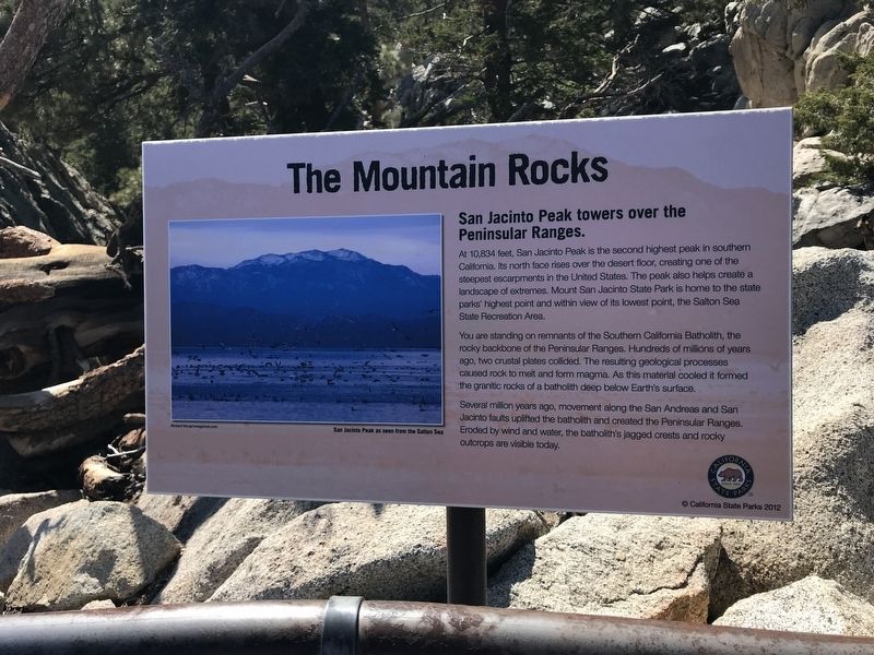
The Mountain Rocks
San Jacinto Peak towers over the Peninsular Ranges
You are standing on remnants of the Southern California Batholith, the rocky backbone of the Peninsular Ranges. Hundreds of millions of years ago, two crustal plates collided. The resulting geological processes caused rock to melt and form magma. As this material cooled it formed the granitic rocks of a batholith deep below Earth's surface.
Several million years ago, movement along the San Andreas and San Jacinto faults uplifted the batholith and created the Peninsular Ranges. Eroded by wind and water, the batholith's jagged crests and rocky outcrops are visible today.
Erected 2012 by California State Parks.
Topics. This historical marker is listed in this topic list: Natural Features.
Location. 33° 48.757′ N, 116° 38.29′ W. Marker is near Palm Springs, California, in Riverside County. Marker can be reached from Tram Way. Touch for map. Marker is at or near this postal address: 1 Tram Way, Palm Springs CA 92262, United States of America. Touch for directions.
Other nearby markers. At least 8 other markers are within 6 miles of this marker, measured as the crow flies. The Wilderness Before You (within shouting distance of this marker); The Accidental Sea (within shouting distance of this marker); The Valley's Faults (within shouting distance of this marker); Wilderness Preservation (within shouting distance of this marker); Palm Springs Aerial Tramway Valley Station (approx. 2.2 miles away); Original Cabin #2 (approx. 2.2 miles away); Tahquitz Rock History (approx. 4.3 miles away); The Willows (approx. 5.1 miles away). Touch for a list and map of all markers in Palm Springs.
Credits. This page was last revised on November 30, 2023. It was originally submitted on November 19, 2022, by Adam Margolis of Mission Viejo, California. This page has been viewed 94 times since then and 11 times this year. Photos: 1, 2. submitted on November 19, 2022, by Adam Margolis of Mission Viejo, California. • Bill Pfingsten was the editor who published this page.
Editor’s want-list for this marker. Photo of the mountain rocks, viewed from the marker. • Can you help?

