Olde Towne in Portsmouth, Virginia — The American South (Mid-Atlantic)
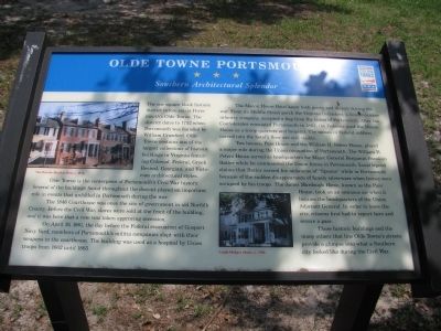
Olde Towne Portsmouth
Southern Architectural Splendor
Olde Towne is the centerpiece of Portsmouth’s Civil War history. Several of the buildings found throughout the district played an important role in events that unfolded in Portsmouth during the war.
The 1846 Courthouse was once the site of government in old Norfolk County. Before the Civil War, slaves were sold at the front of the building, and it was here that a vote was taken approving secession.
On April 19, 1861, the day before the Federal evacuation of Gosport Navy Yard, members of Portsmouth’s militia companies slept with their weapons in the courthouse. The building was used as a hospital by Union troops from 1862 until 1865.
The Macon House Hotel knew both gaiety and despair during the war. From its Middle Street porch the Virginia Defenders, a local volunteer infantry company, accepted a flag from the ladies of Portsmouth. After the Confederates evacuated Portsmouth in 1862, the Federals used the Macon House as a troop quarters and hospital. The names of Federal soldiers carved into the hotel’s floor are still visible.
Two houses, Pass House and the William H. Peters House, played a major role in the Union occupation of Portsmouth. The William H. Peters House served as headquarters for Major General Benjamin Franklin Butler while he commanded the Union forces in Portsmouth. Local legend claims that Butler earned his nickname of “Spoons” while in Portsmouth because of the sudden disappearance of family silverware when homes were occupied by his troops. The James Murdough Home, known as the Pass House, took on an ominous air when it became the headquarters of the Union Adjutant General. In order to leave the city, citizens first had to report here and secure a pass.
These historic buildings and the many others that line Olde Towne’s streets provide a glimpse into what a Southern city looked like during the Civil War.
Erected by Virginia Civil War Trails.
Topics and series. This historical marker is listed in this topic list: War, US Civil. In addition, it is included in the Virginia Civil War Trails series list. A significant historical date for this entry is April 19, 1861.
Location. 36° 50.414′ N, 76° 18.097′ W. Marker is in Portsmouth, Virginia. It is in Olde Towne. Marker is on Crawford Parkway west of Court Street, on the left when traveling west. Touch for map. Marker is in this post office area: Portsmouth VA 23704, United States of America. Touch for directions.
Other nearby markers. At least 8 other markers are within walking distance of this marker. Arnold's British Defenses, 1781 (a few steps from this marker); Cornwallis at Portsmouth (a few steps from this marker); Fort Nelson (a few steps from this marker); Craney Island (within shouting distance of this marker); Crawford Bay (about 300 feet away, measured in a direct line); Watts House (about 700 feet away); The Yellow Fever of 1855 (about 700 feet away); Elks Lodge (about 700 feet away). Touch for a list and map of all markers in Portsmouth.
More about this marker. On the left is a photo of The Brooks Benthal Row. On the lower right is a photo of the Leigh-Hodges Home.
Credits. This page was last revised on February 1, 2023. It was originally submitted on July 26, 2009, by Kristin Rollins of Portsmouth, Virginia. This page has been viewed 1,480 times since then and 40 times this year. Photo 1. submitted on July 26, 2009, by Kristin Rollins of Portsmouth, Virginia. • Craig Swain was the editor who published this page.
