Near Cumberland in Cumberland County, Virginia — The American South (Mid-Atlantic)
Campaign of 1781
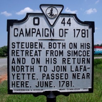
Photographed by Bernard Fisher, July 25, 2009
1. Campaign of 1781 Marker
Erected 1934 by Conservation & Development Commission. (Marker Number O-44.)
Topics and series. This historical marker is listed in this topic list: War, US Revolutionary. In addition, it is included in the Virginia Department of Historic Resources (DHR) series list. A significant historical month for this entry is June 1781.
Location. 37° 28.631′ N, 78° 16.913′ W. Marker is near Cumberland, Virginia, in Cumberland County. It is at the intersection of Anderson Highway (U.S. 60) and Cumberland Road (Virginia Route 45), on the right when traveling east on Anderson Highway. Touch for map. Marker is in this post office area: Cumberland VA 23040, United States of America. Touch for directions.

Regionally, this marker is in the Piedmont and in Central Virginia. It is also in the American South and specifically in the Upper South. Globally, it is in North America, the Western Hemisphere, the Western World, and the Anglosphere. Historically, it finds itself in what was once the territory of the Mississippian
this page online
Other nearby markers. At least 8 other markers are within 5 miles of this marker, measured as the crow flies: Jackson Davis (approx. 2.4 miles away); First Call For Independence (approx. 2½ miles away); Cumberland County Court House (approx. 2½ miles away); Confederate Memorial (approx. 2½ miles away); Veterans Memorial (approx. 2½ miles away); John Robinson (ca. 1825-1908) (approx. 2.6 miles away); Buckingham County / Cumberland County (approx. 3.9 miles away); Lucyville (approx. 4.6 miles away). Touch for a list and map of all markers in Cumberland.
Another marker is no longer nearby. Jackson Davis (was approx. 2.4 miles away but has been replaced with another marker now near it).
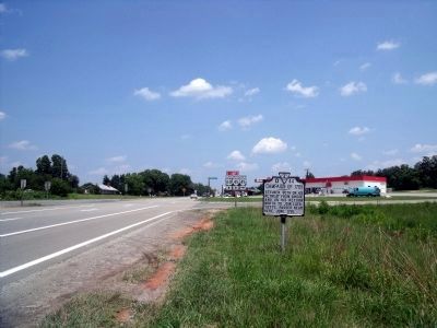
Photographed by Bernard Fisher, July 25, 2009
2. Campaign of 1781 Marker on Rte 60 (facing east)
Credits. This page was last revised on June 16, 2016. It was originally submitted on July 26, 2009, by Bernard Fisher of Richmond, Virginia. This page has been viewed 1,143 times since then and 27 times this year. Photos: 1, 2. submitted on July 26, 2009, by Bernard Fisher of Richmond, Virginia.
