Greenbrier West in Chesapeake, Virginia — The American South (Mid-Atlantic)
At Dawn On December 9, 1775
Photographed by Bernard Fisher, April 28, 2012
1. At Dawn on December 9, 1775 Marker
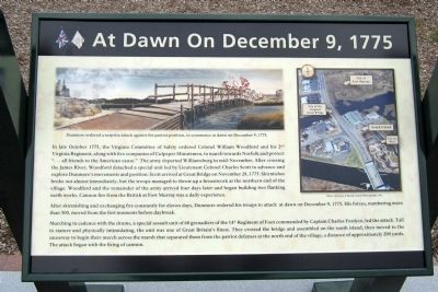
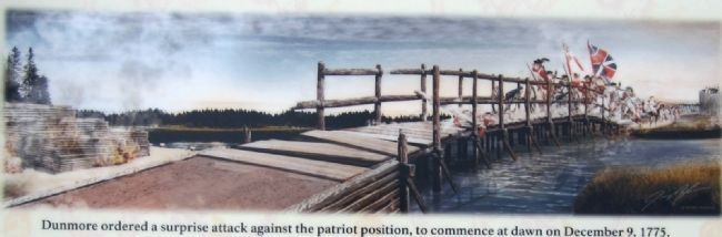
After skirmishing and exchanging fire constantly for eleven days, Dunmore ordered his troops to attack at dawn on December 9, 1775. His forces, numbering more than 500, moved from the fort moments before daybreak.
Marching in cadence with the drums, a special assault unit of 60 grenadiers of the 14th Regiment of Foot, commanded
this page online
Erected 2012 by Great Bridge Battlefield & Waterways History Foundation.
Topics. This historical marker is listed in this topic list: War, US Revolutionary. A significant historical month for this entry is October 1775.
Location. 36° 43.334′ N, 76° 14.375′ W. Marker is in Chesapeake, Virginia. It is in Greenbrier West. It can be reached from the intersection of North Battlefield Boulevard (Business Virginia Route 168) and Watson Road, on the left when traveling south. Touch for map. Marker is at or near this postal address: 2614 Watson Rd, Chesapeake VA 23320, United States of America. Touch for directions.

Regionally, this marker is in Virginia’s Hampton Roads, specifically in Coastal Virginia, and in the Hampton Roads
2. At Dawn on December 9, 1775.
Dunmore ordered a surprise attack against the patriot position, to commence at dawn on December 9, 1775. Painting by Jeremy Horne
Other nearby markers. At least 8 other markers are within walking distance of this marker: Causeways (a few steps from this marker); Causeway Construction (within shouting distance of this marker); First Fire (within shouting distance of this marker); Liberty to Slaves (within shouting distance of this marker); Site of the Original Causeway (within shouting distance of this marker); The Day is Our Own! (within shouting distance of this marker); Fort Murray (within shouting distance of this marker); Billy Flora (about 300 feet away, measured in a direct line). Touch for a list and map of all markers in Chesapeake.
Related markers. Click here for a list of markers that
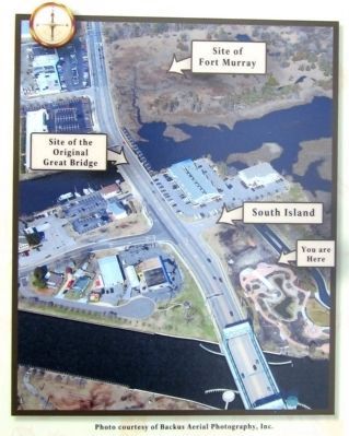
3. Orientation Overview
Photo courtesy of Backus Aerial Photograpghy, Inc.
Also see . . . Great Bridge Battlefield & Waterways History Foundation. (Submitted on April 29, 2012.)
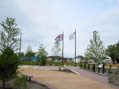
Photographed by Bernard Fisher, April 28, 2012
4. At Dawn on December 9, 1775 Marker
Credits. This page was last revised on February 1, 2023. It was originally submitted on April 29, 2012, by Bernard Fisher of Richmond, Virginia. This page has been viewed 2,480 times since then and 34 times this year. Last updated on November 25, 2022, by Carl Gordon Moore Jr. of North East, Maryland. Photos: 1, 2, 3, 4. submitted on April 29, 2012, by Bernard Fisher of Richmond, Virginia.
