Greenbrier West in Chesapeake, Virginia — The American South (Mid-Atlantic)
The Battle of Great Bridge
Great Bridge Battlefield & Waterways Park and Visitor Center
Photographed by Bernard Fisher, October 28, 2011
1. The Battle of Great Bridge Marker
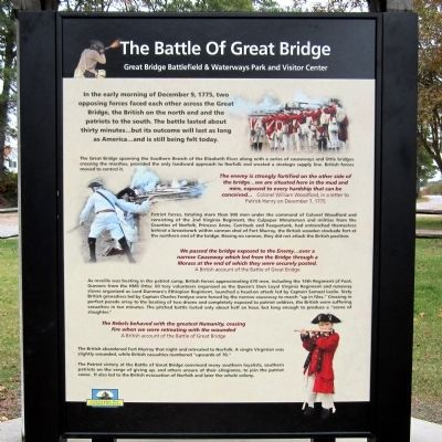
In the early morning of December 9, 1775, two opposing forces faced each other across the Great Bridge, the British on the north end and the patriots to the south. The battle lasted about thirty minutes...but its outcome will last as long as America...and is still being felt today.
The Great Bridge spanning the Southern Branch of the Elizabeth River along with a series of causeways and little bridges crossing the marshes, provided the only landward approach to Norfolk and created a strategic supply line. British forces moved to control it.
The enemy is strongly fortified on the other side of the bridge…we are situated here in the mud and mire, exposed to every hardship that can be conceived… Colonel William Woodford, in a letter to Patrick Henry on December 7, 1775
Patriot forces, totaling more than 900 men under the command of Colonel Woodford and consisting of the 2nd Virginia Regiment, the Culpeper Minutemen and militias from the Counties of Norfolk, Princess Anne, Currituck and Pasquotank, had entrenched themselves behind a breastwork within cannon shot of Fort Murray, the British wooden stockade fort at
this page online
We passed the bridge exposed to the Enemy...over a narrow Causeway which led from the Bridge through a Morass at the end of which they were securely posted. A British account of the Battle of Great Bridge
As reveille was beating in the patriot camp, British forces approximating 670 men, including the 14th Regiment of Foot, Gunners from the HMS Otter, 60 tory volunteers organized as the Queen’s Own Loyal Virginia Regiment and runaway slaves organized as Lord Dunmore’s Ethiopian Regiment, launched a head-on attack led by Captain Samuel Leslie. Sixty British grenadiers led by Captain Charles Fordyce were forced by the narrow causeway to march “up in files.” Crossing in perfect parade array to the beating of two drums and completely exposed to patriot soldiers, the British were suffering casualties in ten minutes The pitched battle lasted only about half an hour, but long enough to produce a “scene of slaughter.”
The Rebels behaved with the greatest Humanity, ceasing fire when we were retreating with the wounded A British account of the
Photographed by Bernard Fisher, October 28, 2011
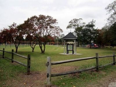
2. Great Bridge Battlefield & Waterways Park and Visitor Center Markers
The British abandoned Fort Murray that night and retreated to Norfolk. A single Virginian was slightly wounded, while British casualties numbered “upwards of 70.”
The Patriot victory at the Battle of Great Bridge convinced many southern loyalists, southern patriots on the verge of giving up, and others unsure of their allegiance, to join the patriot cause. It also led to the British evacuation of Norfolk and later the whole colony.
Erected by Chesapeake Bay Gateways Network.
Topics. This historical marker is listed in this topic list: War, US Revolutionary. A significant historical date for this entry is December 9, 1775.
Location. 36° 43.427′ N, 76° 14.789′ W. Marker is in Chesapeake, Virginia. It is in Greenbrier West. It is on Locks Road 0.6 miles west of North Battlefield Boulevard (Virginia Route 168), on the left when traveling west. Located in Great Bridge Lock Park. Touch for map. Marker is in this post office area: Chesapeake VA 23320, United States of America. Touch for directions.

Regionally, this marker is in Virginia’s Hampton Roads, specifically in Coastal Virginia, and in the Hampton Roads Metropolitan Area. It is also in the American South, specifically in the Upper South, in the Tidewater, and on the Eastern Seaboard. Globally, it is in the North Atlantic Region, North America, the Western Hemisphere, the Western World, and the Anglosphere. Historically, it finds itself in what was once the territory of the Mississippian Culture, one of the original Thirteen Colonies, one of the Confederate States of America, and the Antebellum South.
Other nearby markers. At least 8 other markers are within walking distance of this marker: Welcome (here, next to this marker); Bridging the Past with the Present (here, next to this marker); What is a Lock? (within shouting distance of this marker); Why Build a Canal Here? (within shouting distance of this marker); The Iron Titans Tame the Marsh (within shouting distance of this marker); Liquid Highways (within shouting distance of this marker); a different marker also named Village of Great Bridge (about 400 feet away); Marine Veterans Memorial (approx. 0.3 miles away). Touch for a list and map of all markers in Chesapeake.
Another marker is no longer nearby. Village of Great Bridge (was about 400 feet away, measured in a direct line but has been replaced with another marker now near it).
Related markers. Click here for a list of markers that are related to this marker. To better understand the relationship, study each marker in the order shown.
Also see . . .
1. Great Bridge Battlefield & Waterways History Foundation. (Submitted on October 30, 2011.)
2. Battle of Great Bridge. Wikipedia (Submitted on October 30, 2011.)
3. Site of Great Bridge Battle. National Register of Historic Places (Submitted on November 4, 2021.)
Credits. This page was last revised on February 1, 2023. It was originally submitted on October 30, 2011, by Bernard Fisher of Richmond, Virginia. This page has been viewed 1,782 times since then and 51 times this year. Last updated on November 25, 2022, by Carl Gordon Moore Jr. of North East, Maryland. Photos: 1, 2. submitted on October 30, 2011, by Bernard Fisher of Richmond, Virginia.
