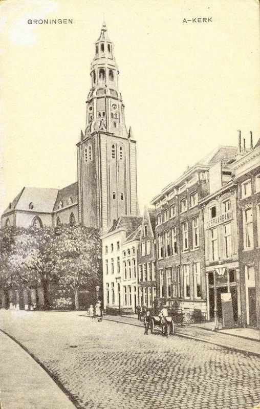
Groningen, Netherlands — Northwestern Europe
A-Kerk / A-Church
— Stadsmonumenten —
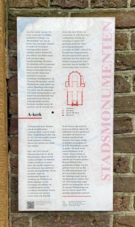
Aan het einde van de 12e eeuw waren de westelijke stadsdelen ‘Utinga-’ en ‘Westerkluft’ toe aan de bouw van een kapel. Omdat er onder de bewoners varensgezellen waren, wijdden zij het bouwwerk niet alleen aan Maria maar ook aan hun eigen beschermheilige Nicolaas. Ze mochten zelf een pastoor kiezen, maar konden voor doop en huwelijk niet bij hem terecht. Daarvoor moesten ze naar de Groninger hoofdpastoor, de ‘Persona Personatus’ van de Martinikerk. Ook nadat een zekere Bisschop Otto begin 13e eeuw aan dit ongemak een einde had gemaakt en de kapel tot parochiekerk had gepromoveerd, bleef de ondergeschikte positie bestaan. Jaarlijks moest de pastoor van de A-kerk vier ‘Grinspennincken’ betalen aan de hoofdpastoor vanwege diens ‘regt en magt’. Deze verplichting leidde nog in 1523 tot een conflict tussen beide pastoors, waaraan alleen een notaris een einde kon maken.
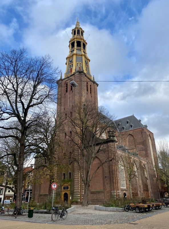
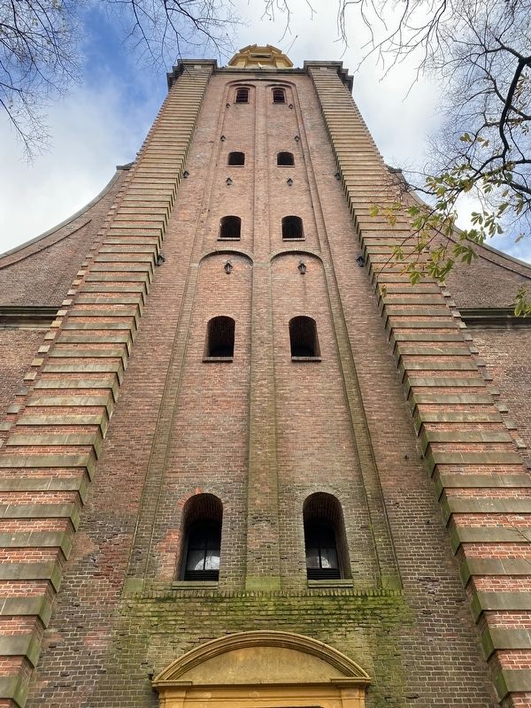
Op 1 mei 1671 trof de bliksem zowel de A- als de Martinitoren. Maar terwijl ‘melk en huiden’ de Martini redden, bleek de A-toren door zijn smalle trappen en het afvloeien van smeltend metaal ontoegankelijk. Toren, kerkdak, orgel en klokkenspel gingen in vlammen op. Dankzij een flinke bijdrage van de Groninger bevolking ‘tot restablissement van dit vervallene Godtshuis’ kwam er wel weer een nieuwe toren, maar erg degelijk bleek die niet. Zelfs een restauratie in 1687 kon niet verhinderen dat hij op zaterdag 12 april 1710 spontaan instortte. ‘Een geweldig geschreeuw vervulde de lucht’, schreef de Frankforter burgemeester, die zich zijn bezoek aan de stad toch wel wat anders zal hebben voorgesteld. Acht jaar later was de huidige 76 meter hoge toren verrezen.
In de Franse tijd werd de kerk een militair object. De officieren van het garnizoen meenden ‘de kussens en boeken van hun bank’ daarom niet langer nodig te hebben en maakten ze in 1795 ‘bij publieke vendu te gelde’. De kerk werd excercitieplaats en de ‘maire’ sloeg er hooi en levensmiddelen op. Na de aftocht der Fransen poetste Koning Willem I het geschonden imago van het gebouw weer wat op. Bij het 200-jarig bestaan van de Universiteit deed hij het Schnitgerorgel van de Academiekerk cadeau. Het uit 1702 stammende orgel speelt een belangrijke rol in de nieuwe bestemming van het in 2 fasen vanaf 1976 grondig opgeknapte gebouw.
At the end of the 12th century the western city districts ‘Utinga’ and ‘Westerkluft’ wanted to build a chapel. Because the local population also included sailors, they dedicated the structure to
both Maria and their own Patron Saint, Nicolaas. They were allowed to choose their own pastor, although he was not granted the permission to baptize or marry anyone. Only the main pastor of Groningen, also known as the ‘persona Personatus’ of the Martinikerk (Martini Church) was allowed to do this. Even after a Bishop Otto in the early 13th century ended this disparity and promoted the chapel to a parish chuch, it maintained an inferior role. The Pastor of the A-Church had to pay an annual fee of four ‘grinspennincken’ to the Main Pastor because of his ‘regtenmagt’ (right and power). This obligation lead to a conflict between both pastors in 1523 which could only be resolved by a notary.
On May 1st1671 Lightning struck the A-church as well as the Martini tower. While ‘milk and animal hides’ saved the Martini tower, the A-church remained inaccessible because of its small stairs and the flow down of molten metal. The Tower, roof, organ, and bells all went up in flames. Thanks to big donations from Groningen’s population for the ‘reestablishment of this battered house of God’ the tower was rebuilt, but this was done very poorly. Even a restoration in 1687 could not prevent it from suddenly collapsing on Saturday 12th of April 1710. ‘A huge scream filled the air’ wrote Frankfort’s mayor, who pictured his visit to the city differently. Eight years later the currently 76-Meter-tall tower was reconstructed.
In the French era the Church became a military object. The officers of the stationed garrison were of the opinion that ‘the pillows and books of their bank’ were therefore no longer needed so they sold them to public venues. The Church became a drill station and the ‘maire’ stored their hay and food there. After the retreat of the French, King Willem I enhanced the damaged image. At the 200-year anniversary of the University he donated Schnitger’s organ of the Academia church. The 1702 built Organ played a major role in the new destination of the in two phases from 1976 restored building.
Erected by Gemeente Groningen. (Marker Number 24.)
Topics and series. This historical marker is listed in this topic list: Churches & Religion. In addition, it is included in the Groningen Stadsmonumenten series list. A significant historical date for this entry is April 12, 1710.
Location. 53° 12.983′ N, 6° 33.718′ E. Marker is in Groningen. Marker is at the intersection of Akerkhof and Vismarkt, on the right when traveling north on Akerkhof. Touch for map. Marker is in this post office area: Groningen 9711 JB, Netherlands. Touch for directions.
Other nearby markers. At least 8 other markers are within walking distance of this marker. Evert Jan Thomassen à Thuessink (within shouting distance of this marker); Postkantoor/ Post Office (within shouting distance of this marker); Alida
(about 120 meters away, measured in a direct line); Oprichting van de Loge / Establishment of I.O.O.F. Lodge (about 120 meters away); Korenbeurs / Grain Exchange (about 120 meters away); Vereeniging van Groningen Handelaren / Groningen Merchants Association (1847 - 1992) (about 120 meters away); Sociaal Democratische Bond / Social Democratic Union (about 120 meters away); Vismarkt 56 (about 150 meters away). Touch for a list and map of all markers in Groningen.
Credits. This page was last revised on December 31, 2023. It was originally submitted on November 26, 2022, by Andrew Ruppenstein of Lamorinda, California. This page has been viewed 82 times since then and 10 times this year. Photos: 1, 2, 3, 4, 5. submitted on November 26, 2022, by Andrew Ruppenstein of Lamorinda, California.
