Capitol Hill in Southeast Washington in Washington, District of Columbia — The American Northeast (Mid-Atlantic)
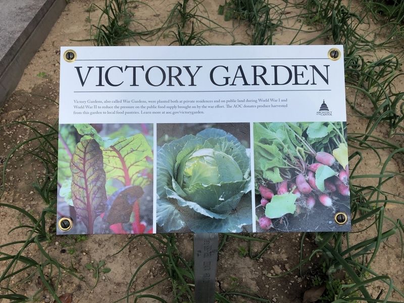
Victory Garden
Erected by Architect of the Capitol.
Topics. This historical marker is listed in these topic lists: Agriculture • Horticulture & Forestry • Patriots & Patriotism • War, World I • War, World II.
Location. Marker has been permanently removed. It was located near 38° 53.221′ N, 77° 0.347′ W. Marker was in Southeast Washington in Washington, District of Columbia. It was in Capitol Hill. Marker was on First Street Southeast just south of Independence Avenue Southeast, on the right when traveling north. Marker is on the grounds of the Madison Library of Congress building along the west side of the building. Touch for map. Marker was at or near this postal address: 99 Independence Ave SE, Washington DC 20540, United States of America.
We have been informed that this sign or monument is no longer there and will not be replaced. This page is an archival view of what was.
Other nearby markers. At least 8 other markers are within walking distance of this location. Destroying the Library (approx. 0.2 miles away); The Capitol in Flames (approx. 0.2 miles away); American Legion Post 8 (approx. ¼ mile away); Capitol Square (approx. ¼ mile away); St. Mark's Church (approx. ¼ mile away); Florida House (approx. ¼ mile away); Original Site Of Providence Hospital (approx. ¼ mile away); United States Capitol Grounds (approx. ¼ mile away). Touch for a list and map of all markers in Southeast Washington.
Credits. This page was last revised on January 30, 2023. It was originally submitted on November 28, 2022, by Devry Becker Jones of Washington, District of Columbia. This page has been viewed 59 times since then and 3 times this year. Photo 1. submitted on November 28, 2022, by Devry Becker Jones of Washington, District of Columbia.
Editor’s want-list for this marker. A wide shot of the marker in context. • Can you help?
