Potomac West in Alexandria, Virginia — The American South (Mid-Atlantic)
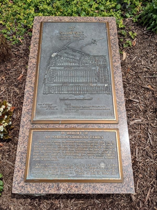
In Memory of an African-American Family
Inscription.
Charles A. Watson, an African-American, purchased this land in 1870. In 1905, three years after the passing of the "Jim Crow" Laws in Virginia, his wife Laura and sons Frank and Attorney Thomas M. Watson dedicated and subdivided the land to provide a place for other people of African-American heritage to build their homes. They named it Sunnyside. The streets Elbert, Charles, and Courtland were named as a memorial to the deceased members of the Watson family.
Emma Watson, the wife of Thomas and sole heir of the remaining properties became ill. Upon her death, her properties were placed in the hands of the General Receiver of the Corporation Court of Alexandria, Virginia on July 26, 1954. Her land was later sold at auction.
Map of Sunnyside
Alexandria County, VA.
Surveyed July, 1905
Geo. E. Garrett.
County Engineer
St. Elmo, VA
Virginia
In the clerk's office of Alexandria County, August 24, 1905, this deed was received and with the annexed certificate admitted to record.
Topics. This historical marker is listed in these topic lists: African Americans • Settlements & Settlers. A significant historical year for this entry is 1905.
Location. 38° 50.457′ N, 77° 3.996′ W. Marker is in Alexandria, Virginia. It is in Potomac West. Marker is at the intersection of Charles Avenue and Shorter Lane, on the right when traveling north on Charles Avenue. Touch for map. Marker is at or near this postal address: 3900 Courtland Circle, Alexandria VA 22305, United States of America. Touch for directions.
Other nearby markers. At least 8 other markers are within walking distance of this marker. The Columns of This Portico (approx. 0.2 miles away); Dr. Betty Louise Josephson King (approx. 0.4 miles away); Four Mile Run and Flooding / The Restoration Project / I Live Here...Can You Find Me? / Public Art (approx. half a mile away); History at Four Mile Run Park (approx. half a mile away); Fort Scott (approx. 0.6 miles away); Transportation (approx. 0.7 miles away); The Triangle Site (approx. ¾ mile away); Ruby Tucker (approx. 0.8 miles away). Touch for a list and map of all markers in Alexandria.
Additional keywords. urban development
Credits. This page was last revised on January 27, 2023. It was originally submitted on December 3, 2022, by Sean C Bath of Silver Spring, Maryland. This page has been viewed 121 times since then and 31 times this year. Photo 1. submitted on December 3, 2022, by Sean C Bath of Silver Spring, Maryland. • Bernard Fisher was the editor who published this page.
