Taft in San Patricio County, Texas — The American South (West South Central)
Site of White Point Mass Graves of 1919 Hurricane Victims
Inscription.
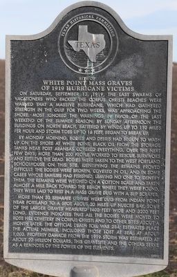
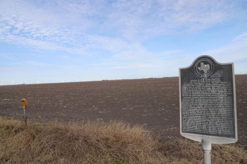
On Saturday, September 13, 1919, the last swarms of vacationers who packed the Corpus Christi beaches were warned that a massive hurricane, which had gathered strength in the Gulf for two weeks, was approaching the shore. Most ignored the warnings in favor of the last weekend of the summer season. By Sunday afternoon the buildings on North Beach, battered by winds up to 110 miles per hour and storm tides up to 16 feet, began to break up.
By Monday morning, bodies and debris had begun to wash up on the shore at White Point. Black oil from the storage tanks near Port Aransas covered everything. Over the next few days, more than 200 people worked to rescue survivors and retrieve the dead. Bodies were taken to the West Portland schoolhouse on this site. Identifying the remains proved difficult; the bodies were broken, covered in oil, and in some cases whole families had perished, leaving no one to identify them. The remains were weighed on a cotton scale and taken almost a mile back toward the beach where they were found. They were laid to rest in a mass grave dug with a slip scraper.
More than 30 separate graves were dug from Indian Point near Portland to a spot about 20 miles up Nueces Bay. Some of the larger graves measured 1400 feet wide and 3200 feet long. Evidence indicates that all the bodies were moved to Rose Hill Cemetery in Corpus Christi and to other sites about a month later. The official death toll was 284; estimates place the actual number, including those lost at sea, at about 1,000. Property damage from the 1919 storm was estimated at about 20 million dollars. This gravesite and the others serve as a reminder of the power of the elements.
Erected 2000 by Texas Historical Commission. (Marker Number 12186.)
Topics and series. This historical marker is listed in these topic lists: Cemeteries & Burial Sites • Disasters. In addition, it is included in the Lost at Sea series list. A significant historical date for this entry is September 13, 1919.
Location. 27° 53.365′ N, 97° 24.574′ W. Marker is in Taft, Texas, in San Patricio County. Marker is on Farm to Market Road 1074. Touch for map. Marker is at or near this postal address: 9506 FM 1074, Taft TX 78390, United States of America. Touch for directions.
Other nearby markers. At least 8 other markers are within 6 miles of this marker, measured as the crow flies. Reef Road (approx. 4.2 miles away); Site of Indian Point Mass Grave of 1919 Hurricane Victims (approx. 4.2 miles away); 1919 Storm (approx. 4.8 miles away); USS Lexington CV-16 (approx. 5.3 miles away); Rising Sun (approx. 5.3 miles away); Kamikaze (approx. 5.3 miles away); Nueces County (approx. 5.4 miles away); Site of Bay View College (approx. 5˝ miles away).
Also see . . . Corpus Christi Caller-Times Article on the 100th Anniversary.
Sometimes it takes a hurricane to blow the winds of change into a city.(Submitted on December 5, 2022, by Dave W of Co, Colorado.)
Such was the case in Corpus Christi, where the seawall, Shoreline Boulevard and even the Port of Corpus Christi owe their existence to the devastating storm that smashed into the city Sunday, Sept. 14, 1919.
Credits. This page was last revised on December 12, 2022. It was originally submitted on December 5, 2022, by Dave W of Co, Colorado. This page has been viewed 182 times since then and 40 times this year. Photos: 1, 2. submitted on December 5, 2022, by Dave W of Co, Colorado. • J. Makali Bruton was the editor who published this page.

