Clawson in Oakland County, Michigan — The American Midwest (Great Lakes)
Ambassador Roller Rink
Downtown Clawson History Walk
Photographed by Joel Seewald, December 3, 2022
1. Ambassador Roller Rink Marker
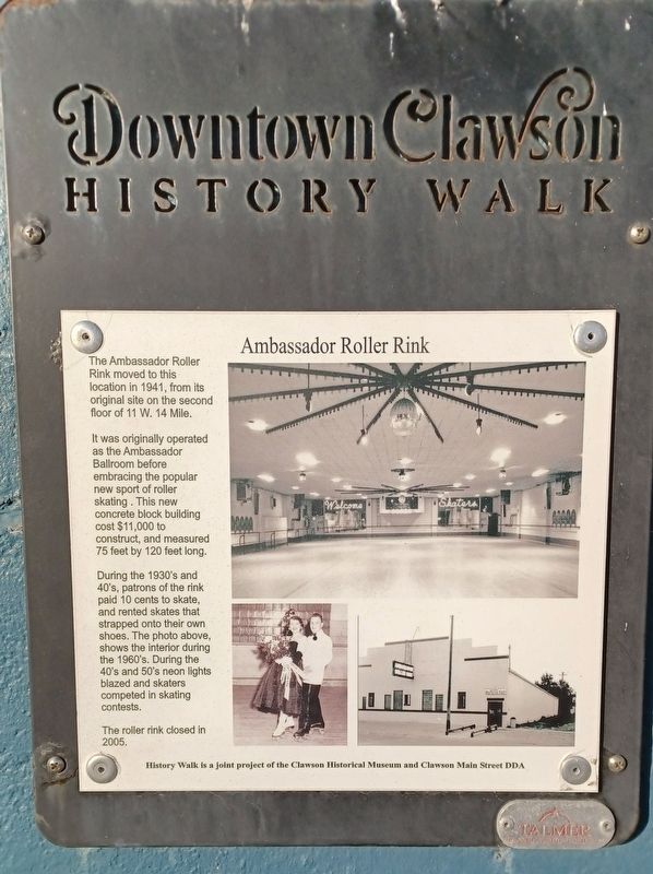
The Ambassador Roller Rink moved to this location in 1941, from its original site on the second floor of 11 W. 14 Mile.
It was originally operated as the Ambassador Ballroom before embracing the popular new sport of roller skating. This new concrete block building cost $11,000 to construct and measured 75 feet by 120 feet long.
During the 1930's and 40's, patrons of the rink paid 10 cents to skate, and rented skates that strapped onto their own shoes. The photo above, shows the interior during the 1960's. During the 40's and 50's neon lights blazed and skaters competed in skating contests.
The roller rink closed in 2005.
Erected 2014 by Clawson Historical Museum and Clawson Main Street DDA.
Topics. This historical marker is listed in this topic list: Entertainment. A significant historical year for this entry is 1941.
Location. 42° 32.014′ N, 83° 8.893′ W. Marker is in Clawson, Michigan, in Oakland County. It is on West 14 Mile Road 0.1 miles west of Main Street, on the right when traveling west. Touch for map. Marker is at or near this postal address: 96 West 14 Mile Road, Clawson MI 48017, United States
this page online

Regionally, this marker is in Southeast Michigan and in Greater Detroit. It is also in the American Midwest. Globally, it is in North America, the Western Hemisphere, the Western World, and the Anglosphere. Historically, it finds itself in what was once the Northwest Territory.
Other nearby markers. At least 8 other markers are within walking distance of this marker: Clawson Theatre (a few steps from this marker); First City Hall (about 300 feet away, measured in a direct line); The Evolution of a Corner, 1860-1940 (about 400 feet away); Evolution of a Corner, 1900-1940 (about 500 feet away); The Interurban 1899-1931 (about 500 feet away); Interurban Railroads in Michigan 1899-1931 (about 500 feet away); Snapshot of Clawson, 1920s (about 500 feet away); 1 East 14 Mile (about 600 feet away). Touch for a list and map of all markers in Clawson.
Photographed by Joel Seewald, December 3, 2022
2. Ambassador Roller Rink Marker
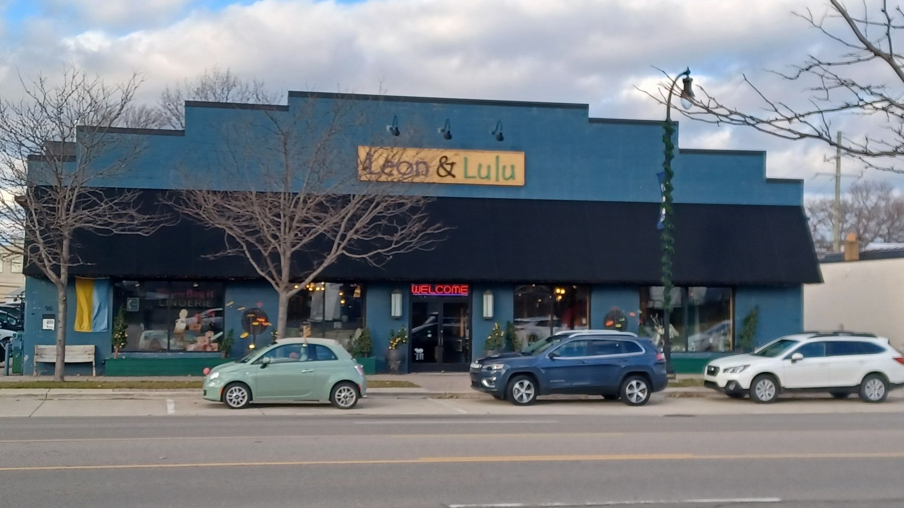
Marker is at the far left of the building.
Credits. This page was last revised on December 7, 2022. It was originally submitted on December 7, 2022, by Joel Seewald of Madison Heights, Michigan. This page has been viewed 2,080 times since then and 202 times this year. Photos: 1, 2. submitted on December 7, 2022, by Joel Seewald of Madison Heights, Michigan.
